Points of Interest
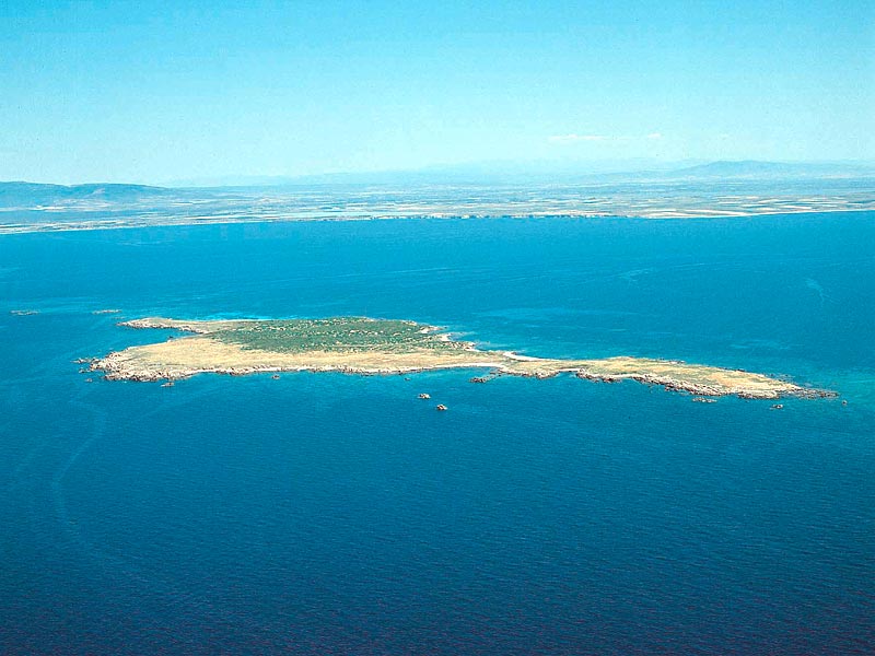
Mal di Ventre Island
The Island of Mal di Ventre is what has remained of a large granite outcrop which edged the whole western coast of Sardinia in very ancient times.
It has a surface of about 80 hectares and is about 5 nautical miles from the coast; it maximum height on the sea level is about 18m.
The weathering of its rocks feeds the sands of the quartziferous beaches of the Sinis. The landscape is characterized by the intrusive granite rocks with particular shapes resulting from the erosive action of the often exceptional forces of nature which sometimes create shapes which have been transformed by the popular imagination into persons, things, or animals.
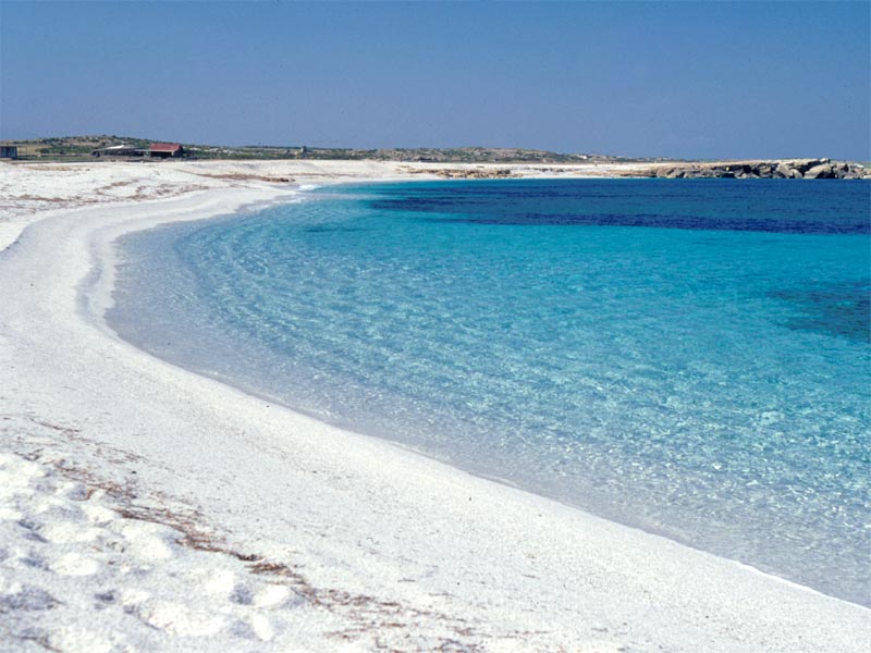
The Beaches of the Sinis
The lower coastal strip
The Marine Protected Area of Penisola del Sinis-Isola di Mal di Ventre is characterized by fifteen kilometers of beaches set among the rocks and the cliffs outcropping from the water like white, provisional and unstable shorelines which, according to the season, have particular colors and shades.
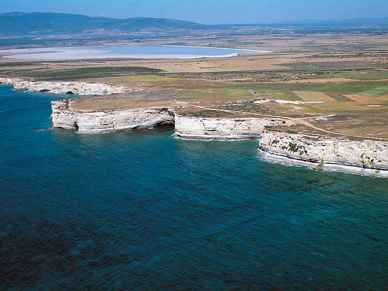
The Cliffs
The upper coastal strip
The setting of the rocky coast is a scenery which is constantly changing and, like in the past, also the vegetable and animal species populating both the emerged and the submerged land (some meters below the sea level) are rather "special".
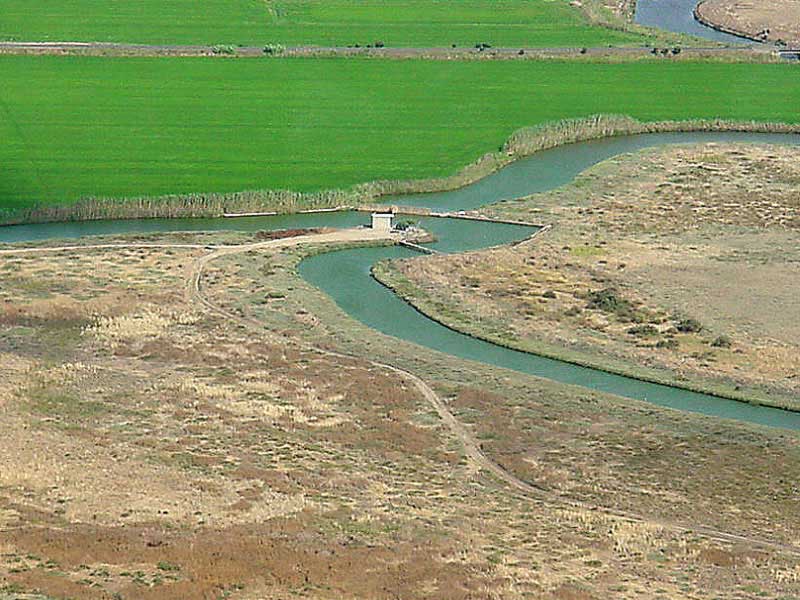
The Wetlands
The origin of the ponds of Sinis is linked to the isolation of some stretches of sea deriving by the "building" of sandy strips parallel to the coast: an evident example is the lagoon of Mistras. Everything derives from the natural and progressive filling which shaped the plain landscape within which the Wetlands have developed.
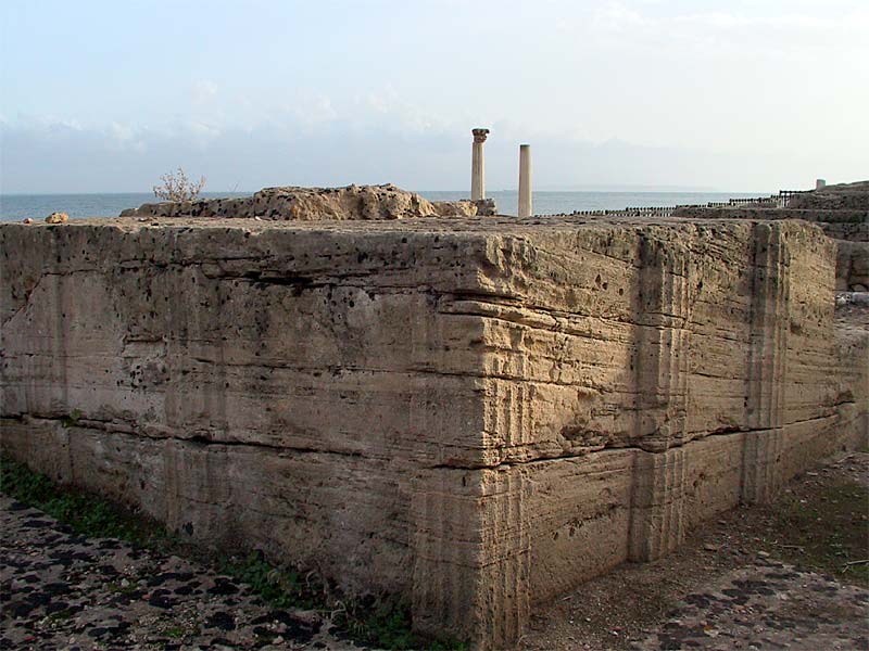
Tharros Archaeological Site
The promontory of San Marco, where Tharros lies, is the extreme end of the Sinis Peninsula.
Of the nuraghic period, the rests of about 100 nuraghi scattered on the peninsula remain; only on the promontory, four nuraghic settlements have been discovered, which had been abandoned before the arrival of the Phoenicians.
The Coastal Towers
Different authors ascribe to the territory of Cabras five coastal towers, three of which are directly situated on the coast. They had the task to watch over the coasts in order to prevent the frequent incursions by the so-called "barbareschi", as well as to prevent the landing of infected boats or boats suspected of smuggling. The surveillance was particularly important near the so-called "tonnare" and fish pools, like in Cabras, which was more than once subject to pirate attacks.
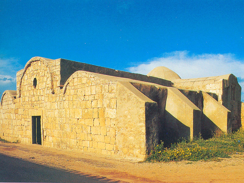
San Giovanni di Sinis Church
Along the road leading to Tharros there is the church of San Giovanni di Sinis, which probably dates back to the 5th century, and is therefore one of the most ancient churches in Sardinia still in use. The first structure had a central plan with a dome; in the 11th century it was enlarged with early Romanesque forms, and the interior was divided into a nave and two aisles separated by low arcs and heavy pillars; the two aisles were covered with barrel vaults, while the nave and the apse were covered with the dome. The church still preserves the original central dome supported by four solid arcades.
San Salvatore Hypogeum
The ancient village of San Salvatore, built between 1600 and 1700, represents one of the most important villages of "cumbessias" (accommodation for pilgrims) of the province. The small settlement was built around the homonymous church which, built in the 18th century on the ancient hypogeum, is still used by believers. It is a building covered with roofing-tiles, supported by an arc delimiting a small nave on the right.
Cuccuru Is Arrius
The prenuraghic site of Cuccuru Is Arrius, discovered during the excavations in the drainage channel, is situated along the western banks of the Cabras Lagoon. The site includes a necropolis and different settlements dating back to the Neolithic Age, the Chalcolithic Age, the Punic Age, of a temple with nuraghic well where there was an annexed cultural area dating back to the late Republican period, and finally a Roman-Imperial necropolis.
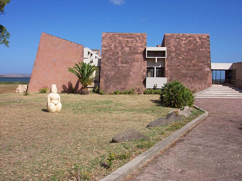
G. Marongiu Museum in Cabras
Giovanni Marongiu Museum in Cabras, inaugurated in 1997, houses a large collection of archaeological finds which give the opportunity to retrace the millenary history of the Sinis Peninsula, a wide area which with Capo San Marco marks the north-west border of the Gulf of Oristano.
The exhibit is divided into two sections, respectively dedicated to two of the main local archaeological sites, Cuccuru is Arrius and Tharros.