Protected Area
Identity Card
- Adda Nord Regional Park:
- Land Surface Area: 8'979.00 ha
- Regions: Lombardia
- Provinces: Bergamo, Lecco, Milano, Monza e Brianza
- Municipalities: Airuno, Bottanuco, Brivio, Busnago, Calco, Calolziocorte, Calusco d'Adda, Canonica d'Adda, Capriate San Gervasio, Casirate d'Adda, Cassano d'Adda, Cisano Bergamasco, Cornate d'Adda, Fara Gera d'Adda, Galbiate, Garlate, Imbersago, Lecco, Malgrate, Medolago, Merate, Monte Marenzo, Olginate, Paderno d'Adda, Pescate, Pontida, Robbiate, Solza, Suisio, Trezzo Sull'Adda, Truccazzano, Vaprio d'Adda, Vercurago, Verderio, Villa d'Adda
- Establishment Measures: LR 80 16/09/1983
- PA Official List: EUAP0736
- Park Authority: Ente Parco Naturale Adda Nord
- Further managed Protected Areas:
- Zona di Protezione Speciale Il Toffo
- ZSC Lago di Olginate
- ZSC Oasi Le Foppe di Trezzo sull'Adda
- ZSC Palude di Brivio
Altimetry: h min 100m asl - h max 260m asl
The Park and Nature
Geology
The physical environment crossed by the river Adda and included in Adda Nord Park, from Lecco to Truccazzano, is characterized by a system of river-glacial terraces.
The glacier which in the Quaternary period went down from the Alps
towards the plain, in its alternating movement of advancing and
withdrawing, gave origin to wonderful morainic amphitheaters.
After the definitive withdrawal of the glacier, the river slowly dug
its own bed carrying with it enormous quantities of morainic detritus.
The territories crossed by the river are therefore made both by ancient river-glacial deposits (red-yellowish clays, the so-called
"ferretti") and locally, especially between Paderno and Trezzo, by
conglomerate banks ("ceppo") eroded by the course of the river which
shaped steep vertical slopes, and by more recent deposits, sandy and
gravely materials which can be found above all between Cassano and
Truccazzano.
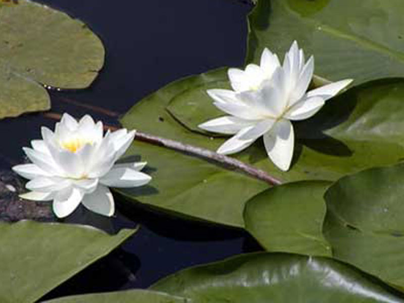
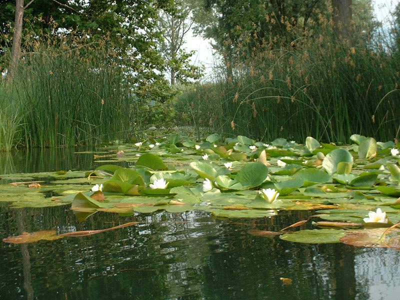
Vegetation
After the long glacial eras, the change of climate allowed the formation of large forests covering not only the hills but also great part of the Po Plain. The large woods, which until the last century covered the territory surrounding the river, have been subsequently reduced by the steady and strong presence of human settlements growing together with the development of agricultural and industrial activities. Despite this, nowadays we still find many areas which can be considered interesting for their vegetation, like the canebrake wetlands of Isola della Torre and Isolone del Serraglio, surrounded by meadows and high-trunk trees: black alders, plane trees, poplars, birches, willows, oaks. Along the northern banks of Trezzo there are also black poplars, locust trees, white willows, black alders, and British oaks. Besides high-trunk tree woods, there are large areas covered by typical essences of coppice wood and underwood: hornbeam, chestnut tree, crab grass, hazelnut tree, locust tree. Among the marshy vegetation you can admire the most beautiful waterflowers: the delicate water-lily, the yellow lily, the lily of the valley, and several families of spicate veronica.
Fauna
This environment is the shelter of a rich fauna. The most beautiful and interesting local amphibian is without a doubt the tree frog with a bright green coat and a black strip on its sides, but there are also several and noisy green frogs, together with the brown common frogs. There are also several birds: swans, ducks, mallards, coots, hooded crows, seagulls, but also the wonderful and continuously increasing gray herons.

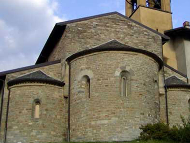
The Park and History
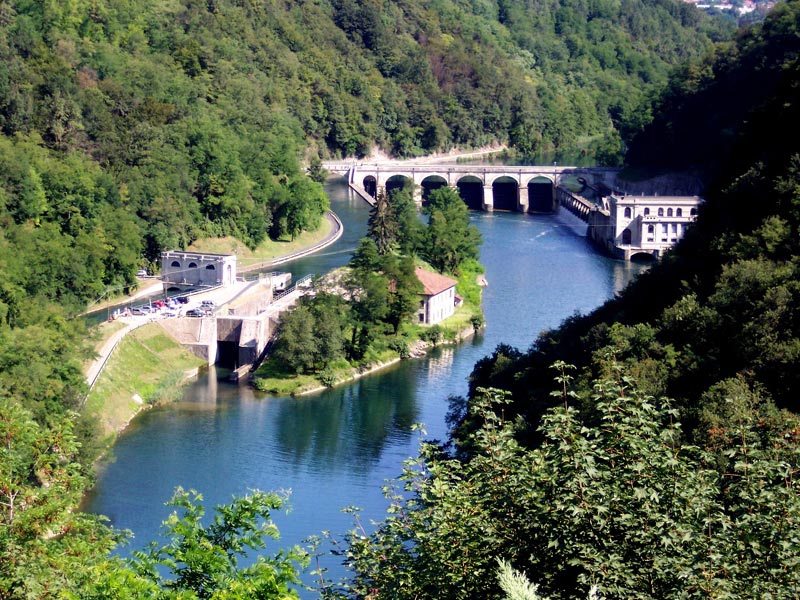
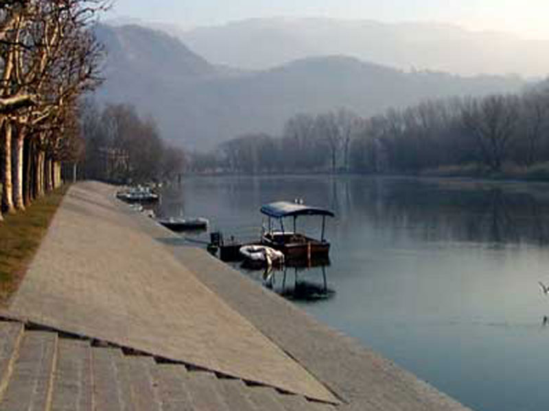
The river and the surrounding territory are rich in significant
historical evidences dating back to very ancient epochs. For instance,
the bridge separating the lake of Garlate from the one of Olginate,
lies where in the past a very ancient Roman bridge gave the opportunity
to cross the river to the Como-Aquileia, one of the main communication
roads of that period. The river marked the border between the Dukedom
of Milan and the Republic of Venice, and it represented an important
cultural and commercial way of communication both towards Bergamo and
towards Milan.
Several defensive works have been built along the
course of the river Adda throughout the centuries: the first
fortifications were built along the roads to check and push back the
raids of the enemies; further on, they were used to signal the presence
and the movements of the enemy troops.
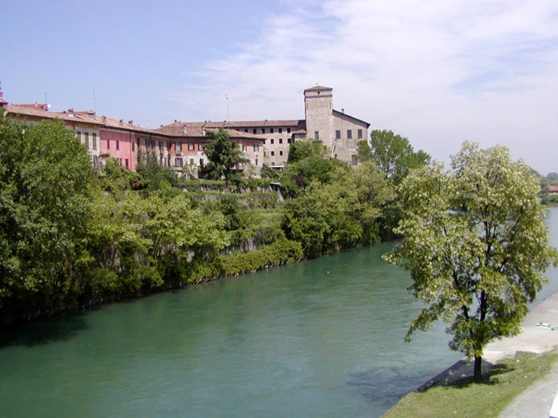
Trezzo Castle is very ancient: today we can see only
the primitive Lombard stronghold which, according to the tradition,
was built by the queen Teodolinda. From that first stronghold, a
tormented series of struggles, conquests, and dead followed, with
protagonists Frederick Redbeard, the Torriani and the Visconti families.
The castle of Cassano was also theater of many battles. It was built
before the year 1000 and, according to history, also Charlemagne
stopped there.
In the territory of Truccazzano, in the country ward Corneliano
Bertario, there is the castle where it is said that Frederick Redbeard
stopped during the struggles with the people of Milan in 1164.
The castle of Brivio became the shelter for the noblemen chased away
from Milan by its inhabitants in the 13th century. The town sent on
that occasion an army which destroyed its walls - which were rebuilt by
the Visconti family in the following century.
The 'Navigli'
In 1457 Francesco Sforza entrusted the building of Naviglio della Martesana to Bertola from Novate. In only 35 years, from 1439 to 1475, 90 kilometers of navigable canals were built. A supremacy that no other town could ever approach. However, the development of the system did not stop at this point, but, with the arrival of Leonardo in 1482, the Martesana was improved and a new canal system giving the opportunity to navigate Valtellina up to Milan was built.
In 1482 Leonardo da Vinci was entrusted by Ludovico il Moro to study a navigation system from the lake of Como up to Milan. A possible solution can be found in some drawings of Codex Atlanticus, according to which a great dyke on the river Adda in locality Tre Corni would be built, and an outlet in the gallery would allow the passage of boats downhill the river's rapids. The dam would also increase the river level and feed a canal which, according to the water level, would be used only for irrigation or also for navigation, and, leaving from Brivio, would reach Trezzo by flowing parallel to the Adda. Another brilliant solution to get over the 23,76 meters of difference in height of the rapids in Paderno was found at the half of the 16th century by the engineer and painter Giuseppe Meda who created what subsequently will be called Naviglio di Paderno. The ingeniousness of the technical solution was praised when two centuries later the work was resumed under the Austrian empire of Maria Teresa: the Minister for Lombardia, the Count Carlo Firmian decided to adopt an intermediate solution with six basins with jumps between four and six meters. The works began in 1591, were resumed in 1773 and completed in 1777.
The connection Adda-Milan was created under Ludovico il Moro.
Even if the navigation was difficult because of the excessive water
withdrawals for irrigation purposes, only in 1574 the Martesana was
renewed and extended, its waters regimented and the Canale Molgora was
built. In order to recover, enhance and use the stretch of the river
Adda studied by Leonardo, Adda Nord Park, Comitato per il restauro delle chiuse dell'Adda together with the Province of Milan and the support of Regione
Lombardia, have obtained from the European Union the possibility to
include this stretch of river in the project "Canaux Historiques Voies
d'Eau Vivantes".
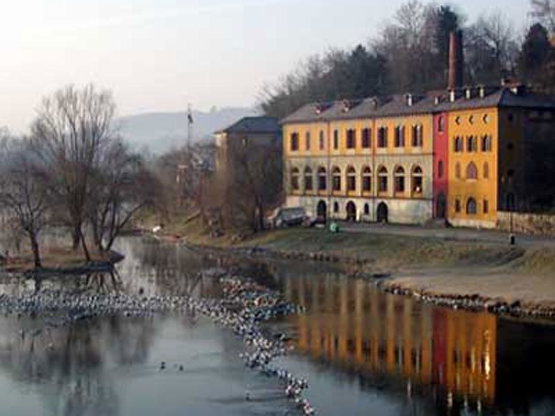
Industrial Archaeology
The iron bridge of Paderno d'Adda is considered the symbol of the
industrial archaeology in Italy and one of the most interesting
creations of the 19th century Italian engineering. Built between 1887
and 1889 in the National Workshop of Savigliano and based on a
technical project of the Swiss Eng. Rothlisberger, the bridge is 266
meters long and it is run through by the railway line and the
provincial road towards Bergamo. The entangled series of plates and
bars which left our ancestors astonished is one of the most interesting
evidences of the period in which steel, iron, and cast iron were the
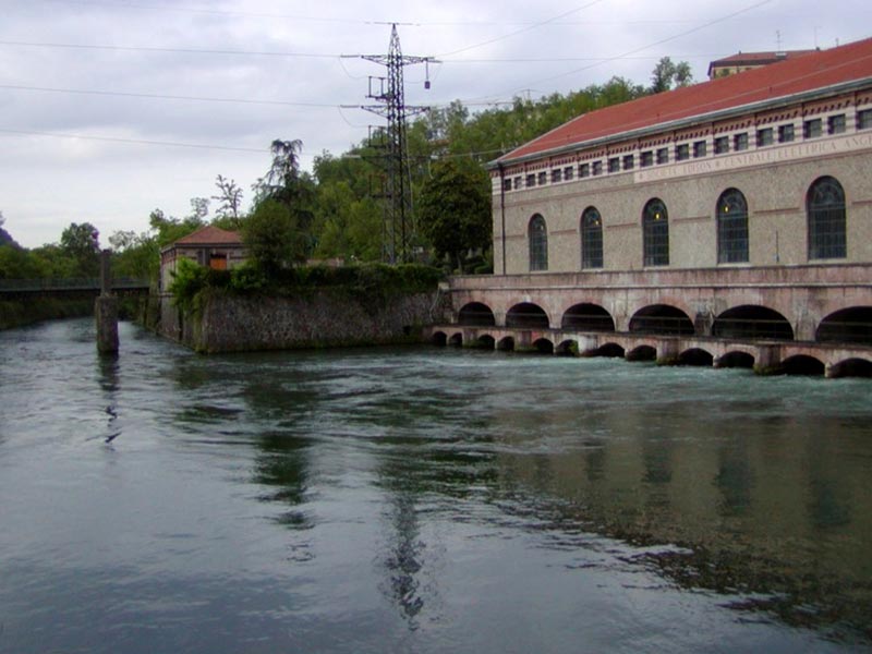
symbols of human progress. The most ancient industrial monument among
the ones which can still be seen along the river Adda is the plant
Velvis in Vaprio d'Adda which was quoted in 1857 by Cesare Cantù in his
description of the Lombardo-Veneto for the quality of the velvets
produced. At that time the plant was owned by the company "Sioli
Dell'Acqua & Co.", founded by Carlo Sioli, Agostino Dell'Acqua and
the Count Giuseppe Archinto, but which passed in 1865 to the Duke
Visconti di Modrone who gave the plant its current name, "Velvis" the
initials of "velvets Visconti".
In Cassano d'Adda there is the
National Linen and Hemp Mill which was used at the beginning only for
the spinning, but which was completed with the weaving and the
bleaching of linen and hemp. The place was occupied by a spinning mill
until 1873, when the company which already owned a plant in Fara
d'Adda, bought the premises and organized them according to the English
models, both as far as planning and machinery were concerned and, at
least at first, also as far as the direction was concerned,
transforming it at the end of the 19th century into on of the largest
linen mills of Europe.
In Brivio, on the bank of the Adda, there is an example of illustrious
architecture applied to an industrial building: it is the spinning mill
Molinazzo, built before 1875.
The spinning mill Abegg in Garlate was built in 1841 and, after
belonging to Gaetano Bruni and to the Gnecchi family, it was bought in
1887 by the Abegg family from Zurich.
Since in the early 30s the work for the spinning mill diminished, the
plant was used for rewinding and doubling works up to 1950, when Carlo
Job, who was in charge of the Abegg group, decided to dedicate a part
of the mill to the first nucleus of what will become the Museum of Silk
in Garlate.