


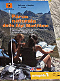
Path map - Wegplan 1:25.000 Parco naturale delle Alpi Marittime
Map of the trails in scale 1:25000 - Palanfré (Vernante), Valdieri, Entracque, Massicci Argentera, Matto, Clapier-Maledia-Gelàs
Map of trails in scale 1:25000, published in collaboration with Alpi Marittime Park, that has updated roads and trails and checked altitudes and place names.On the back, brief descriptions of 33 tours on foot and by mountain bike, 5 traverses, and information on the Park.
- Author/s: Parco naturale delle Alpi Marittime
- Publisher: Blu Edizioni
- ISBN: 978-88-7904-079-2
- Size: 12x22cm (closed)
- Year: 2009
- Scale: 1:25.000
- Price: 7.00 €
- Text language: EnglishDeutsch
Notes: Edition in English and German.
Item temporarily sold out at Emporio dei Parchi
Item temporarily sold out at Emporio dei Parchi
Path map - Wegplan 1:25.000 Parco naturale delle Alpi Marittime


© 2024 - Ente di gestione Aree Protette Alpi Marittime - p. iva 01797320049