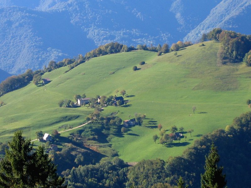
Discovering the Wonderful Valvestino
Three days to visit Valvestino
- Trail Conditions: On foot
- Interest: Panorama, Photography
From the restricted byway of "Camerate", following upstream Toscolano valley until you reach the bridge, after crossing it and reaching the opposite bank, continue along the dirt road developing on the north-western slope of Pizzocolo and reach Campiglio valley, at the end of which, in loc. Campiglio di Cima, you will find the departure point of the horse-riding tourist itinerary (about 10 km). Go ahead, reach the opposite slope and, walking along the southern slopes of Mt. Zingla (1,496m), cross upper Vesta valley to reach the first stop at malga Corpaglione, in the Municipality of Capovalle (4.5 km). After the stop, continue your tour and reach Ganone Pass. After meeting the road coming from Cavallino della Fobbia pass, you will cross Coccaveglie, situated under Mt. Manos (1,517m), and you will walk along the slopes of lngorello peak and Mt. Carzén (1,507m) to reach the stop at Vesto di Cima, in the Municipality of Gargnano (about 3 km).
Go ahead heading for Vesta pass, downhill across Val Selva, and reach Bollone, country hamlet of Valvestino, where you will find the first welcome point.
The day after, you will enter the charming and uncontaminated Valvestino, representing the innermost area of the Park. From Bollone country hamlet, go ahead along the ancient "Valle dei mulini" (the valley of the mills) and, on the opposite side, reach the SP road you will follow uphill until you will meet the trail leading to Turano; running along the valley of river Toscolano, you will reach this locality and head for Persone, both stops in the Municipality of Valvestino (about 5 km). From Persone, reach the locality of Messane, stop under Pase peak (1,503m), and Ponte Franato to head for the localities Vott and Denai, welcome point in the Municipality of Magasa (about 6 km) or you can reach the locality Cima Rest, via PilasterGrune, stop in the Municipality of Magasa (about 3 km).
On the third day, from locality Cima Rest go ahead to malga Alvezza and, going around val di Campei under Mt. Coplone (1,976m), go downhill to the slopes of Bus del Balì peak and Costone peak; climb to malga della Puria and Scarpapè pass, in the Municipality of Tignale, up to the stop of Cascina Nuova (about 8 km). From Cascina Nuova, reach Ere Pass and, going along the military road of Bocca Paolone, you will reach the country hamlet of Costa, in the Municipality of Gargnano, arrival, stop, and welcome point (about 5 km).