The Via GeoAlpina
- Trail Conditions: On foot
The 'Via Geoalpina' was established on the occasion of the International Year of Planet Earth that involves six European Countries (Australia, France, Germany, Italy, Slovenia and Switzerland) with the aim to make people know the beautiful geological history of the alpine mountain chain and to enhance it. This initiative comes from the idea to offer an alternative and aware way to enter in contact with Earth Sciences (geology, geophysics, geomorphology, pedology, paleontology, geodesy, hydrogeology, climatology etc…): some explanatory panels will lead visitors along the thematic routes crossing the Alps.
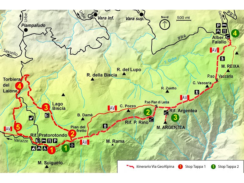
The Beigua Geopark - whose territory is characterized by rock formations belonging to the evolution history of the Alps, and therefore it is considered an 'alpine' environment from the geological point of view (in contrast with its geographical location within the Northern Apennine) - contributes to the wide and complex information project of the 'Via Geoalpina' with two itineraries dedicated to the local geological heritage:
- the ring-route that departs from Prariondo and reaches Pianfretto, the Biscia Lake and the Laione peatland and then goes back to Prariondo
- the stretch of the Alta Via dei Monti Liguri between Prariondo and the Faiallo mountain pass.