


Itinerary Arenzano - Cima Pian Di Lerca
Connection with the Alta Via dei Monti Liguri
- Trail Conditions: On foot
- Departure: Arenzano
- Arrival: Cima Pian Di Lerca
- Duration: 4 hour/s
- Difficulty Level: EE - For expert hikers
- Length: 11 km
- Difference in height: 1,050m
- Trail marker: red full double circle / three red balls / full red triangle
Follow the itinerary marked with the two red circles up to the Gava Pass, keep on following the path marker with the three circles up to Mount Argentea, and then the triangle up to Pian di Lerca.
Further information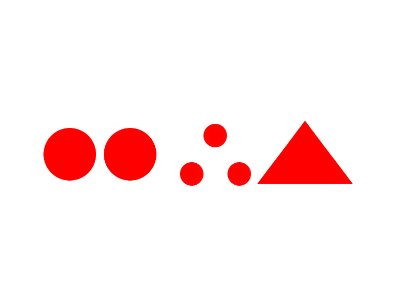
Trail marker: itinerary Arenzano - Cima Pian Di Lerca (red full double circle / three red balls / full red triangle)
 Download KMZ
 Download the GPX format
Books and Guides

Protected Area(8.790,71 ha)

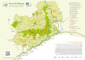
Lay-out of the itinerary

Departure

Arrival

Park Authority Offices

Visitor Centers (8)

Mountain huts/bivouacs* (1)

Municipalities (11)

Points of Interest (35)

Photos (20)

EV charge ≥100kW (286)

Airports (1)

Ports (1)

Station (4)
*: only Operators with Accommodation Page


© 2024 - Ente Parco del Beigua