Protected Area
Identity Card
- Beigua Regional Nature Park:
- Land Surface Area: 8'790.71 ha
- Protected flora: 6 species (Italian text)
- Protected wildlife: 87 species (Italian text)
- Habitats: 13 types (Italian text)
- Regions: Liguria
- Provinces: Genova, Savona
- Municipalities: Arenzano, Campo Ligure, Cogoleto, Genova, Masone, Rossiglione, Sassello, Stella, Tiglieto, Urbe, Varazze
- Establishment Measures: LR 12 22/02/1995 - LR 16 09/04/1985
- PA Official List: EUAP0452
- Park Authority: Ente Parco del Beigua
- Further managed Protected Areas:
- Zona di Protezione Speciale Beigua - Turchino
- Zona Speciale di Conservazione Beigua - Monte Dente - Gargassa - Pavaglione
- Zona Speciale di Conservazione Foresta della Deiva - Torrente Erro
- Zona Speciale di Conservazione Pian della Badia (Tiglieto)
- Zona Speciale di Conservazione Praglia - Pracaban - Monte Leco - Punta Martin
- Beigua UNESCO Global Geopark
- The Park Plan: approved with "Deliberazione del Consiglio Regionale no. 44" of 03-08-2001
- Pluriennial Social-Economic Plan: approved with "Deliberazione della Giunta Regionale no. 1722" of 27-12-2002
A Park to Safeguard Biodiversity
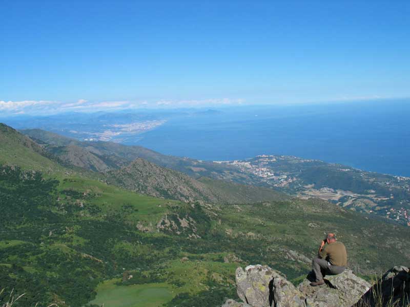
Twenty-six kilometers of mountain ridges which are situated very near to the Riviera Ligure and which develop from the Colle del Giovo to the Passo del Turchino parallel to the coast, passing for the summits of Mt. Beigua (1,287m), Cima Frattin (1,145m), Mt. Rama (1,148m), Mt. Argentea (1,082m), and Mt. Reixa (1,183m). They include grasslands and valuable wetlands, thick woods of beeches, English oaks, and chestnut trees, steep slopes and rocky outcrops, maritime pinewoods and belts of Mediterranean vegetation.
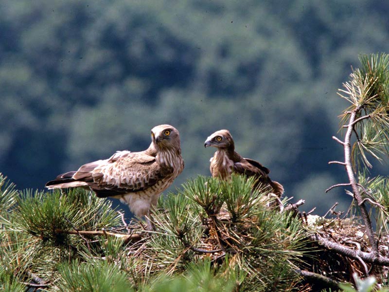
A mosaic of environments for which Beigua mountain group is considered one of the richest areas in biodiversity of Liguria: for this reason, in the Park 3 Sites of Community Importance have been proposed. The European Community, through the proposal of Regione Liguria and Ministero dell'Ambiente e della Tutela del Territorio, has further recognized the extraordinary naturalistic value of Parco del Beigua by establishing a Special Protection Area which is particularly important for migratory birds (the area is recognized as an "Important Bird Area" according to the classification of Bird Life International). The area is populated by over 80 nesting species, some of which of great value like the Golden Eagle, the Short-toed Eagle, the Rock Thrush, the Nightjar, and the Red-backed Shrike.
Along its most difficult routes which remain concealed to the sight of man, there is the wolf, and from the spurs facing the sea it is easy to see the silhouettes of the whales passing in front of Varazze, Cogoleto, and Arenzano.
In a few kilometers you can find an environmental variety which goes from the typical bloomings of the Mediterranean maquis to the high altitude peatbogs which are evidences of the past struggles of ice and rocks to shape the terrestrial surface.
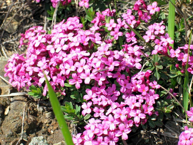
A park where it is possible to find multicolored endemic floral species (Viola Bertolonii, Cerastium utriense, Asplenium cuneifolium, Daphne cneorum, Cheilantes marantae) and some animals belonging to the minor fauna (like the Montpellier snake, the Alpine newt, the crested newt, the common frog, etc.).
A park including three important Regional State Forests ("Deiva" in the Municipality of Sassello, "Lerone" in the Municipalities of Arenzano and Cogoleto, "Tiglieto" in the Municipalities of Tiglieto, Masone, and Campo Ligure) where the typical ungulates of the Ligurian Apennine live: among the others, wild boars, roe deer, and fallow deer.
Further information on the Park's environment, natural heritage and biodiversity are included in the Park management plan (in Italian).
A Geological Heritage Recognized all Over the World - Beigua Geopark
The territory of Beigua Regional Park, Liguria's largest protected area, preserves the geological history of this region, told through rocky outcrops, mineralization, fossiliferous deposits, spectacular forms uninterruptedly shaped by exogenous agents. Because of this extraordinary geological heritage, in March 2005 Beigua was included in international networks as European and Global Geopark. Then, in November 2005, it was recognised as UNESCO Global Geopark.
Beigua Geopark includes the whole area of Beigua Regional Park, as well as a large section of territory functionally connected with the Park. It covers an area of 39,230 hectares, spread on 10 Municipalities (Arenzano, Campo Ligure, Cogoleto, Genoa, Masone, Rossiglione, Sassello, Stella, Tiglieto, and Varazze) in two provinces (Genoa and Savona).
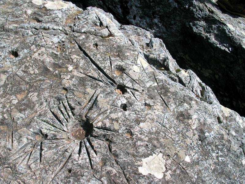
The Geopark features a rich and varied geological heritage, which exemplifies the several branches of Earth Science, and which is especially significant to retrace Italy's geological history and to understand the evolution of the Alps. On these geosites, visitors can observe several types of rocks, shapes, and processes, which are not only interesting from a scientific point of view, but have a distinct aesthetic and educational value, too.
Many ophiolites or "green rocks" with an Alpine metamorphic imprint characterise the area: they were part of a Jurassic seabed (which therefore originated about 160 million years ago) that seldom outcrops to such extent on the Alps and in Europe.
The spectacular canyons carved in the conglomerates of Val Gargassa (Municipality of Rossiglione) and the rich fossil flora, including tree trunks and many leaves, in the paleontological area of Stella Santa Giustina are absolutely fascinating. A further amazing feature is the fossil coral reef in Ponte Prina-La Maddalena (Municipality of Sassello), where conspicuous coral colonies are set directly on the ophiolitic substrate, or the curious lherzolite spheroids (dark green intrusive rocks) at Lago dei Gulli (Municipality of Sassello). An ideal geological trip would also include the meanders of Piana della Badia (Tiglieto), where the first Cistercian abbey outside of France was built in 1120, or the ophiolite outcrops at Passo del Faiallo. The outcrops are the keepers of precious garnets: gorgeously transparent, red crystals. The extraordinary blockstreams and blockfields on the Park's ridges (Torbiera del Laione, Prariondo, Pian Fretto) are not to be left out: they are evidence of the geomorphological processes occurred in periglacial environments. And finally, a last stop to admire the marine terraces along the coast, among Varazze, Cogoleto and Arenzano, that have been keeping track of changes in the sea level throughout time.
At the Geopark there are thematic trails, equipped trails, Visitor Centres and Infopoints, to provide visitors with insights and information on the environmental, historical and cultural characteristics of the Beigua Geopark area.
A Park for Sustainable Development
Beigua Park is characterized by precious historical-cultural features you can find scattered throughout the territory or in the museums: it tells the tale of the evolution of the human settlements in the Park area and the important ways of commerce existing between the coast and the Po Plain.
Such a precious resource to hand down to future generations makes the Park a special territory not only for the preservation of biodiversity, but also because it safeguards and enhances the value of the cultural identity of each community settled in its territory, and because it is a laboratory for the experimentation and the development of sustainable social-economical activities.
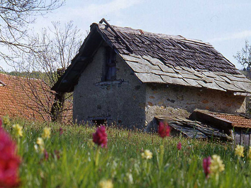
From the paleontological finds witnessing that the forests of Mt. Beigua were known by hunters and shepherds already in the prehistoric period to the importance acquired by the area as a crossroads of important ways of commerce between the coast and the Po Plain, thanks to the considerable impulse given in the territory of Valle dell'Orba by the settlement of the Cistercian Monks in Badia di Tiglieto (founded in 1120), to the traditional agricultural and woodland management activities which developed in the territory over the lastest centuries, Beigua Park has always been interested by the dominating and reassuring presence of man over the environmental resources of this section of the Ligurian territory, where it is still visible a rich and widespread heritage of buildings and rural structures.
Of particular interest also the various production and agricultural activities characterizing the Park territory and attracting tourists: among the main ones, the paper industry, above all in the valleys of Arenzano (Cantarena and Lerone); the ironworks which developed in the Sassellese area and in the valleys Stura and Orba; the glassworks which developed first in Valle Stura, and then in Valle dell'Orba; the characteristic filigree activity of Campo Ligure which transformed it in a craftsmanship center known all around the world; and the productions linked to the forest activities and to timber working (with the traditional professions of the woodcutters, the sawyers, the basket makers, and the coopers).
As far as the characteristic agricultural and food production activities are concerned, it is necessary to mention the role of the chestnut tree with all the recipes deriving from its fruits.
The confectionery industry of Sassello is very important and known for its characteristic "amaretti" and "canestrelli", exported all over the world.
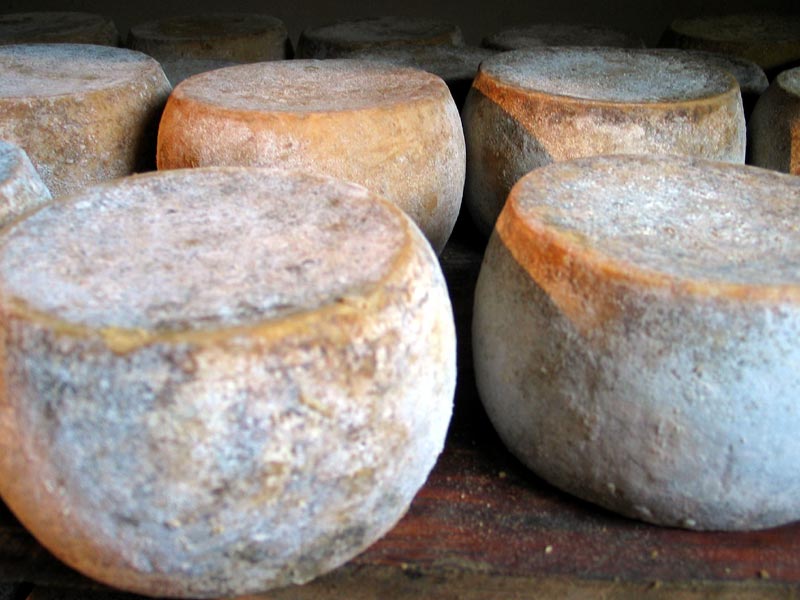
The panorama is completed by beekeeping, berries and medicinal plant cultivations, the wide range of dairy products, the processing of cow and sheep meat, as well as mushroom picking and preservation.
The Environmental Management System
In 2005, Beigua Park Authority adopted an Environmental Management System in compliance with the UNI EN ISO 14001 standard, for the conservation and promotion of the protected area's environmental, historical and cultural resources through:
- maintenance and rehabilitation of the territory;
- safeguard of biodiversity;
- safeguard of landscape heritage;
- research activities and scientific education;
- education to sustainable development;
- promotion of tourism and eco-compatible production activities.
The system is applied in all the structures that the Park Authority directly manages.
To read the environmental policy approved by the Park Council, and download the ISO 14001 certificate, please visit the page about the Environmental Management System.