

Points of Interest
The Natural Environment
The plateau group of Colfiorito has an extension of about 50 kms. and the seven basins forming it are situated between 750 - 800 mts above sea-level.
The most important karst phenomenon of the Marsh of Colfiorito is the swallow hole of Molinaccio, while the marsh vegetation (Hordeo-Ranunculetum velutini, Caricetum gracilis, Phalaridetum) is disposed in concentric circles.
The marsh is an important rest area for the migratory avifauna typical of the wetlands (grey herons, purple herons, bitterns, little bitterns, mallards, shovelers).
The presence of the eagle owl and of the wild cat is relevant in the nearby Selva di Cupigliolo.
The marsh of Colfiorito and the Plains are generally one of the most interesting natural elements in the Apennine chain for their geomorphological, geological, hydrological, paleontological, botanical, historical, and agronomical features, and for their landscape.
The hydrology of the area is of particular importance for its role as a nourishing basin of the main drinking and hydromineral springs of Umbria.
The Story of Man and its Traces
The presence of the Protoumbrian and Umbrian civilization is demonstrated by important urban finds and by necropolis.
Of all the pre-Roman settlements the main one is that of Mt. Orve, surrounded by walls made of calcareous rocks and with proto-urban features. The Plestia area was the seat of of a Roman Town Hall already in 178 BC.
The expansion of the human presence in the plateaus is linked to the richness in waters, the cultivation, the altitude of the ground, and to the fact that Colfiorito was the crossroads of the most important routes crossing the Central Apennines.
In the 5th century BC, Plestia had its own bishop and the city is mentioned in the certificates of the Emperor Ottone III in 996.
Under the pressure of the Gothic, of the Longobard, and of the Hungarian invaders, the urban structure dissolved and the inhabitants returned to the hills where the old castles stood.
In the 12th century, the plateaus housed a new civil-political organization with castles (Anifo, Lignano, Popola), with monasteries (Sant'Andrea di Gricciano, Sant'Angelo di Bagnara), and hermitages.
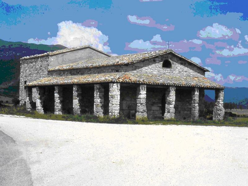
In 1269 the Castle of Colfiorito was built, but Santa Maria di Plestia has more important historical features. The Sanctuary rises isolated at the confluence of old roads and on the Roman temple and the early Christian Basilica ruins.
The Most Important Environmental Features
- The Colfiorito swamp, perfect representation of the floristic and faunal biodiveristy
- The sinkholes, the superficial karst phenomena (the Molinaccio sinkhole)
- The karst plains representing the bottom of ancient lake basins which dried up naturally or due to land reclamation works, are one of the most interesting natural features of the Central Apennine (Colle Croce Plain, Annifo Plain, Colfiorito Plain. Arvello Plain, Colfiorito Plain, Ricciano Plain, Popola and Cesi Plain).
- The great Castellieri system, namely fortified high areas that functioned as defense and sighting places. The most famous are situated in: Mount Orve, Casicchio, Vervara, Borgarella - Castellina, La Torre a Casenove, Castellaccio or mount Torricelle, Monte, Le Penne, Afrile, Castellaro di Talogna and Croce di Fumegghia ad Annifo, Le Cese, Carmello, Castellare in mount Acuto, mount Trella. By Dignano they are Castello, Tolagna, mount Birbo, mount San Salvatore di Verchiano.
- Sites of Community Importance within the municipality of Foligno:
1. Col Falcone - cod. IT5210031
2. Macchia e Selva di Cupigliolo - cod. IT 5210037
3. Palude di Colfiorito - cod. IT5210072 e cod. IT5210034
4. Piano di Ricciano - cod. IT5210036
5. Piano di Annifo e Avello - cod. IT5210032
6. Sasso di Pale - cod. IT5210038
7. Lecceta di Sassovivo - cod. IT5210042
8. Fiume Menotre - cod. IT5210041
9. Castagneti di Morro - cod. IT5210079
Cultural Heritage
- Il Campo di Colfiorito (The Colfiorito Field)
- Monte Orve: the "Castelliere", the prehistorical settlement
- Plestina: archaeological remanis of the Roman town
- S. Andrea di Gracciano and S. Angelo di Bagnara: the Monasteries and the Hermitages
- Colfiorito: the Castle
- S. Maria di Plestia: the Sanctuary (built on the ruins of a Roman temple), the early Christian Basilica, the remains of the ancient Roman town
- Piano di Ricciano: the Basilica of C. Gentili
- Castellina: the "Castelliere"
- Monte Cupigliolo, Cifo, Madonna di Ricciano, Polveragna, Forcatura, Borgarella: the finds of archaic and Roman nature and the ancient settlements from the early Iron Age to the first Roman Imperial Age.
Places of interest
- Accessible Pedestrian Walkway, 800 meters long, along the northeastern side of the marsh
- Loc. Molinaccio, heart of the Park, it includes the sinkhole, the house of the Mollaro, the bridge and it is the arrival point of the pedestrian walkway.
- Fonte Fontaccia, situated below the built-up area of Forcatura it is a particularly panoramic observation point and picnic area.
- Mount Orve, with its 926 m above sea level it is the highest point of the Park's area, and it offers a panoramic view of the Plestini uplands, where ancient human settlments were situated.
- Santa Maria di Plestia, at the border between the Marches and Umbria it is a crossroads of history and spirituality.
- Naturalistic Observatory, in the central part of the western bank of the marsh it is an ideal place for birdwatching.
- Croce di Cassicchio, ideal observation point with view of the marsh.
Sports Activities
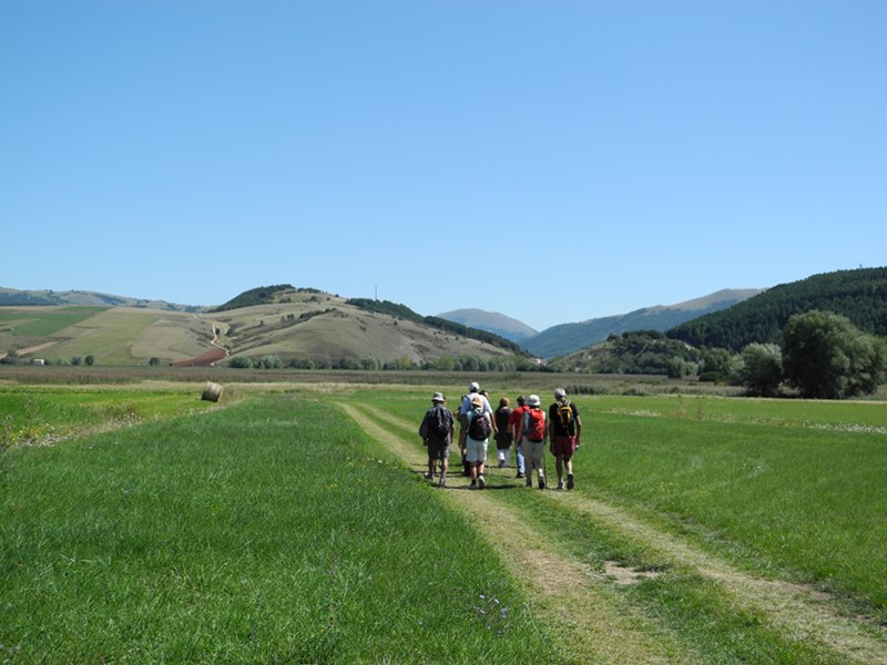
- Trekking
- Mountain biking
- Tours on horseback
In the surroundings of the Park
- Rasiglia
- Rasiglia and its sources
Info and bookings: 349/3479723
- Pale di Foligno
- Hermitage of Santa Maria Giacobbe
- Caves of the Abbadessa
- Altolina Park and Menotre Waterfalls
- Serravalle di Chienti
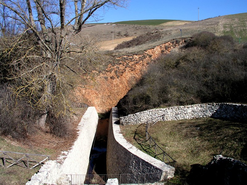
- Barrel of Varano and Roman channel
Info and bookings: gmp.gaia@gmail.com
- Paleontological Museum
Info and bookings: gmp.gaia@gmail.com
- Gelagna Mill
Info and bookings: 335/7119520 - fausto.barboni@gmail.com
- Nocera Umbra
- "Le Ferce" Waterfalls and Topino River in Bagnara
Info and bookings: 0742/813773 - comagrariabagnara@libero.it
- Church of Santa Lucia and Caves of Aggi
Info and bookings: 0742/813773 - comagrariabagnara@libero.it


