Protected Area
Identity Card
- Land Surface Area: 1'907.00 ha
- Regions: Friuli Venezia Giulia
- Provinces: Udine
- Municipalities: Enemonzo, Lauco, Raveo, Villa Santina
- Establishment Measures: Giunta Regionale del Friuli Venezia Giulia n. 2885 17/09/1999 - approvazione ampliamento in corso
- Park Authority: Comune di Villa Santina (Comune capofila)
Colline Carniche Park
It covers an area of about 1,907 hectares; out of them, about 188 are
in the Municipality of Villa Santina; 685 in the Municipality of
Enemonzo; 505 in the Municipality of Lauco, and 529 in the Municipality
of Raveo.
Parco Intercomunale delle Colline Carniche, born according to L.R. 42/96 (art. 6), has been officially established with a decision of Giunta Regionale del Friuli Venezia Giulia no. 2858 of 17th September 1999.
This Park is situated in the mountain section of Region Friuli-Venezia
Giulia called Carnia, in the province of Udine, exactly in the area
situated between the confluence of the stream Degano with river
Tagliamento.
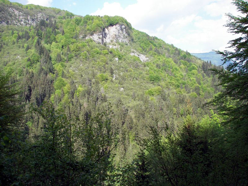
The Park is named after the gentle series of hills characterizing it,
exposed to the sun and covered with meadows and woodlands.
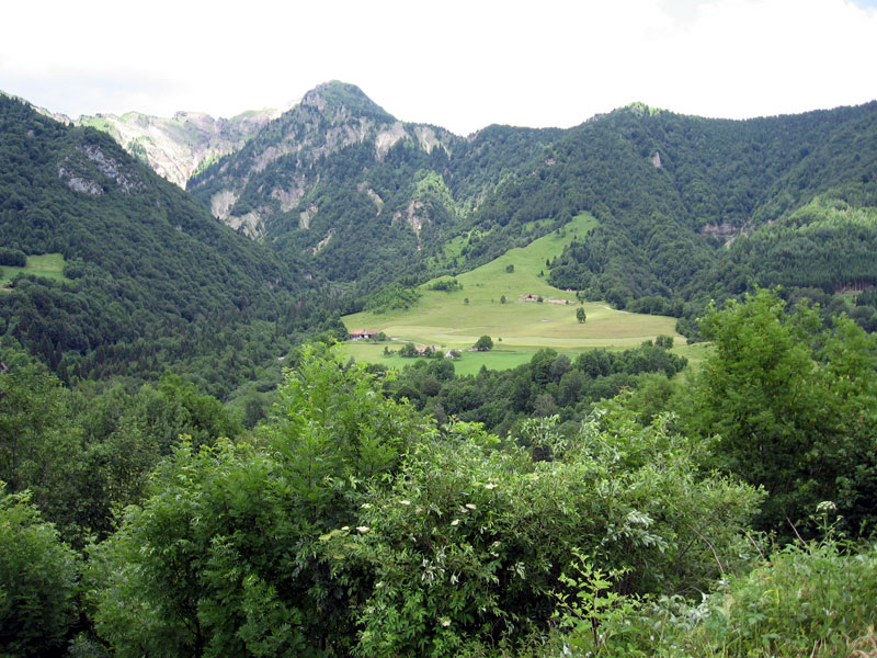
The territory also includes one of the largest and most fertile plains
of Carnia, and plays an important role as crossroads between the two SS
roads, one leading to Upper Val Tagliamento and Cadore, the other to
Canale di Gorto.
The nearest towns are Villa Santina, Invillino, Enemonzo and its
country hamlets, Raveo, and Esemon di Sopra, Lauco with the inhabitants
of Trava, Allegnids, Avaglio, Buttea, Vinaio.
Geological Evolution
The name "Colline Carniche" derives not only from the altimetric strip,
but without a doubt also from the gentle morphology of the area
involved by the Park.
Even if the municipal territories of Enemonzo
and Villa Santina reach the steep northern slopes of Mt. lovinzola
(1,868m) and Raveo stretches out towards north-west up to Col Gentile
(2,075m), the highest summit of the area, the most important
environmental area leading to the Park establishment is situated at the
valley bottoms and in the inner areas of the overlooking slopes.
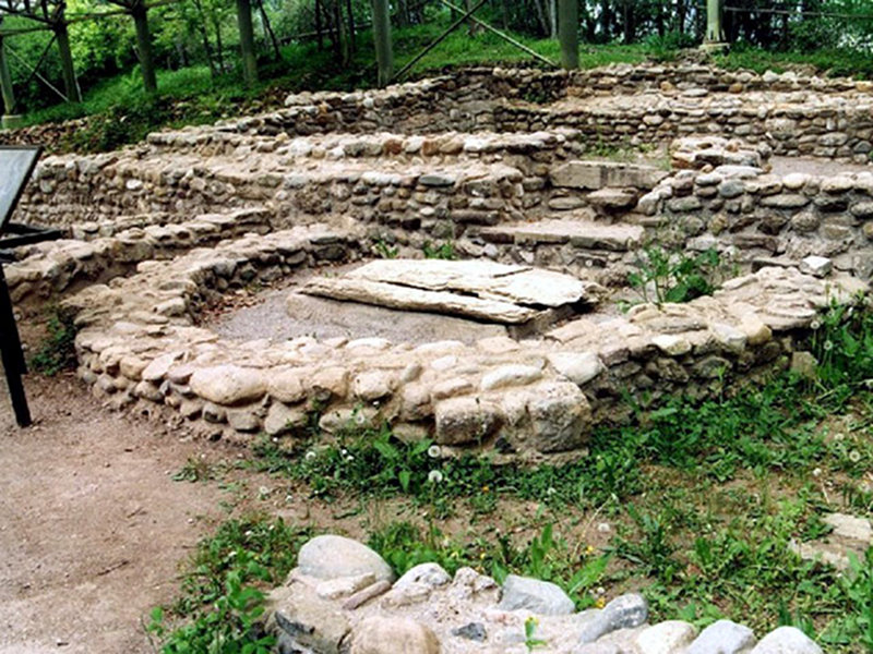
Archaeology and History
Historical Features
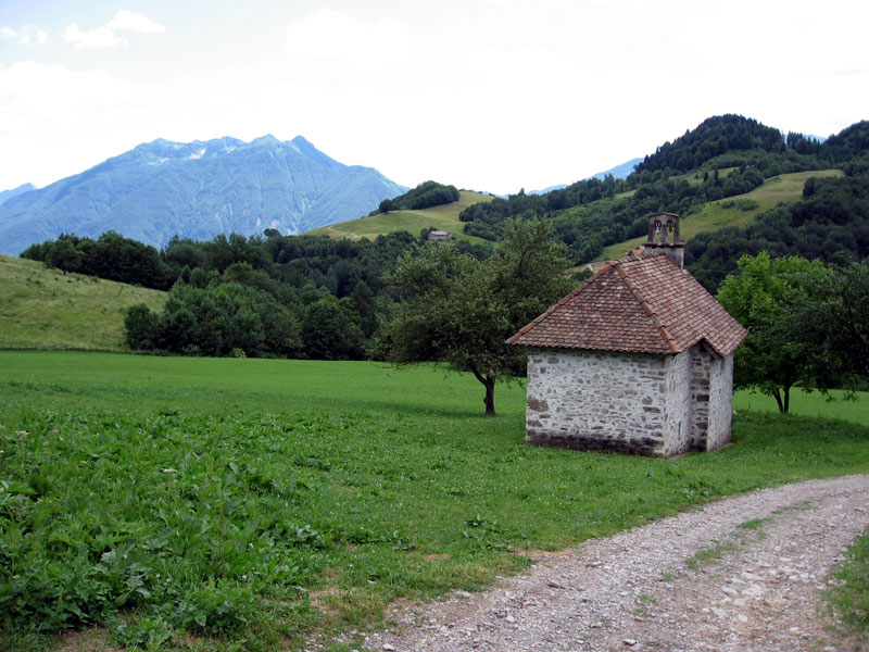
The interpretation of the evidences and historical remains will give the opportunity to carry out a thorough analysis of the territory: areas of archaeological interest, some of which have already been brought back to light (Monte Sorantri and Cuel Budin in Raveo, the tombs of Lauco and Chiauians, while some sites have been located according to some isolated finds like Fieria small treasure in Enemonzo, Monte Quas in Raveo, and different areas of Lauco). We should not forget the religious evidences represented by structures of great historical and artistic value like the Hermitage of Monte Castellano in Raveo and the Sanctuaries dedicated to the Virgin Mary in Raveo and Trava di Lauco, as well as "minor" buildings (smaller from an architectural point of view). The rural culture expressed in the building techniques of the trails, in the rural buildings, and in the creation of agricultural landscapes, finds several evidences within the Park. A careful analysis of the territory has highlighted specific places, areas, routes of historical interest that are still preserved in order to maintain the identity of the places: Country Churches (Sant'Ilario and Taziano in Enemonzo, Santa Maria Maddalena in Invillino di Villa Santina), Sanctuaries dedicated to the Virgin Mary (Madonna di Monte Castellano in Raveo, Madonna del Sasso, Madonna del Ponte in Villa Santina, Madonna di Trava in Lauco), the parish churches having an "influence radius" that may correspond with the parish church perimeter. Vie Crucis, rogation routes, and votive processions in general are particular routes which do not always bear evident traces along the roads, but give hints of the relations existing between different places which may be not that evident.
Flora and Vegetation
Nature and the Park Areas
The Park is characterized by interesting and beautiful naturalistic and
floristic aspects you can easily discover thanks to the presence of the
trail network and the naturalistic itineraries with a great
biodiversity. As a matter of fact, in a luminous woodland it is
possible to observe several species, some of them typical of the lake
environments and others of dry places and to appreciate an
uncontaminated and charming nature for its colors and perfumes. The
strategic places of the Park represent the departure and arrival points
of various routes: they have been thought as stop places for tourists
and reference points for local people. You can reach them by any means
of transport; they can be recognized easily thanks to the signals and
also house restaurants and shops selling agricultural products.
The
four main strategic places are: Villa Santina Pinewood, departure point
of various trails branching off towards the town of Enemonzo (to
discover Clap Foràt and the plain), or towards Invillino. The floristic
heritage you can admire in spring makes the pinewood a showcase of
perfumes and colors that only nature can offer. In the pinewood you
will find a manège where you can practice horse therapy, a large and
equipped sports field, a small lake where you can practice sports
fishing, and a refreshment point. The strategic point in Raveo is
represented by the area of the stream Chiarzò. Here three different
itineraries leave from the sports field; the first one leads from the
town of Raveo to Cuel Budin and Cuel di Nuvolae; the second trail
climbs Mt. Colza to get to Valdie and Pani; the third trail climbs to
Plan di Cès Sanctuary and then continues towards Mt. Sorantri.
The
strategic place in Enemonzo is the green plain with the area dedicated
to sailing flight and provided with games for children and a large
parking area where you can leave your car and take the trail leading to
Clap Foràt. In this area there is a refreshment point where you can
taste the typical dishes of the traditional cuisine of Carnia.
The
strategic point in Lauco is represented by Porteal area, with its
equipped sports area housing important events - not only sports events
- where itineraries leading you to discover the naturalistic and
landscape beauties of the country hamlets of the plateau leave.