

Itineraries
Arrone - Monte di Arrone
Departure: Arrone
Map with georeferenced itinerary
Typology: On foot
Difficulty Level: T - Tourist (level)
Duration: 45 m
Arrone - Tripozzo
Departure: Arrone
Map with georeferenced itinerary
Typology: On foot
Difficulty Level: T - Tourist (level)
Duration: 45 m
Collefergiara – Monte la Pelosa
Departure: Collefergiara
Map with georeferenced itinerary
Typology: On foot
Difficulty Level: E - Hiking (level)
Duration: 1 h 45 m
Colleponte - Umbriano
Departure: Colleponte
Map with georeferenced itinerary
Typology: On foot
Difficulty Level: T - Tourist (level)
Duration: 45 m
Ferentillo - Nicciano Nature Trail
Departure: Ferentillo
Map with georeferenced itinerary
Typology: On foot
Difficulty Level: T - Tourist (level)
Duration: 2 h 30 m
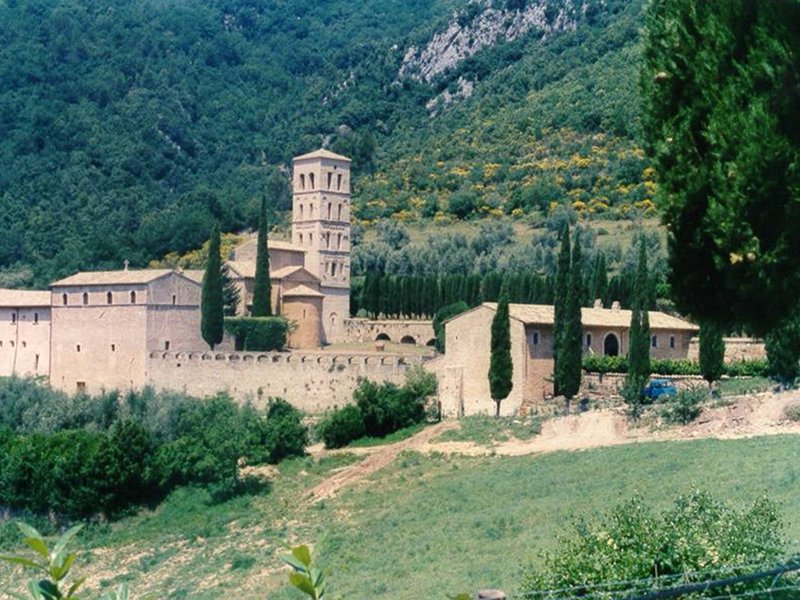
Ferentillo - San Pietro in Valle Abbey
Departure: Ferentillo
Map with georeferenced itinerary
Typology: On foot
Difficulty Level: E - Hiking (level)
Duration: 3 h 30 m
Map with georeferenced itinerary
Typology: On foot
Difficulty Level: E - Hiking (level)
Duration: 4 h
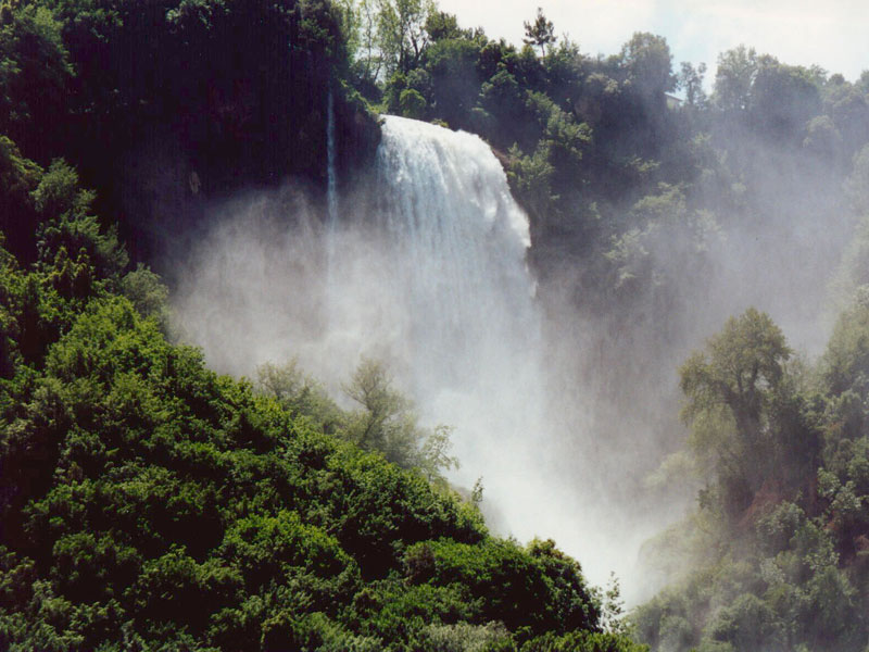
Parco dei Campacci - Piazzale Vasi
Departure: Marmore
Map with georeferenced itinerary
Typology: On foot
Difficulty Level: T - Tourist (level)
Duration: 1 h
Polino - Collebertone
Departure: Polino
Map with georeferenced itinerary
Typology: On foot
Difficulty Level: E - Hiking (level)
Duration: 4 h
Polino - Salto del Cieco
Departure: Polino
Map with georeferenced itinerary
Typology: On foot
Difficulty Level: T - Tourist (level)
Duration: 1 h 30 m
Typology: On foot
Difficulty Level: E - Hiking (level)
Duration: 1 h 45 m
Thematic hiking Routes
Typology: On foot


© 2024 - Regione Umbria