Protected Area
Identity Card
- Land Surface Area: 7'295.00 ha
- Regions: Umbria
- Provinces: Perugia, Terni
- Municipalities: Alviano, Baschi, Guardea, Monte Castello di Vibio, Montecchio, Orvieto, Todi
- Establishment Measures: LR 9 03/03/1995
- PA Official List: EUAP0238
- Park Authority: Regione Umbria
Territory and Environment
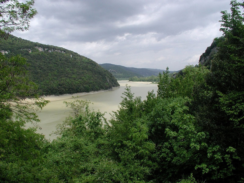
River Tevere Park includes significant territories along the course of the river Tiber from Montemolino (Montecastello di Vibio), near Todi, to Alviano Lake.
It develops along the river Tiber for about 50 km and includes the Municipalities of Montecastello di Vibio, Todi, Baschi, Orvieto, Montecchio, Guardea, and Alviano.
Until the half of the last century, the Park has not suffered significant environmental changes, and for this reason its vegetation has remained intact. The territory is covered with ilex woods, oak woods, and chestnut tree woods, and a part of it is covered by junipers intertwining with creepers, all plants characterizing the original and authentic Mediterranean maquis.
In the hills, specialized vineyards and olive groves are characterized by a stable vegetation. The hop is widespread here, while in other places it is rare: this is an evidence of the untouched features of the area.
As far as the fauna is concerned, the mountains are inhabited by wild boars, fallow deer, and deer. Along the shores of Corbara and Alviano Lakes several bird species nest: among them coots, kingfishers, peregrines, grey herons, and buzzards.
Alviano Lake (WWF Nature Sanctuary) represents an important shelter for migratory birds.
However, the territory is not only characterized by important environmental features, but also by historical and cultural features of great value. Since the Pleistocene, the river Tiber has influenced the structure of this part of Italy: it has shaped hills and terraced slopes through its erosive action and, with its materials, it has silted up the plains.
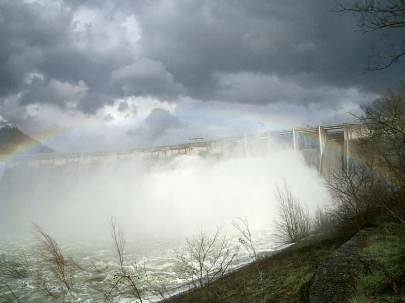
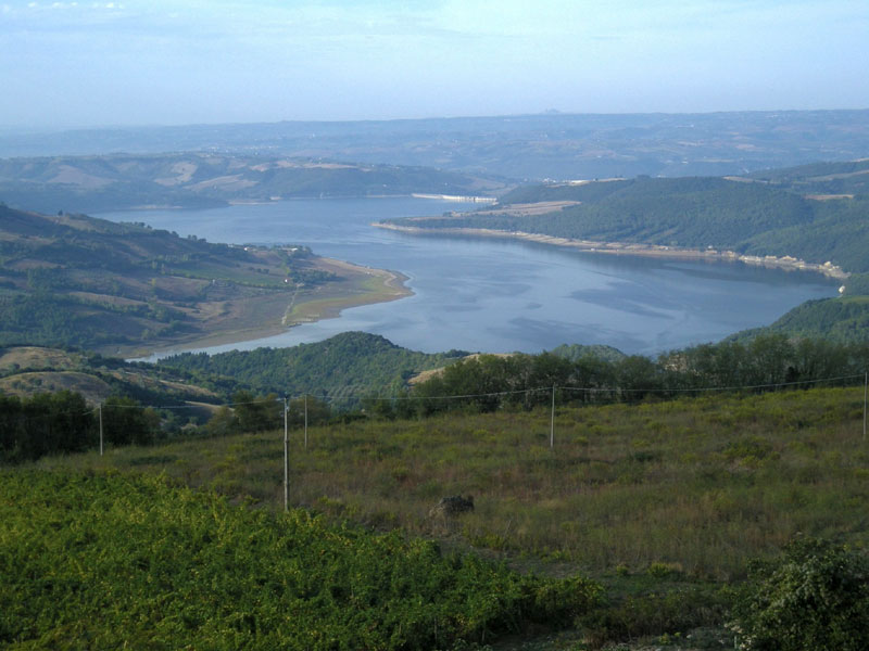
In more recent times, between 1959 and 1962, an artificial basin called Corbara Lake was created with the barring of the waters of the Tiber. The lake covers 10-13 square km, has an average depth of about 30-40 m and a capacity of 207 million cubic meters of water.
The river laps deep abysses; of particular interest, the caves of Santa Romana and della Piana, in loc. la Roccaccia. The main cave is the largest cavity in a travertine formation existing in Italy.
Since the Paleolithic Age, man has adapted to the territory of the river Tiber and its affluents, settling on hills and terraced slopes first and building Etruscan villages and Roman towns after. The Italic and Etruscan populations had the river as a link in its southern stretch and as a border in its northern stretch.
Evidences are represented by hypogean graves dating back to the Umbrian and Etruscan period, found in the territory of Montecchio. The materials that have been found (necklaces, vases, weapons) are on display in Tenaglie Antiquarium.
The river Tiber subsequently acquired an important trading function: in the Roman epoch its course was interested by the building of connection bridges and ports favored by the water seaworthiness.
In loc. Scoppieto, near Civitella del Lago, the rests of a place of worship and a Roman ceramics factory have been brought to light. This settlement dates back to the first period of the Roman Empire and the objects made here were so perfect that, once they reached Ostia, they were spread all over the Mediterranean. The material found during the excavation is on display in Baschi Antiquarium.
Another interesting place is Pagliano Port, born at the confluence of the river Paglia with the Tiber. Here archaeological evidences of structures used for the trading activities between Etruria, Umbria, and Rome have been found. After the fall of the Roman Empire, the Tiber represented the main link between Rome and Ravenna, housing the Byzantine fleet.
The network of the Byzantine castles became in the late Middle Ages the defensive system of the territory, and the Park is situated exactly within this settlement network. The signs of the fortified towns built in the Middle Ages are still evident. One important historical evidence is represented by Alviano castle, whose sober architecture recalls the deeds by Bartolomeo from Alviano, a famous 15th century commander.
It is possible to admire the Park beauties through the wonderful panorama from Civitella del Lago and along the network of trails developing along the Tiber (about 80 km) with Gole del Forello, Titignano, Vallone della Pasquarella woodlands, and Alviano Nature Sanctuary.