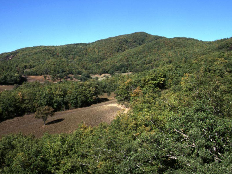
Gallipoli Cognato Forest is part of the Municipalities of
Accettura, Calciano, and Oliveto Lucano, and it covers a surface of
4,159 hectares.
The forest, deriving from the union of two different
wood estates - the wood Gallipoli, 1,117 hectares, and the wood
Cognato, 3,357 hectares, is characterized by a great altimetric
variety: as a matter of fact, it goes from a 200 m of altitude in the
territory bordering with the riverbed of the Basento to the 1,319 m of
Mt. Impiso.
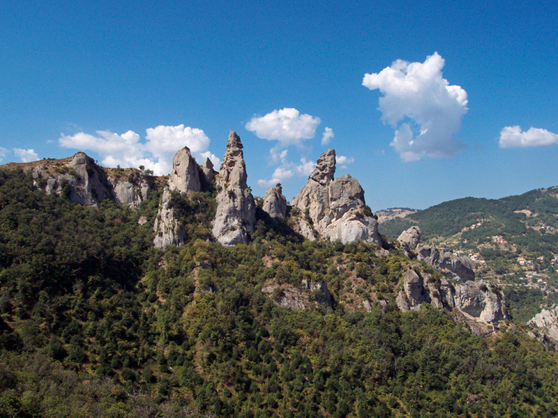
Dolomiti Lucane rise as "Giants from the sea": they are
characterized by high pinnacles which with their silhouette have
suggested fantastic names such as the royal eagle, the anvil, the great
mother, the little owl.
These mountains date back to 15 million
years ago (Middle Miocene), the period in which the sandstones forming
the current rocks originated at the bottom of the sea. The highest
group is that of the Costa di S. Martino, the so-called "Piccole
Dolomiti", since it reproduces the harshness and the features of the
famous "Pule Trentine".
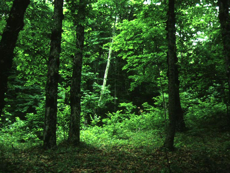
It covers a territory of about 800 hectares, going from 750 to 1,158m above sea-level, with exposition mainly towards the North. In the East and in the South-East the wood faces the plain of Metaponto, while in the West it is linked to the eastern ridge of the Apennines of Lucania.
Further informationBuilt in a territory populated since the 6th-4th centuries BC, Accettura (from the Latin acceptor, meaning sparrow hawk or from acceptae, meaning piece of land) it was quoted for the first time in an Episcopal Bull in 1060. The populations of the rural nuclei which were scattered in the surrounding area (Gallipoli, Cortaglia, and Costa di Raja) probably settled in the current center. Destroyed by the fire of 1272, Accettura was rebuilt by Carlo d'Angiò and became the property of the Bozzano family. Subsequently, it was owned by Giovanni Pipino, Eligio Della Marra, the Ponsiaco, the Carafa, the Colonna, and by the Spinelli family until the eversion of feudalism.
Further informationThe name of the town probably derives from the Latin caucium, meaning low and marshy place. A town of very ancient origin, Calciano was probably populated since prehistorical times, as the finding of tools dating back to the Neolithic period and the remains of a 4th century BC indigenous necropolis witness. In the 15th century it became feudal property of Attendolo Sforza. Calciano is an agricultural town situated at the top of a hill on the right of the river Basento. The most interesting aspect of the town is the Parish Church of S. Giovanni Battista, where an important triptych by Sebastiano from Pistoia (1503), a wooden statue representing the Virgin Mary, and the Chapel "Cognato" founded by S.Giuliano from Vercelli and San Giovanni from Matera in 1123 are preserved.
Further informationIt was first a Longobard stronghold, and then it was conquered by the Saracens from Bonar. It became of great importance under the rule of the Normans and of the Suevians who built a castle, while during the feudalism it passed through the property of many feudal lords. Castelmezzano has ancient origins: it was fortified by the Longobards from Salerno, and then rebuilt by the Normans. It belonged throughout the centuries to many lords, among which the counts Garlon d'Alife, the Suardo, the De Leonardis, and the De Lerma.
Further informationThe town is situated on the eastern slope of Mt. Croccia Cognato, along the left side of the stream Salandrella. The artistic heritage has its most important element (as for Accettura) in the remains of the walls belonging to the ancient center of Mt. Croccia, dating back to the 6th-5th centuries BC. They are, together with other finds along the Basento (Civita di Tricarico and Vaglio di Basilicata) an element of archaeological interest for the Hellenic history of the Basilicata region and of its relationships with the indigenous centers. Among the many monuments we quote: Chiesa Madre di S. Maria Assunta (property of the Church); S. Maria di Piano di Campo. The town has ancient origins and it is quoted since 1060.
Further informationA Saracen fortified center, the ancient Pietraperciata (that is pierced stone, for the presence of a great stone pierced from one side to the other) was an important center during the Norman period. It is an agricultural town situated in the northern part of the ridge of Mt. dell'Impiso, and it is characterized by a mainly mountain territory revolving around the rocky nucleus known with the place name of "dolomiti lucane".
Further information