

Points of Interest
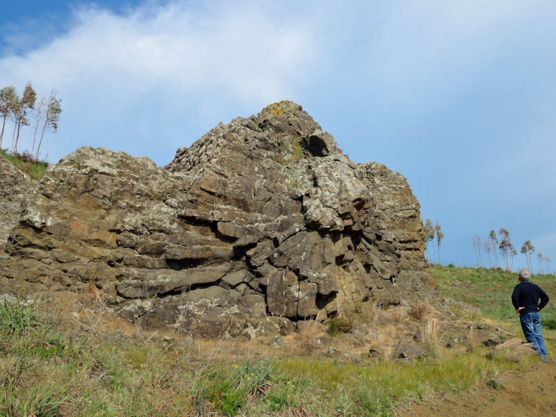
Geomining Area of Monte Arci
The area of Monte Arci is situated in central-west Sardinia, inland from the Gulf of Oristano. It is approximately elliptical in shape, extending in a N-S direction with the major and minor axis 30 km and 7 km long respectively. The maximum elevation is 812 m above sea level, in correspondence with the neck (ancient volcanic conduit) of Trebina Longa.
The area of Monte Arci has a surface area of around 270 sq km, equal to 7% of the entire Geomining Park of Sardinia.
Monte Arci constitutes the first mining district of Sardinia. It was activated at the beginning of the 6th millennium B.C. when small communities, reaching the island following the Neolithic colonisation, discovered and used the obsidian which was to be found in large deposits. It is a rhyolitic volcanic glass, mainly black, with a characteristic conchoidal fracture. It was particularly precious and sought-after amongst men of "the pre-metallurgic age" as a raw material for the production of weapons and cutting instruments.
Geomining Area of Orani, Guzzurra, Sos Enattos
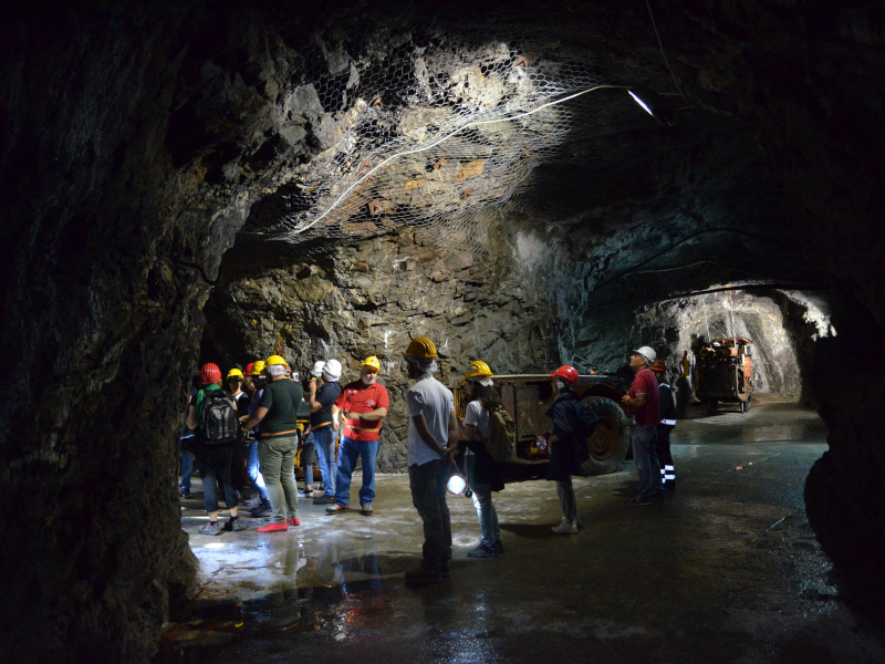
The area of Orani, Guzzurra and Sos Enattos is divided into 2 parts: the first includes the territory of the municipality of Orani, while the second includes naturalistic and mining sites of the municipality of Lula. The whole area, with its 300 sq km, represents about 7% of the Geomining Park of Sardinia territory. The importance of Orani, from a mining perspective, is due to the presence of noteworthy talc and fedspar mineralisations, and numerous marble and granite quarries. This important talc mining district has been well-known since the recent Neolithic period, to which the mining of talc of the "steatite" variety dates back. This material was processed for the production of precious objects, ornaments and statuettes, including the Mother Goddess. However, the importance of Guzzurra-Sos Enattos is due to the presence of metalliferous mineralisations, such as zinc, lead and silver, which bear witness to mining activity started in ancient times, as evidenced by various Roman tunnels and 11th Century mining shafts which have been recently closed. In particular, the mine of Sos Enattos with its perfectly preserved external structures and the mining shafts which can be accessed nowadays by tourists for underground visits.
Geomining Area of Funtana Raminosa
The area of Funtana Raminosa is located in Central Sardinia, between the regions of Sarcidano and Barbagia, and has a surface area of around 145 sq km, equal to 3.85% of the entire area of the Geomining Park of Sardinia. Its relevance from a geomining perspective is due to the presence of the important copper mine of Funtana Raminosa, which, since the Eneolithic period played a significant role in the history of this particular metal in the Mediterranean area. The natural environment, rich in forests, partly still untouched, has allowed a fauna of extraordinary interest to flourish. Mouflon abound, finding refuge in the highest peaks, as well as golden eagles. To this context of extreme naturalistic relevance, we add the mining sites of Giacurru-Perdabila for its iron ore, as well as that of Corongiu e Ingurtipani, rich in history and inherited assets of industrial archaelogy.
Geographical Area of Argentiera, Nurra, Gallura
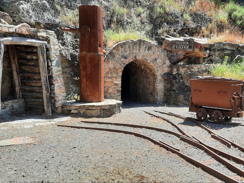
The area of Argentiera, Nurra and Gallura is divided into two parts. The first covers the western sector of the Nurra (north-western Sardinia) extending from the mining sites of Argentiera and Canaglia to the promontory of Capo Caccia. The second area includes part of the municipal territories of Santa Teresa di Gallura, Palau, Arzachena, Golfo Aranci and Olbia. This is an area of interest of approximately 335 sq km, equal to 8% of the entire extension of the Park, where there are several ancient granite quarries, mostly dating back to the Roman age. In the 20th century, the mining areas of Argentiera and Canaglia were the most important metalliferous districts in Northern Sardinia. Argentiera for the consistency of the metalliferous deposits of lead, zinc and silver exploited since the Roman colonizations, and Canaglia for its iron ore. Today, once mining activities are ended, these mining areas constitute a typical example of industrial archaeology. At Argentiera, in particular, on the initiative of the Municipality of Sassari, important mining structures such as the Podestà shaft and the Laveria have been restored and the entire mining compendium has been transformed into a museum.

Geographical area of Sarrabus, Gerrei
Sarrabus-Gerrei is located in the south-eastern area of Sardinia and covers a surface area of 575 sq km, equivalent to 15% of the entire area of the Geomining Park of Sardinia. It is, therefore, the second largest area of the park, and is very representative due to the diffusion, variety and importance of the mining activities that took place.
From a mining point of view, the area, due to the consistency of the its metalliferous mineralisation of lead, antimony, silver and fluorite, became the second largest mining district on the island between 1800 and 1900.
The silver sector of Sarrabus was intensively exploited between the second half of the 19th century and the first two decades of the 20th century. The antimoniferous sector of Gerrei was mainly exploited in the first half of the 1900s while the fluorspar sector is still active.
The main centres involved in the silver mining activity were Burcei, San Vito, Muravera and Villaputzu, whilst those known for antimony were Villasalto, Ballao and Armungia. There are remains of this industrial archaeology in the mines of Tuviois, Serra 'e Silixi, Nicola Secci, S'Arcilloni, Masaloni, Monte Narba, Giovanni Bonu and Bacu Arrodas (Silver), Su Suergiu and Corti Rosas (antimony).
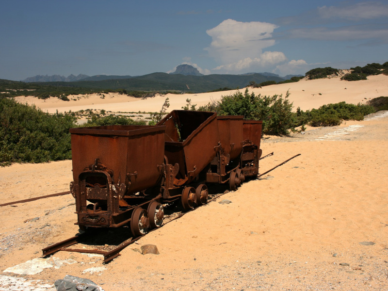
Geomining Area of Arburese, Guspinese
The area of the Arburese and the Guspinese extends for around 520 sq km, equivalent to 13.5% of the entire area of the Geomining Park of Sardinia and is one of the most important park areas in terms of its history and mining heritage. The epitome of its historical and archaeological worth is best expressed by Montevecchio and Ingurtosu where, in some of the renovated structures, it is possible to go on a guided tour. No less interesting, although smaller in nature, are the abandoned mining centres of Bau Gennamari and Perd'e Pibera. The zinc and lead mines of Ingurtosu and Montevecchio are strongly linked not only to the history of the local community, but also to the development of the Italian mining industry. The technological, economic, social and productive activities of over one and a half centuries of mining industry have profoundly marked the territory and the culture of the local population, which today represents an important cultural inheritance in a phase of restoration and development.
Geomining area of Iglesiente
The area of the Iglesiente covers about 480 sq km in south-western Sardinia between those of Arbus, Guspini and Sulcis, equivalent to 12.4% of the entire area of the Geomining Park of Sardinia. It is particularly rich in mines and other aspects linked to their thousand-year activity. The most important mines are within the so-called "metalliferous ring of the Iglesiente", where the mineralisation of lead, silver and zinc is found in the geological calcareous-dolomitic formations which, being more than 500 million years old, are the most ancient rocks in Italy dated paleontologically. Other important mines are spread across the territories of the municipalities of Domusnovas, Fluminimaggiore, Buggerru and Gonnesa.
There are numerous archaeological findings which testify to the presence of man since the Neolithic age, and through the Nuragic, Punic and Roman ages, all populations interested in the mineral resources. Also particularly noteworthy is the evidence of mining activity in the medieval period, which the city of Iglesias in itself is a testament to.
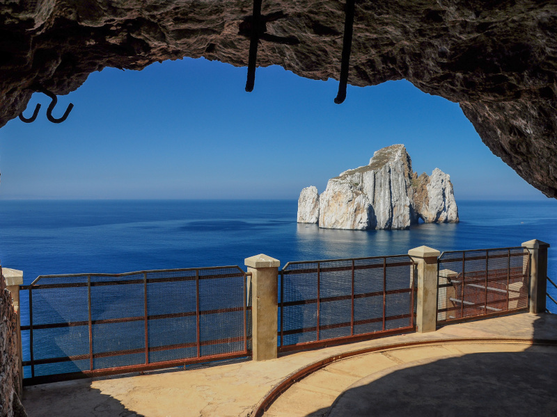
Geomining Area of Sulcis
The area of Sulcis extends across the south-western part or the island with a surface area of about 1.450 sq km, equivalent to 37.6% of the entire area of the Geological and Mining Park of Sardinia. It takes its name from the ancient Punic city of Sulcis or Sulki, which today is Sant'Antioco. The Sulcis geographical area includes the islands of San Pietro and Sant'Antioco. Mining activity in this area was very intensive, particularly since the mid-1800s, reaching a peak in the 1950s and 1960s, and finally closing in the 1970s and 1980s. In the area, there are numerous mining sites. Some, which deserve a particular acknowledgement for their industrial importance, are the coal mine of Serbariu (Carbonia), and the metalliferous mines of Rosas (Narcao), Orbai (Villamassargia), Sa Marchesa (Nuxis), Capo Becco (Carloforte) and San Leone (Assemini). The area of Sulcis also has an interesting environmental heritage given the presence of natural oases (Monte Arcosu), geological monuments and sites of community importance.


