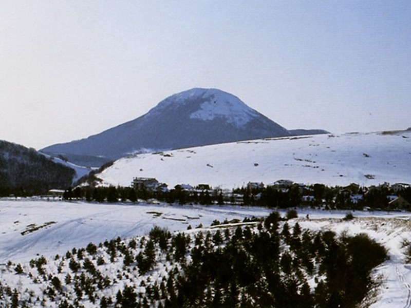
Monte della Sporta
A short but very panoramic trail along the ridge of the Marches
- Trail Conditions: On foot
- Interest: Flora, Wildlife, Panorama, Religion, Hystory, Photography
- Duration: 1h and 55 min
- Difficulty Level: T
- Length: 6.85 km
- Difference in height: 150m
Typology: ring-route
Trail markers: 111 AG, 115
Leaving the picnic area and the hotels of Poggio S. Romualdo behind, following trail marker 111AG, cross the large plateau towards the one and only woodland. Again across the woodland, slightly uphill, take the trail cutting, at the base, the northern slope of Monte della Sporta whose rounded silhouette is interrupted by sharp aerials. Avoiding to make the route shorter by directly following the steep grassy slope, take the trail on the right: flat at first, and then uphill at the beginning of the woodland, sometimes muddy, leading to the beautiful grassy ridge.
On the left, after a short uphill trail, head for the aerials of the summit. Go ahead eastwards walking along the reforestation area with the meadows on the left. Always along the service carriage road, turn right to go downhill with bends across the reforestation area until you reach the Casetta and then the carriage road. After crossing the dirt road, immediately turn left, trail marker 115, and take the carriage road heading for Mt. Zuccarello. Once you reach the crossroads with another carriage road, turn left. Beyond a barn in ruin, you will meet again the carriage road. Follow it northwards and you will get to Poggio S. Romualdo.