

Ser Blanc-Col Blegier
- Trail Conditions: On foot, By bike
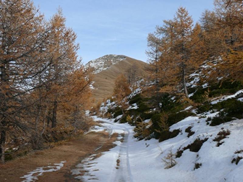
The military road called Ser Gountard-Col Blegier was laid down in 1890, at the times of the Triple Entente, to reach the area of Genevris housing the observatory and the barracks built in 1889 by the 3rd Reggimento Alpini, now in ruin. It is an 8km-long street (650m difference in height), entirely developing in the protected area and therefore closed to motor vehicles. The road crosses a luminous woodland of larches which, at higher altitudes, mix with Scotch pines, then it reaches the highest limit of the arboreal vegetation and the pastures of Colle Blegier with the homonymous peat bog. Along the route, you will find many branches:
- About 500 meters after Ser Blanc, the road leading to Randuin summer mountain pasture and to the beginning of Park trail no. 10 "The Hauling Trail".
- The junction to Montagne Seu.
- The junction to Enfer is at about 1km from the Park entrance in the area of Lampuiè, along the Enfer road (junction on the left along the road to Sportinia, after the last houses of Richardette, before Istituto Sperimentale V.Vezzani) representing one of the three accesses to the Park from Sauze d'Oulx.
- The Road of the Cannons (trail no. 5, recommended by the Park Authority as a route to follow by mountain bike).
- Horseshoe. Junction leading to Alpe Laune (trail no. 4, recommended by the Park Authority as a route authorized for mountain bikes).
Col Blegier Road
Books and Guides


© 2024 - Ente di gestione delle aree protette delle Alpi Cozie