

Protected Area
Identity Card
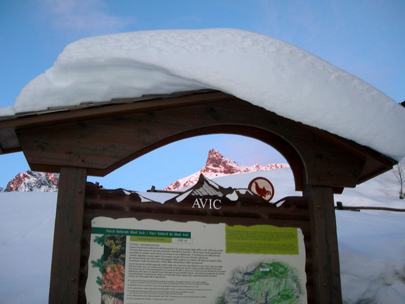
- Mont Avic Regional Park:
- Land Surface Area: 5'747.00 ha
- Regions: Valle d'Aosta
- Provinces: Aosta/Aoste
- Municipalities: Champdepraz, Champorcher
- Establishment Measures: LR 6 07/06/2004
- PA Official List: EUAP0239
- Park Authority: Ente Parco Naturale Mont Avic
- Further managed Protected Areas:
- ZPS Mont Avic e Mont Emilius
- ZSC Parco naturale Mont Avic
Logistic notes: highway A5, exit Verrès, S.S. road 26 towards Aosta, then S.R. road 6 up to Champdepraz and S.C. road to Chevrère (the Visitor Center is in location Covarey, 10 km from Champdepraz).
The Park
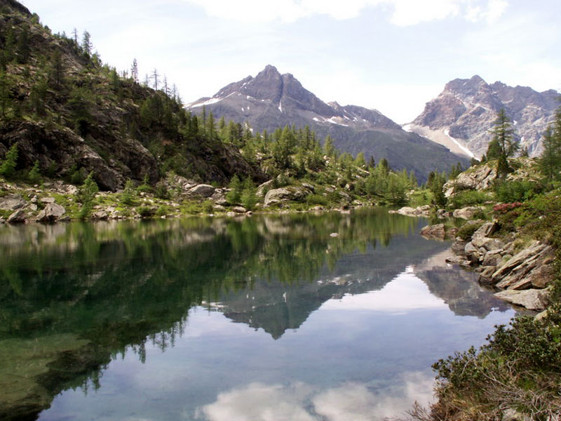
Mont Avic Park, the first nature park in Valle d'Aosta, was established in October 1989 in order to preserve the natural resources present in the upper valley of the Stream Chalamy (in the Municipality of Champdepraz). The safeguarded area is characterized by its extremely charming landscape which has remained largely untouched by man. As a matter of fact, the uneven orography has always limited traditional farming activities and has recently prevented the development of mass tourism both in summer and in winter.
The Park forests, which have been heavily ruined in the past because of mining activities, have recovered their original features offering visitors a landscape of rare beauty. Other interesting natural features enriching the protected area are the peculiar geological formations, the endemic alpine flora and vegetation linked to the substratum of green stones, the numberless small stretches of water, marshes, and peat bogs and the variety of alpine wildlife.
Flora and Vegetation
The flora and the vegetation of the park are deeply shaped by the presence of a large number of lakes and small wetlands, as well as by the serpentinite outcrops originating poor and not very deep soils. The protected area is characterized by unusual landscapes in this region, among which the largest forest of Hooked Pines in Valle d'Aosta. This conifer, not very widespread in the Italian Alps, has perfectly adapted to the poor quality of the soil in this area and it is also able to grow on the edge of the peat bogs.
Another interesting element is the geographical position of Val Chalamy, at the border of a dry area situated in the medium Valle d'Aosta but partly influenced by the more humid climate in the lower valley. On the southern or sunny side of the valley, this contrast is evident from the progressive replacement of Beech trees with Scots Pines, which can adapt themselves to the arid environmental conditions.
The interesting flora linked to the wetlands can be found not only near the lake basins, but also near the many peat bogs and marshes and the resurgences of the whole protected area. The environment houses boreal vegetation which is rare or practically extinct in the Alps. Among the rarest species found in the marshes there are Carex limosa, Carex pauciflora, and Eriophorum vaginatum. Interesting also the presence of the insectivorous plants Drosera rotundifolia, as well as ponds with floating islands of bog moss (among the others, Sphagnum magellanicum, S. squarrosum, and S. angustifolium).

Fauna
As far as the fauna is concerned, the first research brought to light considerable finds in the entomological field (over 1,000 macrolepidopters, rare dragon flies, and more than 110 species of forest phytophagous coleoptera). In addition, there are various mammals and birds typical of the mountain environment of Valle d'Aosta, such as the ibex, the mountain hare, the golden eagle, the goshawk, the rock ptarmigan, the black grouse, the rock partridge, the black woodpecker, the rock thrush, the chough, and the nutcracker.

Geomorphological, Mineralogical, and Hydrological Aspects
As far as geology is concerned, Val Chalamy lies within the Calcareous Schist with Green Stones Complex of Piedmont. The complex, consisting here of ophiolites from the ultrabasic Complex of Mont Avic, represents an oceanic fragment of the basin of Piedmont which was involved in the Alpine orogenesis following the continental collision between Africa and Europe.
Traditions and Culture
As far as the activities are concerned, the Park follows the guidelines of the "Territorial management plan" approved by the regional administration in 1994. According to this plan, management practices compatible with the local environment and referring to particular natural features (geology, hydrology, flora, vegetation, and wildlife), to the woodlands, the pastoral activity, tourism, and didactic activities have been identified.
Natura 2000 Environments
Mont Avic Park includes a "Site of Community Importance" (SCI) of the Natura 2000 Network, ecological network of the European Union aiming at preserving the habitats and the species listed in the EU Directives 79/409 and 92/43. The environments included in the site are broadleaf and conifer forests, the peat bogs, and the high-mountain ophiolitic sites.
In the period 1997-2000, the project "Life-Natura" has been carried out with the following measures:
- scientific research activities on environments of particular naturalistic value
- recovery of the trail network aiming at efficiently channeling the visitor flow
- rationalization of grazing lands when it comes to vulnerable environments (in particular, peat bogs)
- production of information tools (panels and illustrated brochures). The European Community has granted a financial contribution covering the 50% of the expenses.


