Casa Martignona - Croce dei Castelli - Mountain Ring-route
- Trail Conditions: On foot
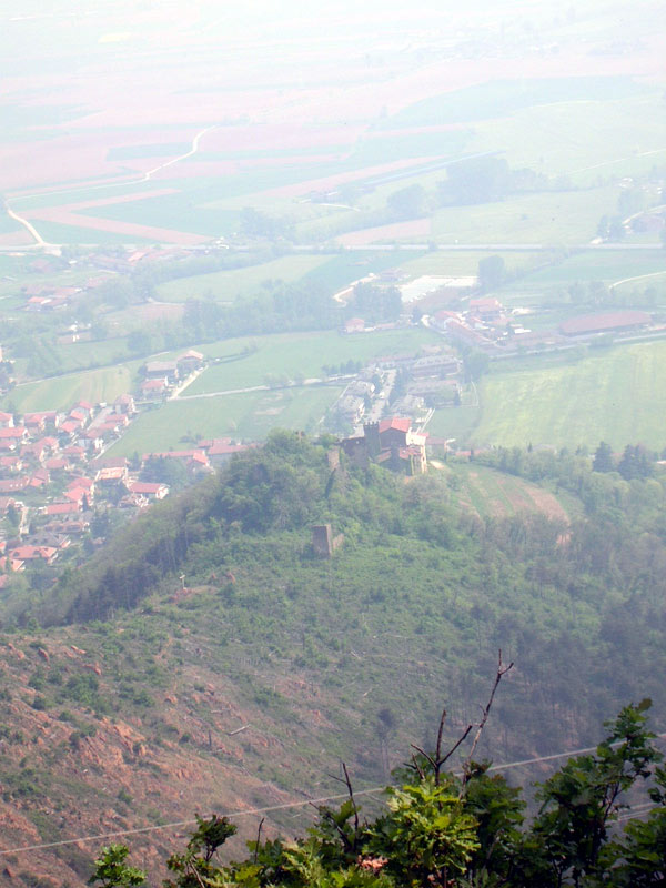
From the parking area of Casa Martignona in Via del Campetto turn after a few meters in Via San Giovanni Bosco, where you will find the first trail marker (2c). In about 20 minutes you will get to Croce dei Castelli by crossing an area dominated by oaks and, subsequently, by black pines: here the signs of the devastating fire of 1999 are still evident. You will find here two benches near the ruins of the upper castle, called "Castellaccio", and you may choose among several opportunities:
- on the left, you can take a trail towards location Campetto (6)
- you can descend towards San Vito square
- you can continue climbing and decide whether to start the mountain ring-route or turn right along the stretch called "Viöl d'l'Asu" (1) leading to the beginning of the dirt road reaching the summit of Mt. San Giorgio.
If you decide to follow the ring-route counterclockwise, follow the indication "Colle della Serva" (2), you will reach after about 40 minutes along a trail mainly deprived of arboreal covering. Once you reach a black pine small wood, you will find a junction: the trail on the right, with CAI trail markers, leads to Mt. San Giorgio (2a). If you decide to go ahead along the mountain ring-route (2b), you will observe a gradual change in the vegetation while you get closer to the stop area near Colle della Serva. Here broadleaf trees, with presence of oaks like Sessile Oaks and Downy Oaks (in the warmest areas), associated with Birch, Chestnut Tree, White Hornbeam, Cherry Tree, and Whitebeam can be found in a mosaic with conifers like the Scots and Black Pine. After a stop in the meadow (with benches and table) facing the dirt road leading to Mt. San Giorgio, you can go ahead towards Colle del Prè walking along the rocky outcrops at first and, at the junction, decide whether climbing the trail leading to Rubatabö (4) or following the easiest flat stretch (5) joining the former. Once you get to Colle del Prè, you can also reach walking along a road leaving from location Campetto (16), you can begin your return journey, closing the mountain ring-route along the downhill trail (3) offering, when the sky is clear, a great view over the plain, Mt. San Giorgio, and the castles.