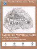
Carta dei sentieri
Monte Subasio Park
Regione Umbria, Club Alpino Italiano - Section of FolignoIt includes 14 paths planned and marked by the volunteer members of C.A.I. with the help of satellite devices (GPS); for this reason, it is one of the most reliable products of the field.
- For each path, you will find difference in height, length, and difficulty level.
- Scale: 1:25.000
Notes: The map is available at C.A.I. - Section of Foligno (Tel. 0742/22921 - E-mail: caifoligno@tin.it - web: www.caifoligno.it)

Carta dei sentieri
© 2024 - Convenzione per la gestione associata del Parco Regionale Monte Subasio


