

Hiking Map of Monti Lucretili Park
Map in scale 1:25000 (GPS compatible)
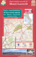
Hiking map of Monti Lucretili Regional Park in scale 1:25000, with the network of the Park trails (laps, difference in height, difficulty level, walking time).The new hiking map of the Park has been published within the fund raising campaign supporting, through a series of actions, the project "Parcooperiamo" for the Environmental Management of the area Rincón de Perez, in Uruguay.
Edited by Vincenzo Lattanzi.
- Publisher: Parco Regionale dei Monti Lucretili
- Size: 15.5x24cm
- Year: 2008
- Scale: 1:25.000
- Price: free
Notes: The publication is not for sale, and the price should be considered as a refund of the expenses.
Hiking Map of Monti Lucretili Park


© 2024 - Ente Parco Naturale Regionale dei Monti Lucretili