Mt. Pellecchia Ridge
The long ridge of the highest summit of Lucretili Mountains
- Trail Conditions: On foot
- Interest: Wildlife, Geology, Panorama, Hystory
- Departure: Borgo di Monteflavio (760m)
- Duration: 5 hour/s 30 minutes
- Difficulty Level: T - Tourist (level)
- Difference in height: 650m
- Minimum Altitude: 760m
- Maximum Altitude: 1,369m
- Recommended Period: from April to November
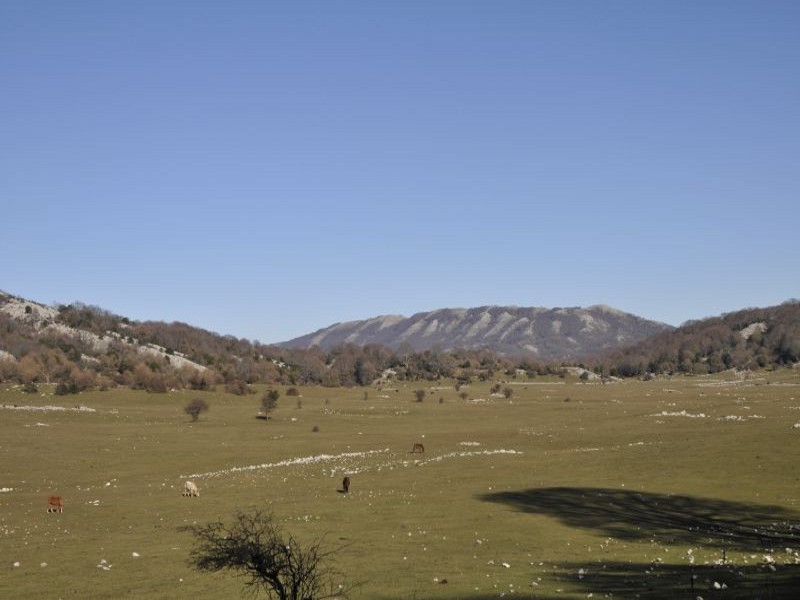
The itinerary leads to the long ridge of the highest summit of Lucretili Mountains, Mt. Pellecchia (1,369m). Situated in the central-northern section of the mountain system, the mountain has the characteristic features of the Apennines with gentle morphology and no particular features on the western slope, very different from the steep south-eastern slopes. Easy itinerary along which you will enjoy a good part of the Apennines of Lazio and Abruzzi. However, it is interested by snowfalls, since it develops on the highest summit and is partly less influenced by the climatic mitigation of the Tyrrhenian Sea.
Difficulty level: none, the itinerary is clear.
Where in Lucretili Mountains: central-northern section
How to reach the departure point: from Monteflavio along Via Monte Pellecchia
 Download KMZ