

Route 692b
Trevi nel Lazio - Le Fontane - Fontana di Faito - Valle Cupa - Colle del Ciuco - Fontana Suria - Trevi (ring route)
- Trail Conditions: On foot
- Interest: Flora, Wildlife
- Departure: Trevi nel Lazio località colle San Biagio
- Arrival: Trevi nel Lazio
- Duration: 5 hour/s 10 minutes
- Difficulty Level: E - Hiking (level)
- Length: 12.90 km
- Difference in height: Uphill 856m - Downhill 855m
- Minimum Altitude: 770m
- Maximum Altitude: 1,469m
From Trevi nel Lazio, near the crossroads to Filettino, one takes the little steep road climbing northwards. One takes the mule track on the left. Once passed a small summit one reaches a large flat zone with an equipped area, a spring and a signpost of the Park (Le Fontane). One takes a small street on the right and then turns left to follow a mule track with some yellow marks leading to an uneven road open to vehicles.
Further information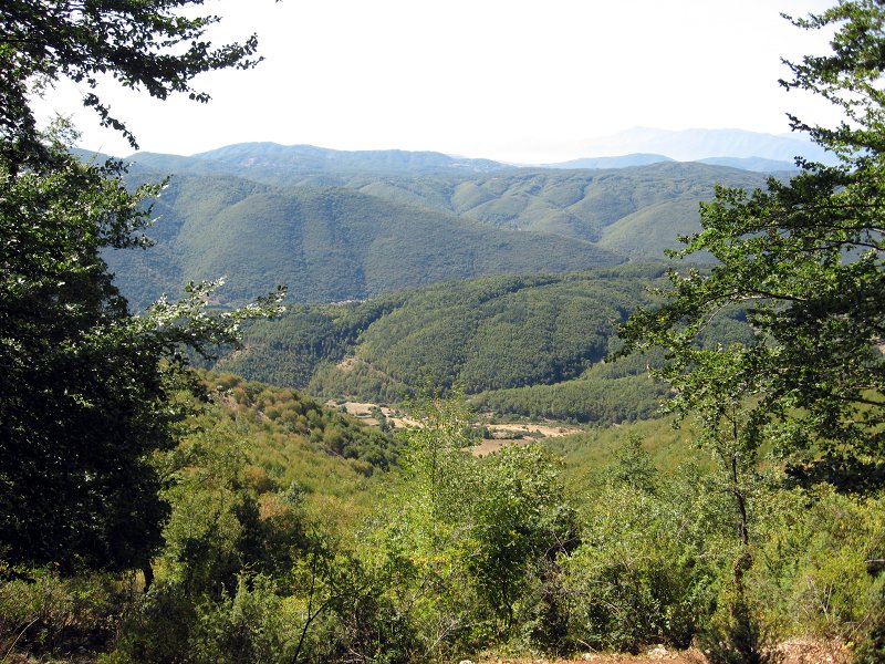
Route 692b, Colle del Ciuco
 Download KMZ
 Download in GPX format
Books and Guides

Protected Area(29.990,00 ha)

Lay-out of the itinerary

Departure

Arrival

Park Authority Offices

Visitor Centers (9)

Where to Sleep* (1)

Municipalities (8)

Points of Interest (78)

Photos (153)

Videos (21)

Pic-Nic Area (36)

EV charge ≥100kW (286)

E-Bike charging (9)

Airports (1)

Highway exits (1)
*: only Operators with Accommodation Page


© 2024 - Parco Naturale Regionale Monti Simbruini