

Route 651 AV3
Alta Via: Campo Staffi - Campocatino
- Trail Conditions: On foot
- Interest: Wildlife, Panorama, Religion
- Departure: Piazzale Campo Staffi
- Arrival: Campocatino
- Duration: 8 hour/s 30 minutes
- Difficulty Level: EE - For expert hikers
- Length: 20.20 km
- Difference in height: Uphill 1,318m - Downhill 1,285m
- Minimum Altitude: 1,629m
- Maximum Altitude: 2,167m
At the entrance of the square in Campo Staffi one follows a semi-asphalted road on the left leading to the Staffi hills' ridge. Following a small ditch through the wood one climbs down up to the Serra di Sant'Antonio's mountain pass.
Further information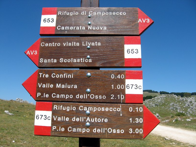
Route 651 AV3
 Download KMZ
 Download in GPX format
Points of Interest
Books and Guides

Protected Area(29.990,00 ha)

Lay-out of the itinerary

Departure

Arrival

Park Authority Offices

Visitor Centers (9)

Where to Sleep* (1)

Municipalities (8)

Points of Interest (78)

Photos (153)

Videos (21)

Pic-Nic Area (36)

EV charge ≥100kW (286)

E-Bike charging (9)

Airports (1)

Highway exits (1)
*: only Operators with Accommodation Page


© 2024 - Parco Naturale Regionale Monti Simbruini