Itinerary 672a
Livata-Pozzo di Monte Calvo-Le Genzane-Campo dell'Osso-Fonte Acquaviva-Livata (ring-route)
- Trail Conditions: On foot
- Interest: Flora, Wildlife, Panorama
- Departure: Monte Livata (1,344m)
- Duration: 2 hour/s
- Difficulty Level: T - Tourist (level)
- Length: 7.2 km
- Difference in height: Uphill 290m - Downhill 290m
- Minimum Altitude: 1,348m
- Maximum Altitude: 1,585m
Short ring-route. From Monte Livata take the large non-asphalt road to Campaegli. After about 1.5 km (Pozzo di Monte Calvo) leave the road and climb on the right along a steep trail to Pecore Pass, under the summit of Mt. Calvo. Once you end the steep uphill path, turn right. After a short slightly downhill path, you will reach a small pass. Leave the ridge and turn north-east until you get out of the woodland, crossing the cross-country skiing track (Le Genzane). Follow the track and, before getting to Campo dell'Osso, you will find a path entering the woodland on the right. Go downhill until you cross a bumpy carriage road with drinking trough (Fontana dell'Acquaviva). Going ahead along this road, you will go back to Mt. Livata ring-road, not far from the beginning of the road to Campaegli.
Further information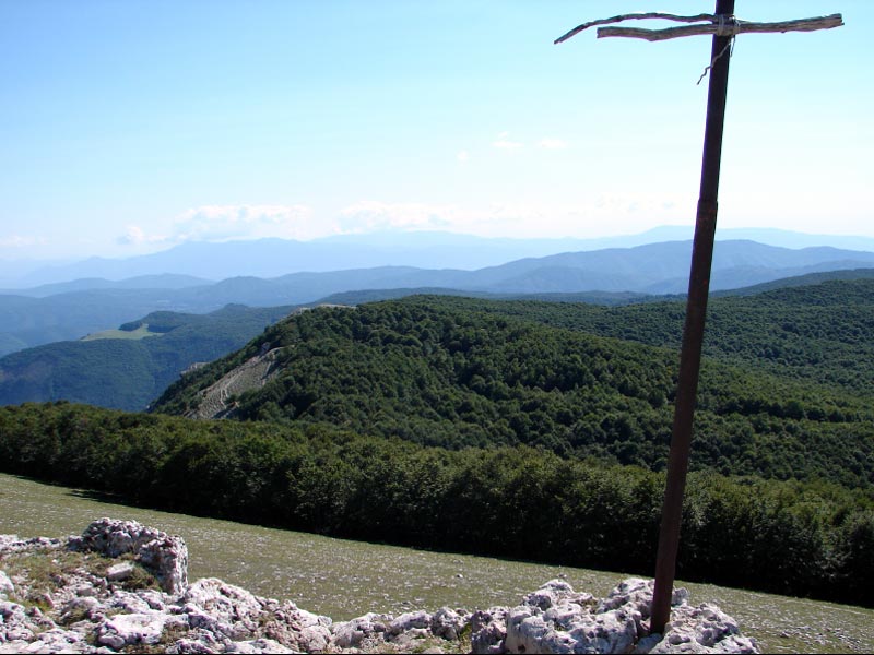
 Download KMZ
 Download in GPX format