1 - Berceto - Lago Santo Parmense
The first leg of the Alta Via is long and demanding, but offers a wide variety of environments, ranging from the agricultural landscape of the mid Apennines to the rugged peaks of the ridge.
- Trail Conditions: On foot
- Departure: Berceto (808m)
- Arrival: Lago Santo Parmense (1,508m)
- Duration: 9 hour/s
- Length: 22.2 km
- Difference in height: Uphill 1,550m - Downhill 850m
- Accomodation structures: Ostello della Cisa, Camping I Pianelli, Rifugio Mariotti, Rifugio Lagdei
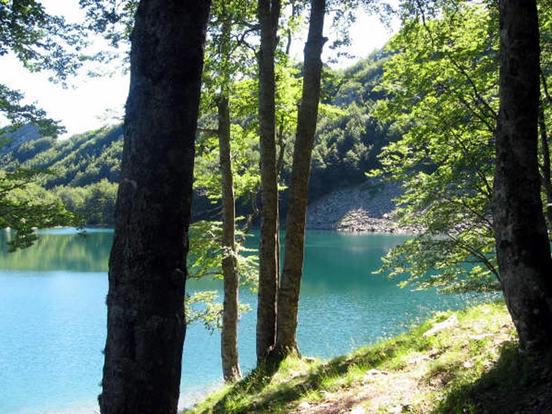
It starts in front of the cathedral of San Moderanno di Berceto, a place trodden by the footsteps of countless pilgrims; it was the last inhabited outpost before Monte Bardone (now the Cisa Pass) for anyone traveling along the medieval Via Francigena towards Rome. From the village one goes up to the ridge a couple of kilometres east of the Cisa Pass, which is an alternative point of access to the path. By following the corrugated and panoramic ridge one reaches the Cirone Pass, a clear geological and geographical border, where the hard sandstones of the Emilia ridge begin: they will accompany the hike for almost two hundred kilometres. The aerial grasslands of Mount Tavola allow some respite, then the ridge rears up the steep climb which leads to the summit of Mount Orsaro (1830 m), an excellent panoramic viewpoint towards Lunigiana. The name of the mountain clearly hints at the bear, where the hard sandstones of the Emilia ridge begin: they will accompany the hike for almost two hundred kilometres. The aerial grasslands of Mount Tavola allow some respite, then the ridge rears up the steep climb which leads to the summit of Mount Orsaro (1830 m), an excellent panoramic viewpoint towards Lunigiana. The name of the mountain clearly hints at the bear, an animal extinct in this area since the end of the 1700s. The rocky environment and the vast grasslands are a prelude to the landscapes to be met in the next days. While descending, one first hikes along the ridge and then through the rocks of the Emilian side. There will be some climbing in order to overcome the obstacles posed by a complex morphology. Through beech forests and reforestation areas one gets to the beautiful marshy basin of Lake Padre, and from there in just a few minutes to the shores of Lake Santo and the historic Mariotti Refuge, which stands in the middle of an area of great natural interest. The crystal clear basin, full of trout and char, is charming, is surrounded by forests, and is dominated by the layered rocks of Mount Sterpara. With a surface area of 81,550 square metres, Lake Santo is the largest natural lake in the northern Apennines. One might arrive here in less than an hour's hike from Lagdei, where a road coming up from Bosco di Corniglio arrives.
Further information1 lap of: Alta Via dei Parchi
Accommodation: Ostello della Cisa, Camping I Pianelli, Rifugio Mariotti, Rifugio Lagdei
 Download KMZ
 Download the route mapping for GPS