


Rio Re and Mt. Sillano
- Trail Conditions: On foot
- Interest: Panorama, Archeology
- Departure: Ligonchio di Sopra (982m)
- Arrival: Ligonchio di Sopra (892m)
- Duration: 5 hour/s
- Difficulty Level: T+ - - Tourist (level)+ - 1
- Difference in height: 1,020m
- Maximum Altitude: 1,876m
- Recommended Period: from June to October
- Localities Crossed: Ligonchio - Rio Re - M. Sillano - Il Piano - Ligonchio
The uphill trail leading to Mt. Sillano from Ligonchio offers a slow itinerary along the forest mule tracks of the small and isolated valley of Rio Re, a beautiful and aerial ridge and a not very busy summit. Take then the downhill mule track of the Piano across Tarlanda hydroelectric plants, an example of impossible didactic route dedicated to industrial archaeology.
Further information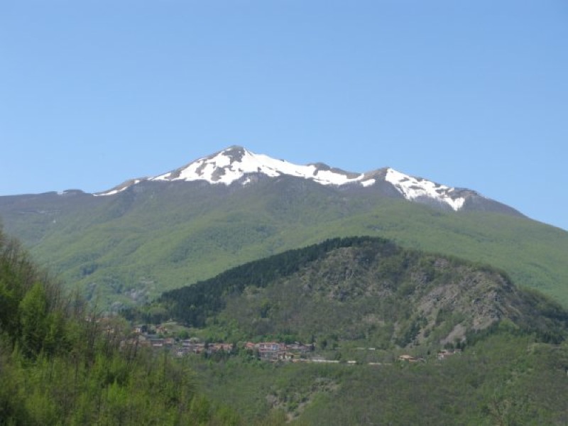
Ligonchio and Cavalbianco
 Download KMZ
Books and Guides
Price: 12.00 €
Price: 18.00 €

Protected Area(26.149,00 ha)

Lay-out of the itinerary

Departure - Arrival

Park Authority Offices (2)

Visitor Centers (9)

Where to Sleep* (3)

Where to Eat* (1)

Mountain huts/bivouacs* (4)

Nature Tour Guides (12)

Municipalities (13)

Points of Interest (148)

Photos (28)

Videos (6)

EV charge ≥100kW (286)

Airports (4)

Ports (1)

Station (6)

Highway exits (7)
*: only Operators with Accommodation Page


© 2024 - Ente Parco Nazionale Appennino Tosco-Emiliano