Bocco and Malpasso
- Trail Conditions: On foot
- Interest: Geology, Panorama
- Departure: Passo di Lagastrello (1,198m)
- Arrival: Passo di Lagastrello (1,198m)
- Duration: 5 hour/s 30 minutes
- Difficulty Level: E - Hiking (level)
- Difference in height: 750m
- Maximum Altitude: 1,790m
- Recommended Period: from June to October
- Localities Crossed: Passo Lagastrello - Foce Branciola - Malpasso - L. Squincio - Passo Lagastrello
Malpasso was probably the highest and most difficult point of the traverse of Lagastrello or Linari Pass, used by the pilgrims heading for Rome in the Middle Ages and, in the following centuries, by the merchants between the slopes of the Po Plain and Liguria, to the extent that it is known as the pass of the "Salt Road" going from the sea to Parma. The most taxed goods were smuggled in order to avoid the State borders continuously cutting across each other, and Malpasso could also be the highest route you will follow here, far from the guards. Steep ups and downs along a lonesome and not very busy itinerary among the springs of Enza and Taverone, with strong historical features, but also one of the most panoramic routes of the National Park.
Further information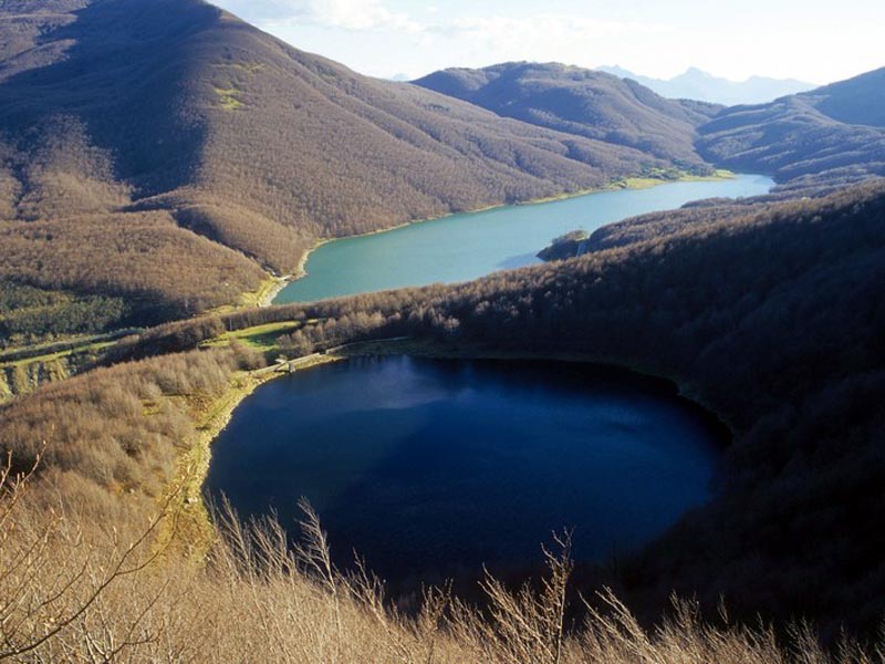
 Download KMZ