Trail of Mt. Capannello
Trail for families
- Trail Conditions: On foot
- Interest: Panorama, Hystory
- Departure: Loc. Le Panche, Rio nell'Elba
- Arrival: Loc. Le Panche, Rio nell'Elba
- Duration: 1 hour/s
- Difficulty Level: for families
- Length: 2 km
- Difference in height: Uphill 134m
This short loop walk begins and ends on provincial road No 32 "del Volterraio", at a spot known as Le Panche. The point of departure is a small parking area with a nice view, 13 km from Portoferraio and very close to Rio Elba. As you enter the wood, you may notice that trees are very evenly spaced, since they are the result of past reforestations, when ideas on nature conservation were different: this is why they planted pines, in order to create job places for Elba inhabitants going through the economic crisis after the World Wars. Follow the GTE for a few minutes and you will reach the watershed by a fire protection tank. Keep on the right and walk up the watershed to the top of Mt. Capannello (405 m a.s.l.), which offers a 360° view over the Bagnaia valley, the Fortress of Volterraio and the island of Capraia. Looking east, you may recognise Mt. Strega on the foreground, Mt. Grosso in the background, and the islet of Cerboli in the Piombino channel. Be careful when walking down the path, as the reddish rock (jaspers and radiolarith) are friable. The GTE intersects with path No 253 at a passage where the power line is visible. Turn right and take the path; turn right again at the following junction. There, the valley widens and the houses of Rio nell'Elba can be seen below; the Park visitor centre is located in the village. At the end of the descent, the path joins a tarmac road, Via Galletti; the point of departure is just a few steps uphill along the road.
Further information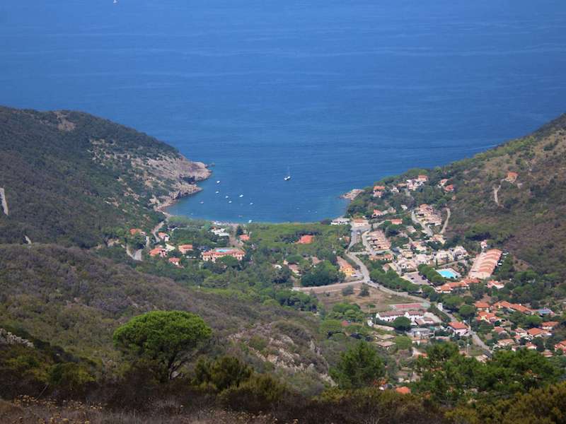
 Download KMZ