


Aerial Panoramic Map Tappeiner - Dolomiti Bellunesi National Park Eastern Section
San Sebastiano - Tamer - Moschesin - Spiz de Mezzodì - Pramper - Talvena - Schiara
An aerial panoramic map of the north-eastern section of the Park.The CAI trails, the position of the mountain huts, and the names of the main summits are overprinted on the color aerial photos.
- Publisher: Tappeiner
- Size: 12x16.5cm (closed)
- Year: 2008
- Price: 3.00 €
 Watch the video
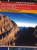
Aerial Panoramic Map Tappeiner - Dolomiti Bellunesi National Park Eastern Section


© 2024 - Ente Parco Nazionale delle Dolomiti Bellunesi