


Val Gresal ring-route
At Belluno's doors
- Trail Conditions: By bike
- Interest: Panorama, Hystory
- Departure: Tisoi (560m)
- Arrival: Tisoi (560m)
- Difficulty Level: MC/BC
- Length: 10 km
- Difference in height: 505m
- Minimum Altitude: 560m
- Maximum Altitude: 1,065m
- Recommended Period: from May to October
- Access: from Belluno follow the signs for Bolzano Bellunese, then continue to Tisoi, where you can park.
- Ground: 70% asphalt, 30% unpaved
- Didactic supports: didactic panel of the Park in San Giorgio
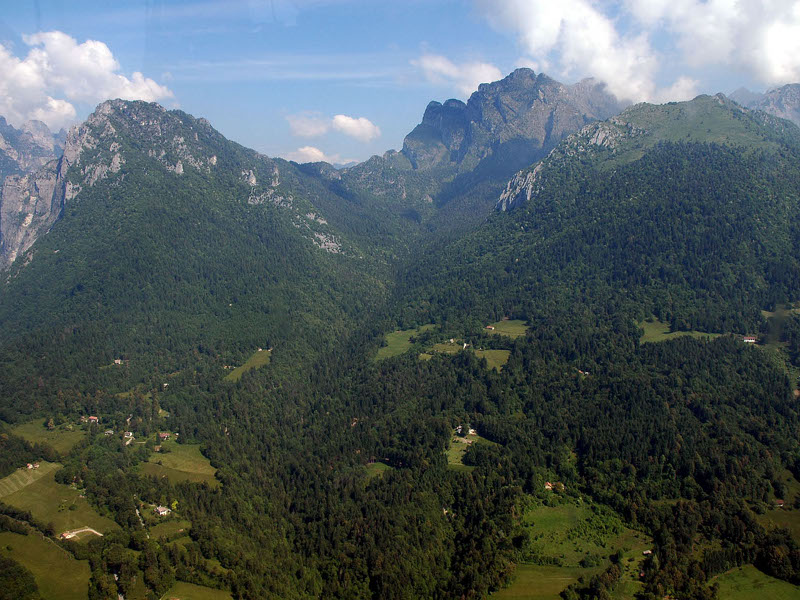
Starting from the center of Tisoi, the itinerary passes through the towns of Zei and Pestesure. It then climbs along the left side of the Val Gresal (CAI 510 trail and itinerary of the Chiesette piedmont park) up to Pian de Fraina (1,065 m), the highest point of the route. From here, if you wish, you can climb (only on foot) to the church of San Giorgio (1,355 m), perched on a spur overlooking the Val Gresal. From Pian de Fraina you descend along the right side of the valley to the Costiet locality, from here you reach Barp and then return to Tisoi.
Loop Val Gresal-Peron Pala Alta-Gresal
 Download KMZ
Protected Area(31.034,00 ha)

Lay-out of the itinerary

Departure - Arrival

Park Authority Offices

Visitor Centers (14)

Where to Sleep* (1)

Where to Eat* (1)

Campsites and camper areas* (2)

Municipalities (15)

Points of Interest (41)

Photos (50)

Videos (113)

Webcam (3)

EV charge ≥100kW (286)

Park's Accesses (6)

Airports (1)

Station (2)

Highway exits (2)
*: only Operators with Accommodation Page


© 2024 - Ente Parco Nazionale delle Dolomiti Bellunesi