Ring-route 5. Falterona and Campigna Forest
Castagno d'Andrea - La Burraia - Campigna - Castagno d'Andrea
- Trail Conditions: On foot
- Interest: Flora, Wildlife, Panorama
- Departure: Castagno d'Andrea
- Arrival: Castagno d'Andrea
- Duration: 4,5 h + 3,5 h + 4 h
- Difficulty Level: T - Tourist (level)
- Length: 26 km (8 km + 9 km + 9 km)
- Difference in height: uphill 500 m + 180 m + 400 m
- Public Means of Transport: Bus line 322 with departure from Florence (Mugelo Valdisieve Buses)
- Accomodation structures: Locanda Chalet Burraia, Rifugio C.A.I. Citta' di Forli', Lo Scoiattolo, Agriturismo Biologico Poderone
An interesting ring-route with departure from the slope overlooking Florence, to discover the Park's most fascinating places: the Gorga Nera, Capo d'Arno and the Idoli Lake, mystical places of spirituality linked with ancient legends. The rise to the Mount Falterona will lead hikers to the Granducale Forest in Campigna, among centuries-old firs and beeches. ![]() Download the description of the Ring-route No. 5
Download the description of the Ring-route No. 5
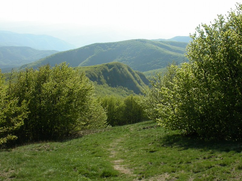
First day. From Castagno d'Andrea the road climbs for some kilometers in the forest, and once reached the 'No Entry' sign there is a comfortable parking area where hikers can leave their cars. After a small stretch one takes the path on the right which enters the beech forest. After a few minutes one finds the first place of natural interest: the Gorga Nera wetland. The path soon becomes steeper and leads to the Crocicchie ridge meadows. The itinerary goes on straight on the path 17 towards the Arno's sources, and to reach the Idoli Lake one goes on in the forest - with no relevant difference in height - and, beyond this charming water expanse, there are the Montelleri meadows. The path turns left and starts to climb again to reach the foot of Falterona Mount's summit. The straightest way to reach it is the path 3. After having admired the landscape one climbs down among the mountain pines, right after a natural terrace overlooking east. Down from the summit the path is that of a ridge, namely the GEA, which soon covers a stretch of the Mount Falco, with the wonderful view of Pian delle Fontanelle. Later the view widens up to the Casentino Valley, and as if by magic hikers find themselves in the wide Burraia meadows. The first day is over.
Second day. The itinerary of the second day starts with the crossing of the Burraia meadows, passing on the right side of the Mount Gabrendo by the old Enel cabin. It is easily reachable from the Gigarello meadows and, before finding the road on the left, the path 82 enters the forest, accompanied by big anthills, and it reaches the Calla Pass. Beyond the asphalted road of the mountain pass, the itinerary follows the path 241, which climbs down and gives us wonderful rocks and majestic beech trees to admire. The Cullacce forestry road proves that we are near a spring situated a few steps ahead, but the path turns left until another path climbs down on the right towards the Ballatoio. If you are tired you can walk the Cullacce road, which is flat up to Campigna and very beautiful as well, and it is equipped with description panels regarding the Park's most important trees. But the route follows the slope through very wild trenches, before climbing again to reach the locality of Villanenta, marking the arrival to Campigna.
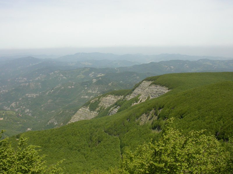
Third day. On the third day one visits the majestic Granduca fir forest, reachable from the asphalted road in the upper side of Campigna. The path is large and the rise becomes difficult only in its second stretch, where the firs are gradually replaced by the beech trees. Once reached the Fangacci parking area the path goes on up to Piancancelli. In this place one finds a barrier, but only for the cars: one goes on walking the same road that will lead hikers to the Fonte del Borbotto parking area, that is to the parked cars.
Involved structures: Burraia: Locanda Chalet La Burraia, Rifugio C.A.I Città di Forlì (first day), Campigna: Lo Scoiattolo, Poderone (second day)
 Download KMZ