Parco della fascia fluviale del Po - tratto Cuneese


Itineraries
Tour of the Lakes
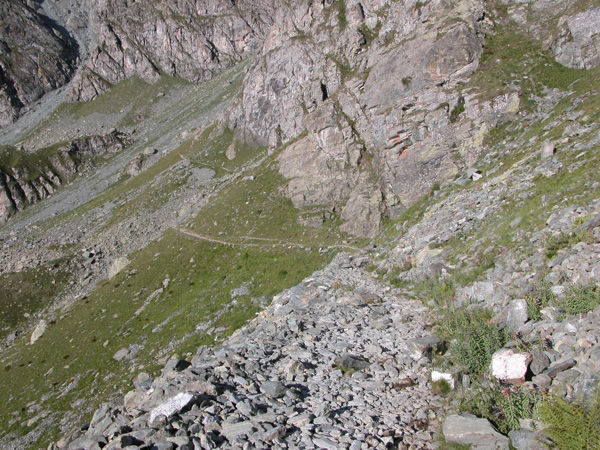
"Giro dei Laghi" is one of the most beautiful itineraries in Po Cuneese Park. From Pian del Re (2,020m) in the upper Po Valley near the sources of the "Big River", take the trail leading to Colle delle Traversette. After a few hundred meters, turn left towards Giacoletti Mountain Hut. After meeting a small waterfall - when snow melts you can get a bit wet, but the trail is equipped with chains in order to make it safe - you will reach a ridge. Here it is possible to enjoy the view of Fiorenza Lake (2,120m) and the small Nona Lake not far from it. Going ahead, you will find Superiore Lake (2,339m) and Lausetto (2,360m). After walking a little bit more, you will reach Chiaretto Lake (2,275m). Meanwhile, your direction has changed to take a trail on the left leading to Giacoletti Mountain Hut. You will meet then the trail leading to Quintino Sella Mountain Hut. From this trail, it is possible to go back to Pian del Re by following the enchanting shores of Fiorenza Lake. Po Cuneese Park, in association with Ciesse Piumini, has provided the itinerary with experimental trail markers, that is small "stone men", a well-known technique often used in the mountains. These "stone men" have been reinforced with a particular kind of mastic by the staff of Po Cuneese Park led by the mountaineer Manlio Motto. The result is that hikers will be led along the trail by about fifteen "small men" well integrating in the landscape, and they will have thus the opportunity to discover the wonders of Viso lakes.
Unfortunately, not everyone has understood the goal of these "stone men", that is providing the trail with trail markers without spoiling the landscape with the more common arrows and panels. As a result, a few days after the end of the work, some of these "stone men" were destroyed by vanals. Unfortunately, it is not the first time these things happen. Ignorance can only be defeated with clever and constant proposals, and this is exactly the goal of this trail.
Itineraries on the Rocca
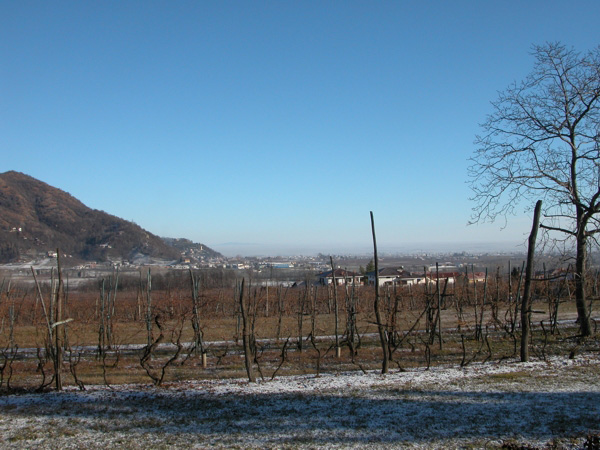
By Car in Po Cuneese Park from Casalgrasso to Crissolo
If you come by car from Turin, the first contact you have with Cuneese area is the symbol image of this territory: Monviso reflecting itself in the waters of the river Po, already a large river in Casalgrasso.
Here you can start an interesting itinerary leading to the springs of the river Po.
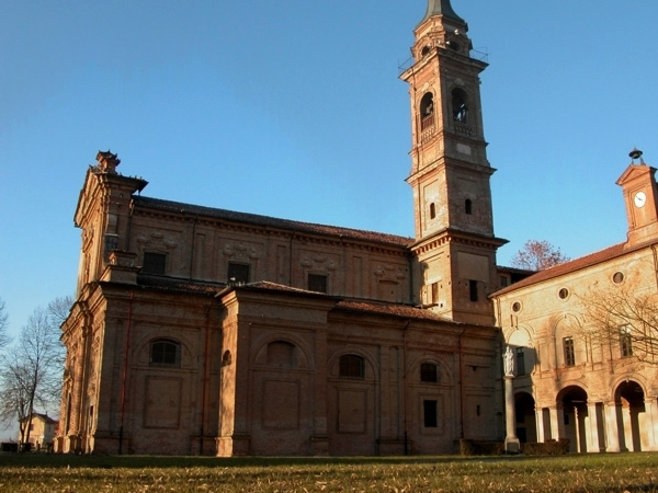
In about twenty minutes, by taking SS 663, you can reach Saluzzo (345m). The ancient capital of the Marquisate is today one of the most fascinating towns in Piedmont, since it has preserved in its urban structure features of different epochs. The most ancient part of the town clings to the hill, while the lower part which has been developing since the 17th century lies out of the city walls. The Cathedral, the Hill to the Castle, the Municipal Tower, the Castiglia, St. John Church, Casa Cavassa Municipal Museum, and S. Bernardino Monastery are the main monuments. After leaving Saluzzo in the direction of Pinerolo along SS 589, you will get to Staffarda (267m), in the Po Plain where, beyond Ponte dei Pesci Vivi Recreational Area, you will find S. Maria Cistercian Abbey. Of great interest the church, the cloister, the guest house, the market wing, all Romanesque-Gothic style buildings characterized by the brickwork reddish color.
Across the green flat countryside, from Staffarda you will get to Revello, at the beginning of the Po Valley. The town (351m) preserves the famous Cappella Marchionale and Chiesa Collegiata. The recently opened Naturalistic Museum of the River Po leads visitors in a virtual journey across the multicolored natural environments crossed by the Big River in its journey from the Mountains to the Plain. The valley becomes then narrower and the river Po becomes a faithful mate during the journey to the springs. Immediately after Sanfront (on the right), in Robella country hamlet, a trail enters the woodlands and leads to a curious rural settlement called Balma Boves, where huge boulders work as roofs for ancient rural houses. Always on the slopes of Mt. Bracco, the well-equipped practice wall - busy with climbers all year round - and, in loc. Combale Reinaudo, some rock engravings are worth a mention.
Paesana (614m), the main town of the Po Valley, is divided in two parts by the river. Here you can carry out several mountain tours. From an artistic point of view, in the district of Santa Maria there is the Parish Church with an imposing Romanesque-style belltower.
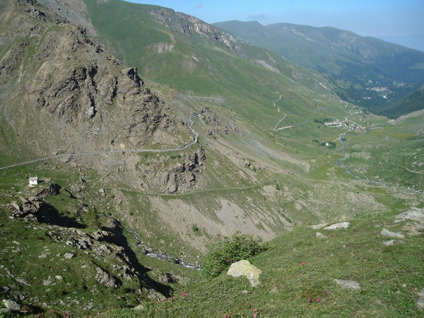
Going upstream and walking along the river Po, characterized by now by a torrential regime, you enter a mountain environment. After a few kilometers you will find the junctions to Oncino (1,220m), in Lenta Valley, and Ostana (1,250m), two characteristic mountain towns formed by several settlements scattered throughout the pastures. There are many tours you can carry out along the trails developing in the woodlands and, at higher altitudes, along the trails which were used in the past by shepherds. Beyond Oncino country hamlets you will get to Rifugio dell'Alpetto, the first mountain hut built by Club Alpino in Italy.
At the head of the valley, 33 km from Saluzzo, there is Crissolo (1,333m).
An interesting feature here is Rio Martino Cave (it is recommended to visit together a tour guide), rich in stalactites and stalagmites. Rio Matino Cave has been recently recognized as Site of Community Importance since it is the most important site (in Italy it is the only one known site) where a small bat, the Barbastelle Bat, spends the winter. In order to avoid disturbing the bats during the delicate wintering period, it is advisable to visit the cave from October to April.
Along the road to Pian del Re you will find (on the right) the interesting San Chiaffredo Sanctuary.
After 5 km you will get to Pian della Regina (1,745m), G.T.A. lap (with winter skilifts). From the foaming small waterfalls you can reach on foot in a few minutes, you enter the heart of the Park in a Special Nature Reserve, and from here you can continue along an easy trail to the springs of the river Po.
By car (be careful, since during the summer the access is regulated) in about three km you will get to Pian del Re (2,020m). The large plateau, where the waters originating from the River Po meet, preserves an ancient peat bog. It is the departure point of several mountain trails leading to Giacoletti (2,837) and Quintino Sella (2,648) Mountain Huts, the bivouacs, and the various climbing trails to Monviso massif, the Stone King.
At less than three hours of walk you can see Buco di Viso at Colle delle Traversette (2,900m), the first mountain tunnel of history, used since 1475 by Saluzzo Marquisate for the trade with the Dauphiné.
The Way of Salt
The Way of Salt is a hiking trail linking Paesana to Colle delle Traversette, along the trail which was used in the past for the trade between Saluzzo Marquisate and France.
The itinerary is dedicated to expert hikers (CAI difficulty = EE) and, because of its length, difference in height, altitudes, and the sometimes steep and exposed trail, it requires an adequate physical and technical training, specific equipment, knowledge of the environment, and a good capacity to assess soil and weather conditions.
The Way of Salt can be gone along in two or three days. The walking time indicated on the trail markers is approximate; along the itinerary you will find indications of the intermediate departure points.
The Way of Salt leaves from Piazza V. Veneto in Paesana (614m a.s.l.) and develops at first within the town, along Via Roma and Via Po, then it crosses the River Po and continues on the right side of the valley. Immediately after the sports ground, take the track and follow it until you will get to SP road no. 26. Cross the road to Erasca (637m a.s.l.); cross the bridge on the Stream Cornaschi and, near the little church, take the mule track leading to the ruins of the old rifle range and at the beginning of the dirt road to Gardiola. After the uphill trail and some hairpin bends, the road crosses chestnut tree woods and leads to borgata Gardiola (774 m a.s.l.); go ahead by following the trail and you will get to Succa (847m a.s.l.) and Sanghione (825m a.s.l.).
Further information (Italian text)