Points of Interest
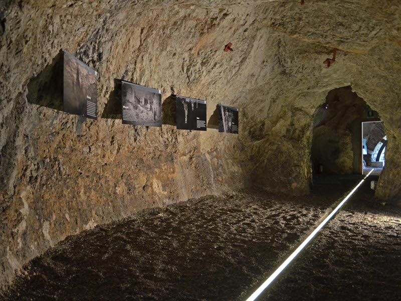
Resiutta's ice-house gallery
It was dug to obtain a depository where to refrigerate the beer. In 1844, in the Habsburg Resiutta, some entrepreneurs started to produce beer by using the excellent water of the stream Resia. Then, in 1881, the business grew with the plant of Francesco Dormisch.
Today, that heart of the mountain on the northeastern side of Mount Gravizze, where once people used to store the natural ice which accumulated in winter and was necessary to store the drink, has been brought to light again. A renovation and restoration work makes it possible to make a jump back in the past and visit the ice-house gallery in Resiutta, a fundamental element of the old brewery, which acquired special features in this environment.
The Ice-house Gallery can be visited, apply to the Resartico mine exhibition
Further info

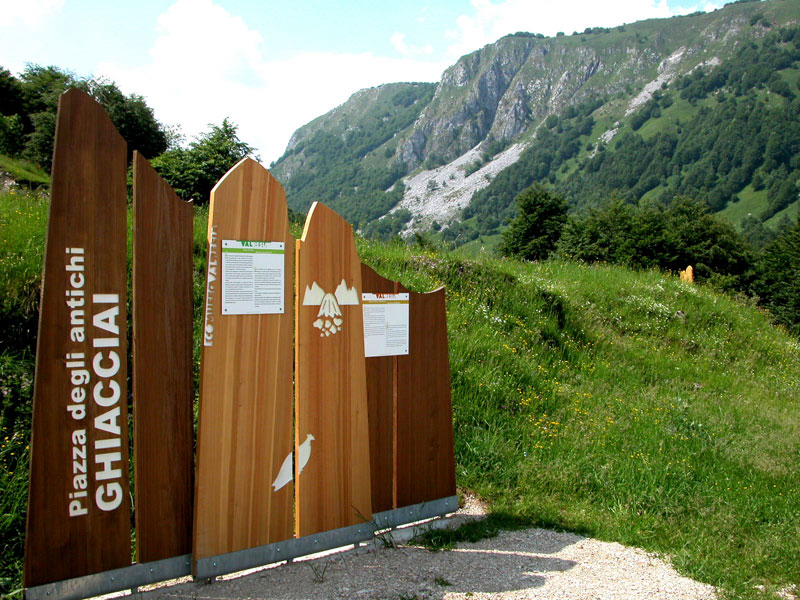
Val Resia Ecomuseum
Val Resia Ecomuseum represents a new model for the management and the enhancement of the territory, for an active and integrated conservation of the local naturalistic and historical-cultural heritage and the relaunching of the social and economic activities of the interested community. The ecomuseum involves the whole valley: it is a museum scattered throughout the valley territory, to visit by following a series of thematic trails along which the physical, biological, and cultural features will represent the stations or the observation points of a more general itinerary. Not only: today the image of a territory is defined through aspects which go beyond geography, landscape, and environment; they also include other material or immaterial resources like houses or barns, life and job habits, products of oenology and gastronomy. The ecomuseum is therefore a key to read the territory and an instrument to promote the heritage in which Val Resia is extraordinarily rich.
Val Resia Ecomuseum consists of four routes, called "Vie", leading to particularly significant places called "Piazze":
- Via agli Antichi ghiacciai, crossing Gniva and leading to Sella Carnizza
- Via agli Alpeggi, crossing Oseacco and leading to Provalo
- Via agli Stavoli, crossing San Giorgio and leading to Stavoli Ruschis
- Via alla Musica, crossing Stolvizza and leading to Coritis
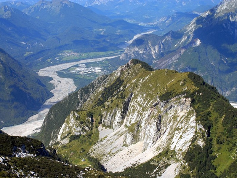
Resartico Mine
On the northern slopes of Mt. Plauris massif, the geological features of the territory have represented for over a century a reference point for the activities of the whole community: as a matter of fact, Rio Resartico mines have been for a long time the main sources of income for the inhabitants of Resiutta.
From the end of the 19th century until the early 1950s, from the bituminous veins intercalated with dolomitic rocks of Resartico Mine, a brown, light, and easily inflammable mineral was extracted. This mineral was brought to Resiutta to be distilled in a premise which is still visible on the left of the stream Resia, to extract some heavy mineral oils, using as fuel the gases released during the distillation.
Further info
Further info about ![]() Resartico Mine (PDF - 642Kb)
Resartico Mine (PDF - 642Kb)

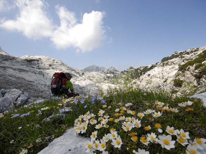
Foran dal Mus Geological Trail on Canin Massif
Thanks to Foran del Mus Geological Trail, from Sella Nevea you can discover one of the most famous high-mountain karst landscapes of all Europe.
It is a charming itinerary with a main and privileged access, represented by Canin cableway.
As a matter of fact, the cableway leads in a short time to the plateau and to the beginning of the geological trail. You can also reach this point in about 2 hours by following the CAI trails no. 635 and 632.
The Geological Trail is formed by two ring-routes: one long ring-route with about 8-10 hour walking time, and one shorter route with about 3-5 hour walking time.
The tour gives the opportunity to discover an extremely particular and characteristic environment, entirely surrounded by a karst plateau where the several and spectacular surface phenomena stand out and where it is possible to observe the complex phenomenon of the subterranean cavities (caves, wells, and abysses), developing for about 50 km, in some points with a depth of over 1,000m.
If you want to discover the Geological Trail, you can use a practical pocket guidebook and a particular and new guide installed on a hand-held device with GPS you can require to the Park Authority.
Further info
Price: 2.00 €
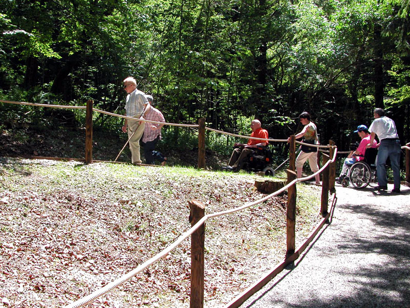
Accessible Trail
Near the Information Center of Pian dei Ciclamini in Lusevera, you will find the Accessible Trail, a trail characterized by special features making it accessible for everyone, including people with disabilities.
The itinerary develops for about 600 meters and is equipped with curb and guiding rope. The road bed features and the limited slopes make it suitable also for people using a wheelchair.
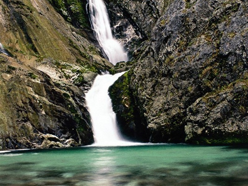
Fontanon di Goriuda
From Fontanon di Goriuda, after a winding route among waterfalls, meanders, and siphons, the waters sinking on the Italian slope of Mt. Canin come out.
It is a spectacular spring representing the karst catchment basin situated at a higher altitude than the real saturated area of the massif.
From a geological point of view, Fontanon is linked to the formation of Dolomia Principale forming the basement of Mt. Canin plateau. The downflow of water within this cave has torrential features; the temperature of water, rather constant all year round, is about 5°C. The cavity is accessible for a few meters on foot, then it is necessary to use a rowing boat if you want to reach the final stretch of the siphon that has been partially explored by the divers expert in speleology.
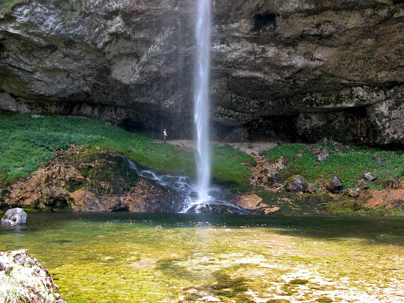
Fontanone Barman
It is a karst spring of remarkable flow. It is situated at 772m, on the northern slope of Musi mountains where, within a hardly accessible gorge, it forms a beautiful and imposing waterfall.
Cjariguart Valley
The name Cjariguart or Cjadiguart, as we find in the old maps, probably derives from "Cjare" = goat and "guart" = enclosure, and indicates the upper section of Lavaruzza Valley, a large valley situated between the two chains of Soreli Mountains – Laraset and Somp Selve – Cervada, ending in the east with the summit of Mt. Plauris.
The severe and wild aspect of the lower section of the valley becomes gentler if you climb across the steep knick of the Pares to the edge of Cjariguart Valley where gravels, boulders, slabs, and rocky formations form the background of the fertile alpine pastures enriched with cool springs. In the valley, rests of ancient dry-stone built structures and a crucifix carved into a rocky spur in 1651 witness the ancient and emblematic presence of man in these charming places. The place was already used in the last century for summer grazing activities, since it used to house a municipal "malga" built in 1896, with 50 heads, mainly cattle and goats, using the pre-summer pastures in Casere del Plan dai Portolans and Cuel de Fratte.
Afterwards, the "malga" was no longer used as such, but as shelter. The building was then destroyed by several landslides, and it has been replaced by a new structure: the shelter Cjariguart is formed by a cosy brickwork structure offering 15 beds and always open to the public, maintained thanks to the volunteers from Venzone. You can reach shelter Cjariguart on foot from Portis di Venzone (CAI trail no. 728/a), from Località Tugliezzo (CAI trail no. 701), and from malga Ungarica (CAI trails no. 705 and 728/a).