|
|
Parco Naturale Regionale delle Serre |
Protected Area |
|||||||||||||||||||||||||||||||||||||||||||||||
 |
|
||||||||||||||||||||||||||||||||||||||||||||||
The Park Official Cartography |
|||||||||||||||||||||||||||||||||||||||||||||||
|
|||||||||||||||||||||||||||||||||||||||||||||||
Parco Naturale Regionale delle Serre |
|||||||||||||||||||||||||||||||||||||||||||||||
|
The Serre represent a rather complex mountain chain of great natural-environmental value, joining in the south with the mountains of Aspromonte. As far as geomorphology is concerned, there are two long and opposite mountain chains (Mt. Covello, Cucco and Mt. Pecoraro) running almost parallel along the Apennine chain. The mountain chains are partly divided by the upper valleys of the basins of Ancinale, the large valleys and the Stilato (on the border of which the location Ferdinandea lies, famous hunting reserve of the Bourbon Kings, around which there is the wood of Stilo, as well as the imposing waterfalls of Marmarico, which, with a difference in height of 90 m, flow into Stilaro). Beautiful waterfalls, even if smaller in size, enrich the Serre, giving birth to natural architectures of great charm: among the others the waterfall of Pietra Cupa on the torrent Assi agro di Guardavalle, which, with a very fast slipway of over 15 m runs along a smooth rocky wall surmounted by giant and twisted trees until a large lake surrounded by bushes and shrubs. Not far from Ancinale, the river Alaca runs: it springs from the Lacina basin and develops along a long stretch at the bottom of a narrow woody valley enclosing wonderful architectures made of rocks and waters. In the south between F.ra Precariti, forming a short but very spectacular canyon, and F.ra Amuse the other important watercourse of Serre runs, F.ra Allaro. However, it is F.ra Assi, situated almost in the middle of the Ionian side of Serre, which encloses and enhance the features of the lower and middle courses of the torrents. The geological nature of Serre is mainly formed by crystals, with a very widespread presence of granites, porphyries, serpentines, quartziferous diorites, etc., which are well evident from the upper stretches to the final stretches of the watercourses. Further geological features of Parco delle Serre are the gullies, characterizing the slopes of the sub-mountainous strips above all in the North and in the East. According to L.R. n. 48/90, the establishing aims of the Park are the safeguard of the natural and cultural environment, as well as the improvement of the life conditions of the local population. |
||||||||||||||||||||||||||||||||||||||||||||||
|
|
|||||||||||||||||||||||||||||||||||||||||||||||
Characterizing FeaturesThe Park area is characterized by the widespread presence of woods and forests, Mediterranean maquis, grazing lands, rural fields. There are very important places of worship (like the centuries-old Abbey of the Carthusian monks of Serra S. Bruno, one of the few which have remained active, the grave of San Bruno from Cologne, the founder of the Carthusian Order), the naturalistic-ecological itineraries, as well as the evidences of industrial archaeology dating back to the Bourbon period; finally, there are several springs, streams, and torrents. |
|||||||||||||||||||||||||||||||||||||||||||||||
|
|
|||||||||||||||||||||||||||||||||||||||||||||||
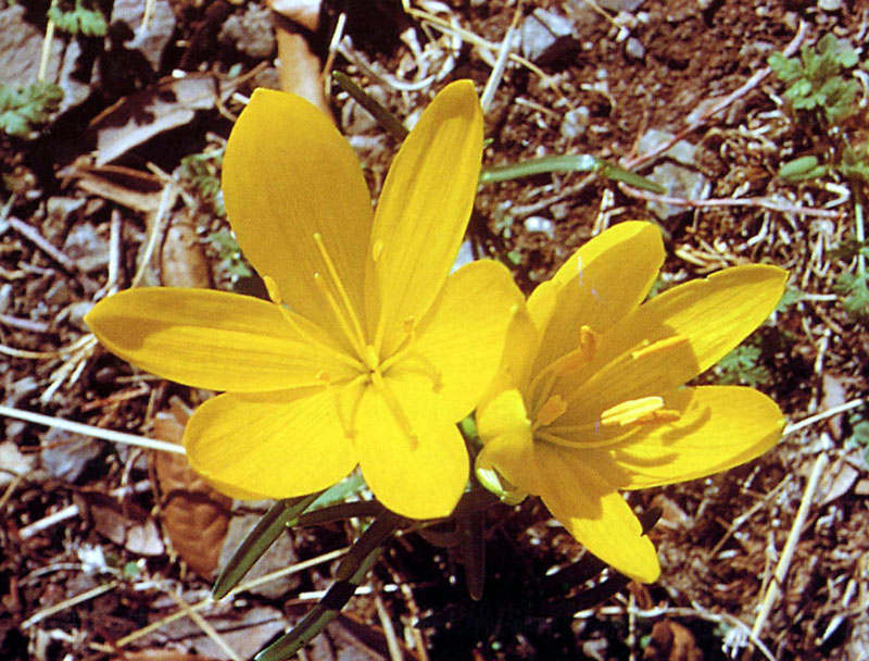 |
Flora and VegetationThe dominating vegetal species are: Castanea sativa (Chestnut tree), dominated by high-trunk species in the best areas and by coppice in the others, Pinus nigra (Austrian Pine), Alnus glutinosa (European Alder), Alnus cordata (Italian Alder) in spontaneous high forests covering all the valleys, the coolest areas, and the fluvial banks, Fagus selvatica (Beech tree) and Abies alba (Silver Fir - species of great naturalistic importance) present in groups and in pure and mixed woods, more or less extended in the highest and coldest areas, Quercus ilex (Ilex tree), Populus alba (White Poplar), Populus tremula (Common Maple) and Robinia pseudoacacia (Black Locust) occasionally in the lowest areas. Further information (Italian text) |
||||||||||||||||||||||||||||||||||||||||||||||
|
|
|||||||||||||||||||||||||||||||||||||||||||||||
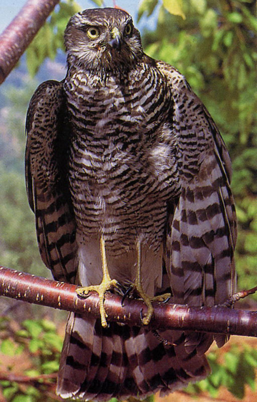 |
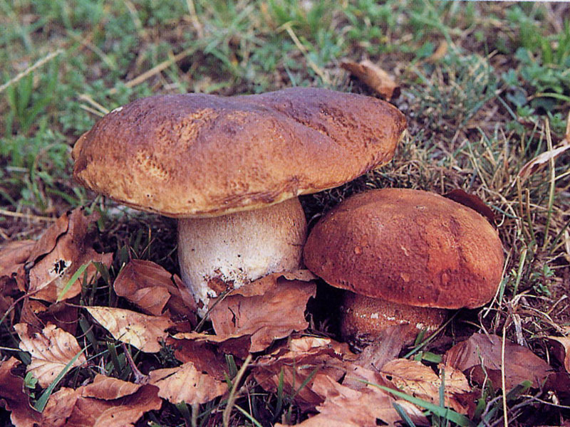
FaunaThe fauna populating the Serre mainly consists of wild boars, foxes, badgers, wild cats, weasels, and stone martens. Moreover, there is the very rare Corsican hare, which is a very interesting species from a scientific point of view. The birds are also present in rich groups. Among them, the Song Thrush, the Grey Heron, the Raven, the Woodcock, the Great Tit, the Hoopoe, the Magpie, the Gowshawk, the Sparrow Hawk, the Eagle Owl, the Peregrine, the Green Woodpecker, the Great Spotted Woodpecker, and also the rare Black Woodpecker. The most common fish species are the Eel, the Carp, and the Brown Trout.
Moreover, among the freshwater fauna we must mention the Brown Trout, the Eel, and the Carp, while among the entomological fauna there are several species of insects, lepidopterans, and coleoptera. Further information (Italian text) |
||||||||||||||||||||||||||||||||||||||||||||||
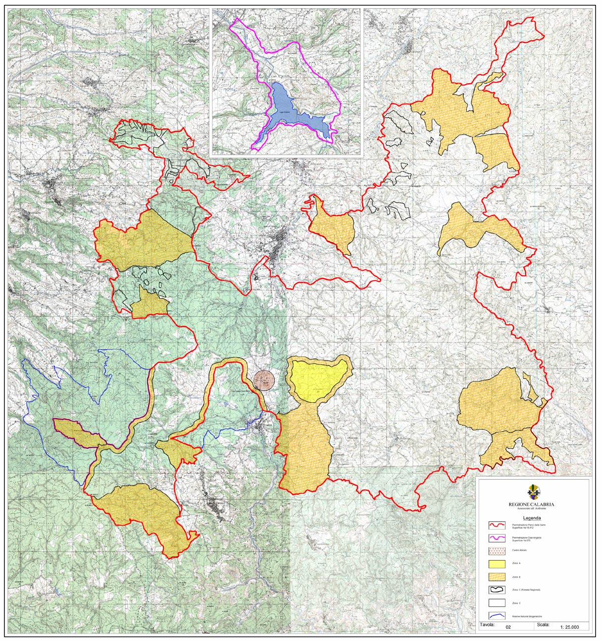
Zoning |
|||||||||||||||||||||||||||||||||||||||||||||||
 |
Given the variety of the natural environments present in the Park area, as well as the presence of human settlements since ancient times, it wouldn't be reasonable to implement in the whole territory the same safeguard, conservation, and enhancement measures. Therefore, the so-called "zoning" is used (division into zones of the Park territory) consisting in dividing the area into different zones, subject to different safeguard criteria according to the features of the vegetal and geomorphological formations and to the environmental features. From the areas preserving the most intact and integral natural features, we can distinguish four zones (A-B-C-D) going from the strict nature reserve to the areas which are more linked to production activities and/or more used for different purposes (grazing lands, agricultural fields, arboriculture).
|
||||||||||||||||||||||||||||||||||||||||||||||