14 - Alpe di Monghidoro - Le Selve
This long stage leads to the hills of Romagna, crossing remarkably different environments.
- Trail Conditions: On foot
- Departure: Alpe di Monghidoro (1,200m)
- Arrival: Le Selve (490m)
- Duration: 8 hour/s
- Difficulty Level: E (for hikers)
- Length: 23.1 km
- Difference in height: Uphill 830m - Downhill 1,370m
- Accomodation structures: Complesso Turistico Le Selve, Gallo Albergo Ristorante, Campeggio Alidosi
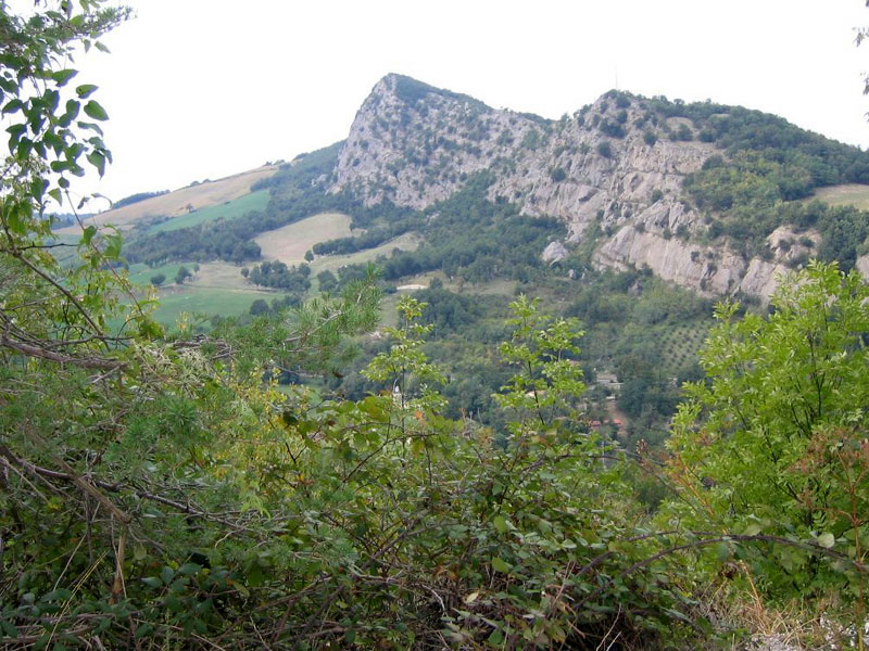
From the end of the previous stage one goes back on the road that connects Castel dell'Alpi with the Futa state road. Continuing to rise in the beech forest one skirts the slopes of Mount Oggioli and then descends to Raticosa Pass, along the ancient road between Bologna and Florence that we now see in its nineteenth century form. From the pass one reaches the above Mount Canda, a good scenic vantage point over the entire Firenzuola basin and the impressive clay landscape towards which we are heading. The route now keeps on the wide ridge between the valleys of the Idice stream and the Santerno river, dotted with juniper trees and rocky boulders among which, down below, is the conspicuous dark ophiolitic monolith of Sasso di San Zenobi. One then enters the valley of the Sillaro Stream, dominated on the left side by the Casoni di Romagna wind farm whereas, on the right side, the valley is dominated by the steepest sandstones of Mount la Fine. One ascends through the woods, until reaching the pillar on top (993 m). After a comfortable stretch on the ridge one descends towards the valley of the Santerno, reaching the Pratolungo. From there the hiker goes to the church of Montefune, where the road becomes practicable for wheeled vehicles. Following it downward, passing through the beautiful chestnut woods of Rio Magnola, one quickly arrives at the junction leading to Le Selve campsite-hostel.
Further information14 lap of: Alta Via dei Parchi
Accommodation: Complesso Turistico Le Selve, Gallo Albergo Ristorante, Campeggio Alidosi
 Download KMZ