


Protected Area
Identity Card
- Rete di Riserve Alta Val di Cembra - Avisio Reserves Network:
- Land Surface Area: 1'900.00 ha
- Regions: Trentino Alto Adige - prov. TN
- Provinces: Trento
- Municipalities: Altavalle, Capriana, Segonzano
- Park Authority: Rete di Riserve Alta Valle di Cembra - Avisio
- Further managed Protected Areas:
- Riserva Naturale Laghetto di Vedes
- Riserva Naturale Lago Nero
- Riserva Naturale Paluda La Lot
- Riserva Naturale Prati di Monte
- Zona Speciale di Conservazione Laghetto di Vedes
- Zona Speciale di Conservazione Lago Nero
- Zona Speciale di Conservazione Paluda la Lot
- Zona Speciale di Conservazione Prati di Monte
- Ambito fluviale di interesse ecologico del Torrente Avisio
- Riserva Locale Acqua della Rossa
- Riserva Locale Cavallo 1
- Riserva Locale Cavallo 2
- Riserva Locale Monpiana 1
- Riserva Locale Monpiana 2
- Riserva Locale Palù del Moro
- Riserva Locale Prati del Toro (A)
- Riserva Locale Prati del Toro (B)
General features
The territory of the Alta Valle di Cembra - Avisio Reserves Network develops on the right side of the Alta Val di Cembra, in northeastern Trentino, by the border with Alto Adige, covering a surface of about 3,314 hectares.
Among the environments having the greatest nature value there are the peatlands, particular wetlands situated on the Dossone di Cembra, a mountain ridge situated behind the built-up areas of the Network, some of which are classified as provincial reserves, while the others as local reserves.
The most significant are the Prati di Monte reserve with the Valda Lake, the Vedes small lake, the Paluda la Lot and the Nero Lake, and the Cavallo, Palù da la Roro, Monpiana, Acqua della Rossa and Prati del Toro local reserves as well.
Another environment of high nature value is the Avisio stream. Situated in the bottom of the Valley, the stream deeply engraved the Cembra Valley with its strength, and transformed some of its stretches into a canyon which is very difficult to reach and not suitable for human activities. Such conformation allowed the stream to flow in an unpolluted and wild environment, safeguarding the important plant and animal bidoversity.
The natural landscape context is characterized by the presence of different habitats: downstream of the villages there are typical terraces cultivated with grapevine - which are the proof of a heroic viticulture - and with small fruits, the broad-leaved tree forests, such as the downy oaks, the common hornbeams and the ashes which alternate with the chestnut trees near the human settlements. Upstream of the built-up areas the tall-tree forests stand out: from the scots pines to the beech forests one climbs up to reach the tree-lined pastures, meeting firs and Norway spruces in the highest altitudes and on the coolest slopes.

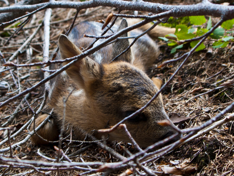
Flora and Fauna
The Network's natural environment consists of several different habitats ranging from the river environment of the stream Avisio climbing through the terraces cultivated with grapevine and among the abandoned ones covered with forests to the broad-leaved forests and to the fir forests in the highest areas of the Dossone di Cembra. Among these many environments and thanks to them, the animal and plant biodiversity of the Network is very rich, and it can have pleasant surprises in store for the visitors.
(The following links lead to Italian texts)
Geology
The Reserves Network is characterized by a substantial geological homogeneity of the substrates deriving from the Atesina Porphyritic Platform. Porphyry - a stone which is frequently used in the building and paving of roads and squares - is a volcanic rock composed by a vitreous paste where many feldspar and quartz crystals are immersed.
Earth and Water
The territory of the Network's municipalities covers a surface of about 46 square kilometers, from an altitude of 445 m above sea level (along the Avisio in the Faver valley) to an altitude of 1,808 m above sea level (by a bump south-west of Mount Corno). It is a large area characterized by the almost exclusive presence of rocks of magma origin (porphyry), which shape different mountains compared with the near Pre-Alps and Dolomites: they are different not only from the geological point of view bu talso from the landscape and nature perspective.
(The following links lead to Italian texts)


