


Costa di Monte Oliveto Nature Trail
- Trail Conditions: On foot
- Duration: 1 hour/s 30 minutes
Once left the Toblino Castle behind your shoulders, the avenue delimited by rows of centuries-old cypresses leads to the forestry road where the Costa Di Monte Oliveto Nature Path starts, the walk lasts 1 and a half hours. After about a hundred of meters one finds the farmhouse called "el Molin" which was activated by the hydraulic power of the Val Busa river and ground the wheat to supply the Toblino Castle. Nearby one crosses a bridge, under which it is still possible to see the foundations of the ancient Roman bridge.
From here the street climbs towards the canyon of the Val Busa river, a small canyon carved in the rock, characterized by four small waterfalls which created a well on the bottom filled with gravel and pebbles.
Along the trail there are the traces left by the works carried out to build the gallery, which brought the water from the artificial basin of Ponte Pià to the hydroelectric power plant of S. Massenza.
A careful look will definitely notice the glacial erratics and moraines, proof of the glacier which occupied the Valle dei Laghi during the last ice age.
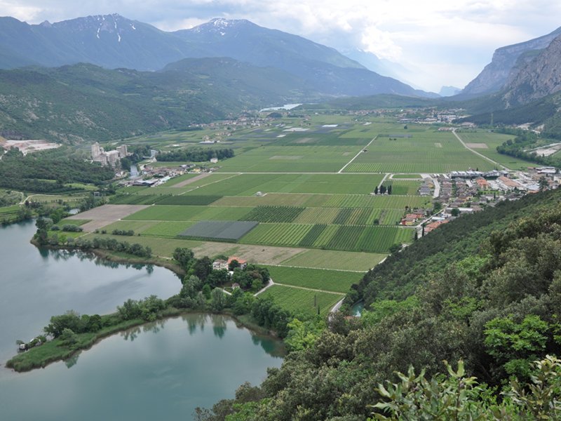
The favorable location and the mild climate allow the visitors to enjoy this trail all year round. At the end of the trail, once reached the natural panoramic point, the 360 degrees view of the Toblino Lake and of the whole Sarca Valley makes up for all the efforts.
Guided visits and didactic activities organized by "Gruppo verso l'Ecomuseo della Valle dei Laghi". For further information: ecomuseo@comunita.valledeilaghi.tn.it


 Download KMZ


