

Monte del Frate and Valle del Raibano
- Trail Conditions: On foot
- Interest: Flora, Panorama
- Departure: Badolo (378m)
- Arrival: Monte del Frate (547m)
- Duration: 3 hour/s
- Length: 8.2 km
The wide ring of the itinerary develops, through a pleasant succession of environments and landscapes, between the panoramic ridge of Monte del Frate (547 m) and the valleys that deepen behind the Rocca di Badolo (476 m), touching some of the places of greatest naturalistic value in the reserve. The route uses well-marked paths and dirt roads, has a few steep sections that can be slippery in rainy periods and requires some attention only along the ridge, when the path approaches the edge of the vertical wall of Monte del Frate.
The itinerary begins in Badolo, which is about 6 km from the Sasso Marconi motorway exit.
The starting point is the small church of S. Michele Arcangelo, where there is the possibility of parking for a limited number of cars (6/7).
From the salt church along via Badolo, following the signs for path 110 towards Monte Adone and Brento. After about 400m, after the intersection with via Brento, you will find a clearly visible track on the right which climbs up the slopes of Monte del Frate.
Further information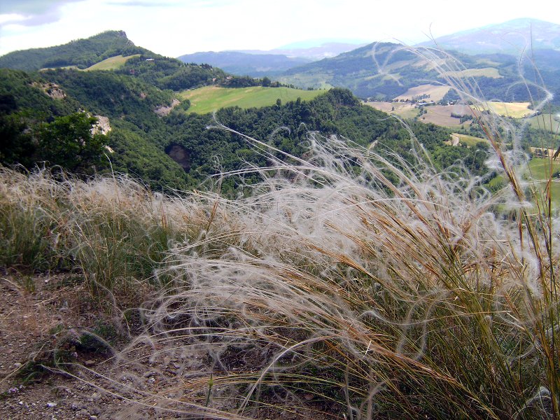
 Download KMZ


