Traverse of the Cjavâlz, Glèris, Russèi mountain group
- Trail Conditions: On foot
- Interest: Flora, Wildlife, Bird Watching, Panorama, Photography
- Difference in height: uphill 1,080 m (by climbing the Mount Cjavâlz it is 1,240 m).
- Difficulty level: EE. Although this path is not difficult, because it is well marked (anyways the topographic map is very useful), in some of its stretches one should pay particular attention while crossing them. Considering the length of the trail, the whole traverse is recommended to expert hikers.
- Duration: it takes the whole day to hike over the trail, it can be walked in 5 hours (6 hours including the climb to the summit of the Mount Cjavâlz).
- Clothing: suitable for the season and for the high altitude, mountain shoes (trekking shoes). Due to the lacking water points it is suggested to be equipped with a proper water supply before starting the hike.
- Suggested period: the warm season, especially spring and autumn. In winter and with the snow, difficult situations could occur because of avalanches danger.
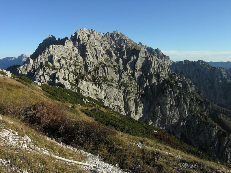
It is a very satisfying itinerary as far as the landscape is concerned, a "classic" to visit a great part of the northeastern sector of the Val d'Alba Nature Reserve, with panoramic views of the surrounding areas too.
The traverse also involves the Site of Community Importance (S.C.I.) called "Çuc dal Bôr".
From the parking lot of the Vuâlt (1,050 m) (see the itinerary n. 1) one follows the path climbing down towards the Alba stream (for a short stretch, CAI path marker n. 428) leading to the "G. Bianchi" bivouac (1,712 m). From the bivouac one goes on towards the Mount Cjavâlz, climbing along the southern slope up to a fork. Going on the left one follows the mule track (CAI marker n. 425) leading to the other slopes of the mount facing west (variation for the most expert and trained participants: it is possible to climb up to the Mount Cjavâlz - 2,098 m - and climb down its western slope - 1st grade passages - crossing the path n. 425 again). Going on walking, the path is always clear and well marked, but some stretches are eroded. The high altitude itinerary crosses the southern slopes of the Glèris-Russèi mountain group, passing under the Pecora pass (1,827 m) and the Vacca pass (1,791) up to the Forcjadice pass (1,604 m).
Following downhill the CAI path 425, one reaches the "Ricovero militare" (military shelter, 1,312 m) and the Vuâlt mountain hut.