Hike by the Rio Simon
- Trail Conditions: On foot
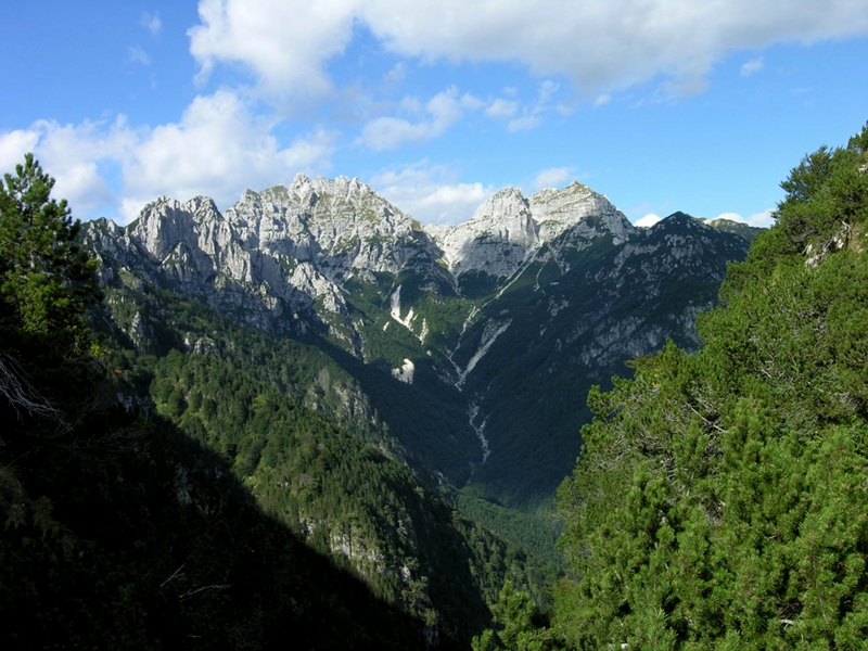
- Interest: Flora, Wildlife, Bird Watching, Geology
- Difference in height: uphill 740 m.
- Difficulty level: the itinerary is situated in a fascinating environment for both its severity and wild beauty. In the Rio Simon there are no footholds, the differences in height uphill and downhill are not remarkable, the difficulty level mostly depends on the length of the itinerary which might be difficult for the less trained people. It is suitable for hikers who have had previous experiences on the mountains. Orienteering skills and use of the topographic map.
- Average duration: 6 to 7 hours. The itinerary can be covered in one day, the indicated average duration refers to a normal pace and with good road conditions.
- Clothing: suitable for the season and for the altitude, mountain shoes.
- Suggested period: avoid the hottest summer days because the Valley faces south and the path could be burning. Spring and Autumn are the best seasons, the latter because of the colors and the charming lights. Hikes can be carried out even in the late Autumn, provided that the ground is not covered with snow and always considering the days' duration. Although the snow offers charming landscapes which are very interesting and worthy of a visit, it could cause several difficulties, especially for not well equipped hikers and for those who are not enough trained to walk snow-covered paths (ability to analyze the blanket of snow, the road to follow, better training, etc…).
From Ovedasso (near Moggio), one follows the road running alongside the southern slope of the Mount Pisimoni towards Roveredo (near Chiusaforte). Once you cross the river Secco, municipal boundary of Moggio, you can leave your car on a small square on the left and then take the marked path towards the rural buildings called "stavoli rauni" (CAI trail marker n. 424). One follows the path 424 northwards, on the Simon river right bank. At an altitude of about 950 m, downstream of the former "casera la Cìta", one crosses the Simon river and goes on until one finds the CAI path n. 425 leading to the former "casera Tamaruç", Centurate stavoli and the northeastern ridge of the mount Belepèit. Following the CAI trail marker n. 425 one walks the western slope of the mount Belepèit, up to the Polizza stavoli (745 m). Leaving the CAI path 425 leading to Chiusaforte, oneturns right and takes the CAI path 425/a. Through a good trail one reaches a pass where the Stavoli of Polizza di là (774 m) and the stavoli Sterpèit (648 m) are situated, up to the street leading to Roveredo, near the bridge above the Rio Simon. Following the asphalted road (of about 2.5 Km) one reaches the departure point.