| |
How to get there
|
|
By Car
|
|
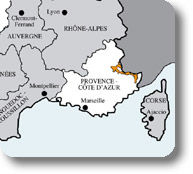
To reach one of the 6 Mercantour valleys leaving from Nice:
- Roya Bévéra: highway direction Mentone/Genova, exit Ventimiglia; take N204 direction Col di Tenda, Cuneo. Recommended access from Nice - since it is more characteristic - across the tortuous Colli di Braus and Brouis, Sospel and Breil / Roya D2204 and D2566.
- Vésubie: N202, then D2565
- Tinée: N202, then D2205
- Haut Var Cians: N202, then D2202 N202, then D28
- Haut Verdon: N202, then D908
- Ubaye: N202, then D2205 and D64 (Colle della Bonette). Colle della Bonette, at 2,800m, is open only from June to September (approximately); therefore, to reach Barcelonnette it is often necessary to cross Digne-Les-Bains and Blanche Valley.
|
|
By Train
|
|
- Roya Valley is accessible from Nice by train.
The villages of Sospel, Breil / Roya, St. Dalmas de Tende, and Tende are accessible by train.
- The train called "Train des Pignes ", despite it does not get to Mercantour, gives the possibility to reach the lower valleys of Var and Verdon (Puget-Théniers, Annot, Thorame, Digne-Les-Bains), always from Nice.
Further information:
SNCF (French railway lines): Tel. 08 36 35 35 35; www.sncf.com
Les Chemins de fer de Provence (Provence railway lines): Tel. 04 97 03 80 80
|
|
Public Transport
|
| |
Bus:
- Daily bus connections from Nice to Mercantour valleys (Alpi Marittime).
Centre Régional d'Informations Routières (traffic information): Tel. 04 91 78 78 78
Bus Station Nice Côte d'Azur: Tel. 04 93 85 61 81
|
|
By Plane
|
| |
Airports:
- Nice Côte d'Azur International Airport, situated in an ideal position connecting it with the clearway N202 leading to Mercantour valleys, offers connections with several French and international cities.
Bus connections to some valleys available from terminus n. 1.
Nice Côte d'Azur Airport: Tel. 04 93 21 30 30; www.nice.aeroport.fr
|