Protected Area
- Park Authority: Ministry of Natural Resources and Tourism
- Headquarters: TANAPA, P.O. Box 3134, Aruscha, Tanzania
- Tel: 0255 27 2501930/1-9
- Fax: 0255 27 2548216
- E-mail: tanapa@habari.co.tz
- Area: 137 square km
- Established in: 1967
The Arusha Region

![]()
The geographical and environmental context
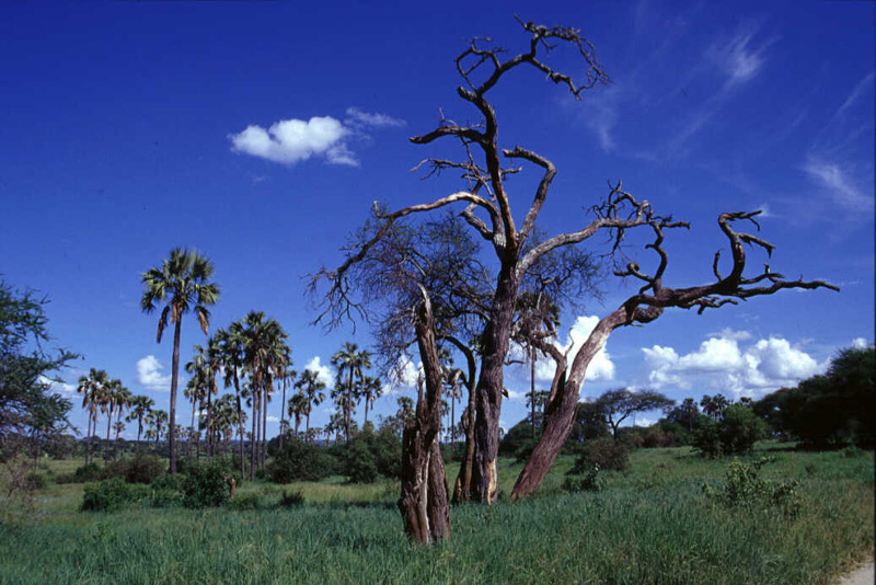
The Arusha Region covers a large part of the territory in the north of Tanzania, about 85,500 square kilometers. The Region includes a section of the East African Rift Valley, delimited in the west by a wall crossing the Arusha Region from north to south, while in the east, in this section of Rift Valley there is no equivalent formation, but the territory gradually rises. In the east of the Rift wall, the territory is slightly undulating, interrupted by isolated hills and dead volcanos; in the west, the territory is more lively and includes the plateau of Ngorongoro Crater and some mountains and hills.
In the western section of the Region there are three big lakes: Eyasi Lake, Manyara Lake, and Natron Lake.
As far as the climate is concerned, the Region is classified as a dry and semi-dry area, with a marked dry season and a rainy season going from November-December to April-May. Usually, the rainy season is characterized by two periods: the first one going from November to February, less intense and regular, also called "small rains", and the second one more intense and less variable, the so-called "great rains" , going from March to May. The average rainfall is of 650 mm per year, with considerable variations from year to year. Temperatures go from a minimum annual average of 16°C in July to a maximum annual average of 27°C.
Flora and Fauna
![]()
![]()

![]()
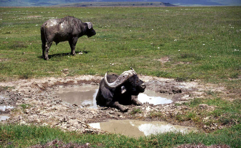
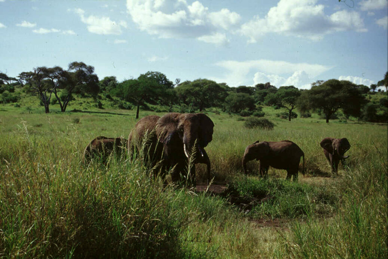
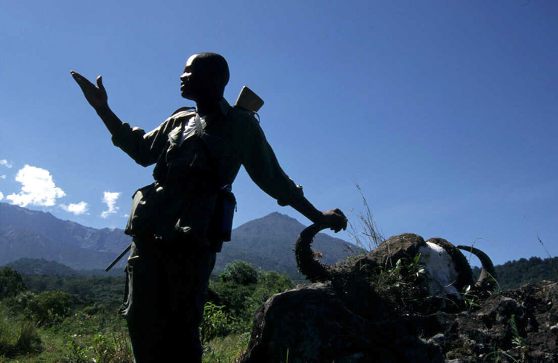
Of great interest in this Region is the wildlife; according to some air census carried out in the whole territory, there are about 1,9 million big-size wildlife heads, not including over 1,5 million flamingos spending part of the year in this area. Most of these animals belong to the district of Ngorongoro.
The species which are numerically more important are three: the gnu, the zebra, and the Thompson's gazelle. These three ungulates form about the 86% of all the local wildlife, except birds. There are also big populations of elephants, other kinds of gazelles and antelopes, buffalos, giraffes and rhinos among the big-size animals; however, there are also several medium- and small-size animals like carnivores (lions, hyenas, leopards, cheetah, jackals, African wild dogs, and small carnivores), small herbivores and several birds.
The whole Region is interested by the migration of some big-size herbivores: their movements have been drastically reduced in the last decades because of a growth in human population and a consequent reduction of the territory available for the wildlife. Moreover, an indiscriminate and illegal hunting activity carried out until a few years ago led to the extinction or drastic reduction of some species, like the rhino, the hippo, and the roan antelope.
Parks and Protected Areas of the Arusha Region
- Tarangire National Park
Covering about 2,600 square kilometers, it is characterized by savannah with trees (baobab and umbrella thorn are the most common trees) and more or less thick shrub formations; it houses one of the most important populations of wild herbivorous animals in Eastern Africa. It is a seasonal Park, where a great quantity of wildlife comes in the dry season because of the presence of a permanent water source represented by the homonymous river running through the Park from south to north, for all its length. In the rainy season, the animals live in a wider area of the Masai steppe. Therefore, it plays a very important role as a shelter during the dry season.
- Arusha National Park
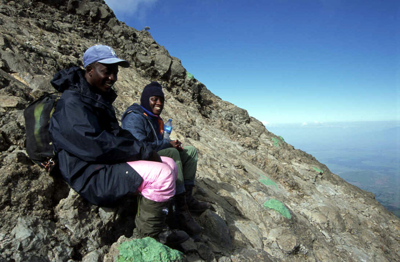
It is a mountain Park including Mt. Meru, reaching the 4,566 meters of height, a volcano which is still partly active. This Park, at a few kilometers from the town of Arusha, is mainly characterized by forests and houses many herbivores, several kinds of monkeys, and several birds. It is possible to find elephants and buffaloes also at a height of 3,500 m. above sea level.
- Manyara Lake National Park
It is situated at the foot of the spectacular wall of the Rift Valley. The Lake, covering about 230 square kilometers, can become dry or almost dry during the years characterized by extreme draught, while during the rainy season houses a great number of flamingos. Despite its small size (330 square km), the Park includes several kinds of habitats: from the forest to the acacia woods, the open grasslands, the marshes, and the shores of the Lake itself.
- Ngorongoro Conservation Area
It includes all the large crater of the dead Ngorongoro volcano, housing a large number of wild animals, among which a few specimens of black rhino still surviving in Tanzania. The forests covering the slopes of the old volcano represent an important shelter for many animals living in the surrounding area, while the open grasslands are used by the migratory fauna of the Serengeti ecosystem during the rainy season. In this area there is also an important archaeological site, where prehistorical finds have been discovered. About 26,000 nomadic Masai shepherds live here with their herds of domestic animals.
The Social and Political Context
![]()
The policy of the Ministry regarding the conservation of the wildlife is based on the involvement of the local communities living in the areas lying outside the National Parks. Among the others, the objectives of such policy are the following:
- protecting and managing the environment, in particular the wildlife: a loss of biodiversity would be a huge damage for the Country, not only from an ecological, but also from an economic point of view;
- ensuring that the conservation of the wildlife could help exploiting the soil, of which local communities can take advantage;
- integrating conservation with the rural development of local communities; in particular, it is necessary to pay particular attention to the sustainable use of the wildlife resource, in order to take advantage of it and to exploit it respecting the environment.
The Arusha Region is a Region mainly based on a rural economy. As many other rural areas of the Country, it is characterized by a very slow economic growth and an unfair sharing of the resources. The rural activities developing in this Region are mainly linked to agriculture and stock rearing. Small villages mainly formed by huts are scattered throughout the territory of the Region. Huts made of mud - typical of nomadic shepherds - are abundant above all in the districts of Kiteto, Ngorongoro, and Monduli.
Intensive agriculture has had a considerable growth in recent years, and it is exactly this kind of use of the soil which clashes with the conservation of the wildlife, but also with the traditional use of the territory linked to nomadism. As far as stock rearing in the whole Arusha Region is concerned, there are about 4,6 million animals, mainly cows and sheep.
The ethnic groups populating the Arusha Region are the following:
- the Masai, who traditionally practice stock rearing based on nomadism and use large territorial extensions; several research activities have demonstrated that this lifestyle is compatible with the conservation of the wildlife and its habitat. Since they can no longer practice nomadism, the Masai are changing their habits and trying to integrate stock breeding with agriculture.
- the Arusha, coming from the area of Mt. Meru and migrated then in the surrounding areas. They are mainly shepherds-farmers, and today they devote themselves also to intensive agriculture and trading activities.
- the Iraqw, Warangi, Mbulu, and Chagga; some members of these groups own tractors, trucks, shops, and cultivate big lots of soil.
- the Sandawi and Dorobo traditionally and exclusively depend on the wildlife, but at the moment they are forced to practice sedentary agriculture.