


From Sassalbo to Ospedalaccio
- Trail Conditions: On foot
- Interest: Geology, Panorama
- Departure: Sassalbo (863m)
- Arrival: Sassalbo (863m)
- Duration: 4 hour/s
- Difficulty Level: E - Hiking (level)
- Difference in height: 480m
- Maximum Altitude: 1,280m
- Recommended Period: from April to November
- Localities Crossed: Sassalbo - Le Fosse - L. Padule - Crocetta - P. Cerreto - Ospedalaccio - Sassalbo
A journey back to the past will lead you from Sassalbo along Via Modenese, a paved road for the State of the Este, then to Ospedalaccio Pass, where a medieval shelter used to welcome the pilgrims. Across the natural settings of Acqua Torbida, the dolines and the gullies, and then again among the chestnut woods and the history of Sassalbo. Before being replaced by "via dei Francesi" (the way of the French) across Gatto Pass, then by Lunigiana Military Road, the current SS 63, almost all the traffic heading for Cerreto and Fivizzano used to involve the Road of Tornello or Ritornella and Crocetta Pass, along the road that in a map dating back to 1827 is called "Strada Maestra dal Cereto a Sassalbo" (Major Road from Cerreto to Sassalbo).
Further information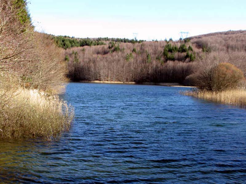
Padule Lake
Books and Guides

Price: 12.00 €
Price: 18.00 €


© 2024 - Ente Parco Nazionale Appennino Tosco-Emiliano