


Val Falcina
Easy loop with a wild charm
- Trail Conditions: On foot
- Interest: Flora, Wildlife, Geology
- Departure: Pian della Falcina (748m)
- Arrival: Pian della Falcina (748m)
- Duration: 2 hour/s
- Difficulty Level: T - Tourist (level)
- Length: 4 km
- Minimum Altitude: 420m
- Maximum Altitude: 660m
- Recommended Period: from March to November
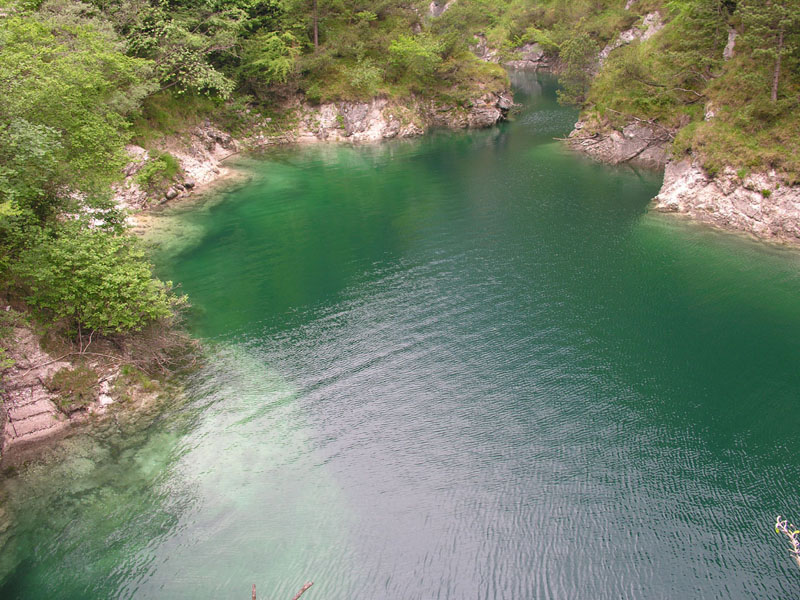
Situated on the orographic right side of the stream Mis, Val Falcina is closed in the south-west by the dolomitic walls of Mt. Pizzocco and ends in the artificial lake Mis. An easy ring-route gives the opportunity to discover wild environments of great naturalistic interest also to non-expert hikers. The information boards placed along the route provide geological, botanical, and faunistic information, turning your walk into an opportunity to improve your knowledge on the Park.
Val Falcina is a fluvial V-shaped valley, deeply cut into the Dolomia Principale, and its geomorphological development is influenced by the presence of an important fault line. For its floristic and vegetational features, the itinerary may be considered representative of the mid-altitude vegetal landscape of the eastern section of the Park. The area is important for the presence of floristic species characterized by an eastern range of distribution (the Austrian Pine, Knautia ressmannii, Bellflower, Kerner's Spurge, etc.). If you pay attention, it is possible to hear or see many passerines and other interesting species, like the Golden Eagle and the Black Woodpecker. The presence of the lake gives the opportunity to observe amphibians, the Grass Snake and, among birds, the Mallard (spending the winter around the lake), and the Grey Wagtail.
 Download KMZ


