
Riserva Naturale Boschi del Giovetto di Paline
www.ersaf.lombardia.it/biodiversita-e-aree-protette/riserve-naturali/riserva-naturale-boschi-del-giovetto-di-paline/
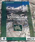
Carta escursionistica della Foresta Regionale Valmasino (SO)
Hiking map (scale 1:25.000) of the trails and territory of the Valmasino Regional Forest
On the back of the map, you will find a general overview of Valmasino and the main hiking itineraries, with a special reference to "sports in nature" that can be practised in the territory.- Series: Foreste da Vivere / Carte escursionistiche
- Publisher: ERSAF - Regione Lombardia
- Size: 11.5x21cm (closed)
- Scale: 1:25.000
- Price: 4.00 €
Carta escursionistica della Foresta Regionale Valmasino (SO)


© 2024 - ERSAF - Ente Regionale per i Servizi all'Agricoltura e alle Foreste