


CAI 751 Hiking Trail
- Trail Conditions: On foot
- Interest: Flora, Geology, Panorama
- Duration: 1 hour/s
- Difficulty Level: E - Hiking (level)
- Difference in height: 210m
CAI 751 Hiking Trail represents the main trail to visit the Nature Reserve.
The trail develops along the promontory ridge, passing through the summit of Mt. Cives in the Municipality of Vidracco (585m asl), and through the hill connecting the two summits of Bric Carleva (507m asl) in the Municipality of Baldissero Canavese.
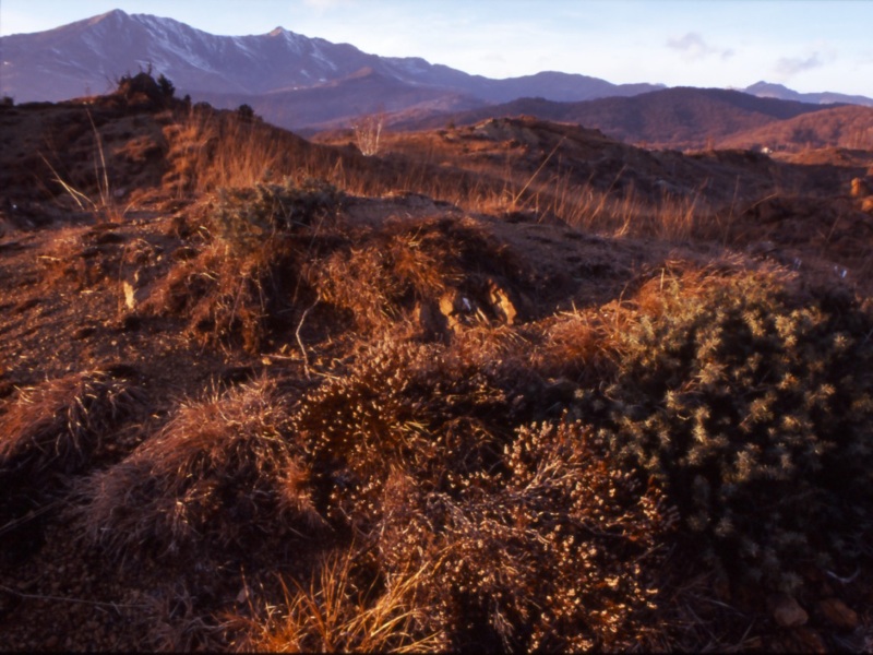
Along the way, it is possible to observe the naturalistic and landscape features of the protected area. The herbaceous communities tolerating high percentages of magnesium in the soil, the wild heather formations and the tufts of rush alternate with local populations of black pines, planted during the school camps of the National Forest Service over 50 years ago. Along the whole ridge, it is easy to observe the outcrops of serpentinized peridotite, a basic rock of intrusive origin rich in olivine. In the area, peridotite is characterized by metamorphosis processes leading to the presence of magnesite veins or areas dominated by serpentinites.
From the trail, and especially from the top of the promontory, you can enjoy a wonderful panorama over the lower Val Chiusella and the adjacent towns.
At the edges of the trail, you will find two recreational areas: one downstream Mt. Cives, built to make its structures form a curious zoomorphic figure; the second one situated at the summit of Mt. Cives, housing the historical Tower.
An alternative route gives the possibility to follow the trail without passing through the summit of Mt. Cives, reducing in this way the difference in height.
The itinerary is usually busy with hikers, above all in winter and spring, and by expert bikers all year round. It belongs to the network of hiking trails of Val Chiusella and, in particular, it develops eastwards, towards the lake and the territory of the Municipality of Vidracco.
Road bottom: trail and dirt road


