

Protected Area
Identity Card
- Land Surface Area: 6'708.24 ha
- Regions: Lombardia
- Provinces: Bergamo
- Municipalities: Bossico, Castro, Costa Volpino, Fonteno, Lovere, Pianico, Riva di Solto, Rogno, Solto Collina, Sovere
- Establishment Measures: DGP n. 292 17/05/2004
- Park Authority: Comunità Montana dei Laghi Bergamaschi
The Park
The Park territory is situated in the Municipalities of Bossico, Castro, Costa Volpino, Lovere, Pianico, Rogno, and Sovere, and, after its enlargement, in the Municipalities of Fonteno, Riva di Solto, and Solto Collina, all belonging to Laghi Bergamaschi Mountain Community, whose offices are in Lovere, which has been temporarily chosen as the leading authority for the Park management.
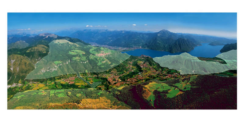
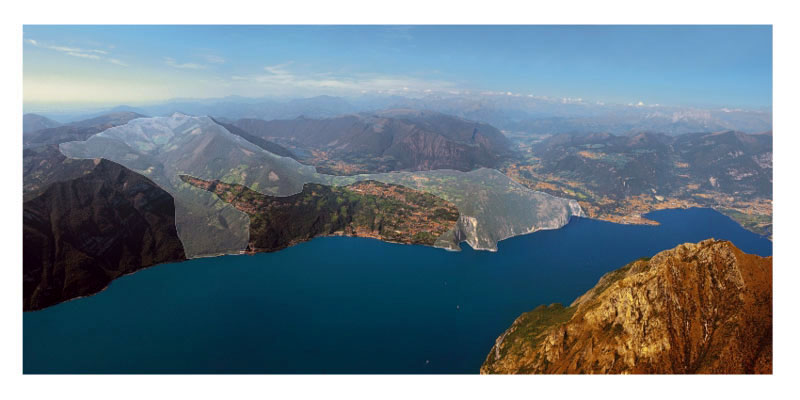
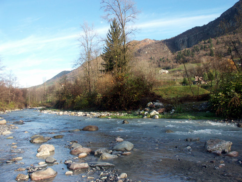
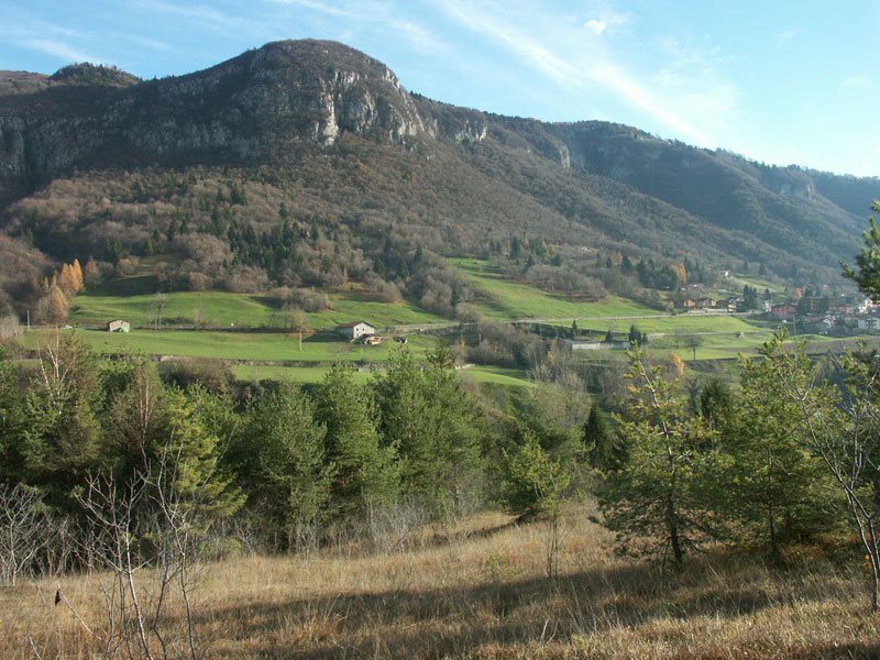
The Park has an average altitude going from the 1,879.8m a.s.l. of Mt. Pora to the 183m a.s.l. (or 185m) of the Iseo Lake surface (Sebino). It is situated in the pre-alpine section (Valle Camonica-Sebino), more precisely between the slopes of upper Sebino, Oglio valley bottom, the slopes of the hydrographic right of the river Oglio, the inner valleys and ridge of Mt. Pora and Mt. Alto, as well as between the valley bottom and slopes of lower Borlezza Valley.
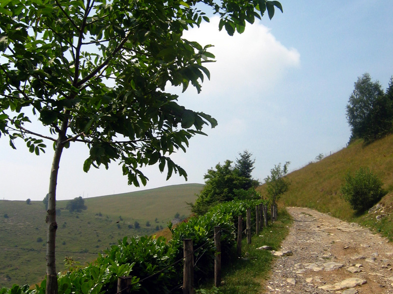
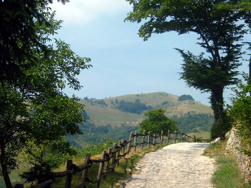
The territory involved by the Park is characterized by a mixture of environments with different vocations: from a natural to a tourist vocation, to agricultural, forest, and breeding activities. There is a good balance between ecology and production activities. The Park mainly includes agricultural areas and woodlands. The complex local geography, varying according to the particular topographical condition and the mitigating presence of the lake, the fragmentation of the environments with different ecological features, the division into altitude strips, has favored the considerable and rich presence of vegetal species, also including endemic species. All these features have also deeply influenced the wildlife, which is rich and diversified. It therefore represents a territory rich in specific features in all fields. Moreover, these specific features do not stop at the Park border but also regard the rest of the territory.
The human action should neither be excluded nor be negatively considered, above all as far as the valley bottoms are concerned, since it is linked to the people's needs; however, it is necessary to consider the local park as an occasion to recover a balance in the existing most negative urban situations and as a reference for an interpretation of the environmental situation of the territory.
The Territory of the PLIS
Geological and Geomorphological Features
Mountains, valleys, and lake are the geographical features of the seven Municipalities thanks to which the Park was established. Each biological and human phenomenon is linked to the presence of a physical structure housing both vegetation and each form of human action going from the land use to the exploitation of the subterranean resources, to the urban planning and infrastructure building.
The Park territory is characterized by several natural phenomena which, from a geological point of view, regard the nature of the rocks forming the mountain structure and the tectonic phenomena deriving from the formation of the Alps that have deformed and positioned it. The general reference geological context of the phenomena is characterized at a local level by aspects of particular interest in different sections of the territory which allow an educational visit to the Park. The territory is part of the Southern Calcareous Alps embracing in our Region the mountains between Valtellina and the Po Plain; these foldings have a particular tectonic style and lithologic formation distinguishing them from the rest of the alpine chain. As a matter of fact, the general structure of the Park mountains is formed by rocks of various nature, but all referable to a common formation environment: a stretch of sea extending between the European and African continents. The complex events shaping the history of this sea can be summarized in regional phenomena linked to the accelerated or slackened seabed subsidence, to the formation of lagoons, or to the formation of coastal features. A varied and changeable palaeogeography has influenced the nature of the Park rocks which, with their fossils, are evident documents allowing a reconstruction of the history of the territory.

Floristic and Vegetational Features
The climate, the nature of the soil, the exposure of the areas, and the centuries-old human action have shaped our superb landscape. The green mantle almost uninterruptedly covering each valley and mountain in the Park you can see in the distance will show you from close up all the richness and diversity of a vegetation which is formed by species with different ecological needs, in a wonderful race for life. According to the particular topographical situations and the presence of the lake with its mitigating effects on the climate, the complex geography of the Park is characterized by a different distribution of the vegetational types, also within an identifiable and classic distribution according to the altitude. If the Park vegetation has been directly influenced by the land use, despite the reduction of the habitats the flora has been able to maintain its biological diversity.
Zoological Features
The Park territory, a large area morphologically articulated and mainly covered by a spontaneous vegetation in harmony with the ecological features of the environment, houses a rich and diversified wildlife.
Landscape Features
The prealpine section the Park belongs to is formed by Mesozoic
sedimentary structures characterized in the north, thanks to the track
of the river Oglio, by the Palaeozoic rise. The deep valleys
penetrating and separating the Park mountains and the presence of one
of the largest lakes of Lombardy - Sebino Lake - form a complex
physical landscape preserving, in the rocks forming it and in the
deforming events, a fragment of history regarding the formation of the
alpine structure.
The geological structure influences all the
physical, biological, and human phenomena in the Park. Each description
or explanation regarding the environmental features is based on
reflections on the physical nature of the territory, as the geologist
Torquato Taramelli from Lombardy wrote in the 19th century: "If we want
to analyze the geology of the Prealps, we will easily realize the
landscape variety and the different features it acquired in each valley
or part of it; it will be enough to bear in mind some correspondences
between the nature of the landscape and the features of the rocks
forming it."


