


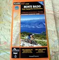
Monte Baldo - Carta Topografica Escursionistica (Scala: 1:25.000)
High Precision Topographic Map 1:25.000
Map No. 117New edition made of Polyart, waterproof, tear-resistant, 100% recyclable, with many routes for mountain bike. The most up-to-date and detailed map of the whole Mount Baldo, Garda Lake, which includes the Mount Baldo Local Park (Trentino-Alto Adige) and the entire area of the Region Veneto. All the roads, paths and points of interest have been monitored with GPS tools.
This is a reference map for Trentino's Mountain Rescue, which actively collaborates on the revision and updates.
This map won the Avenza Map Awards 2013: Best Topographic Map.
- Publisher: 4LAND Cartography
- Size: 12,5x25cm (closed)
- Year: 2013
- Price: 9.95 €
- Text language: ItalianoEnglish
Monte Baldo - Carta Topografica Escursionistica (Scala: 1:25.000)


© 2024 - Parco Naturale Locale del Monte Baldo