

Protected Area
Identity Card
- Land Surface Area: 996.00 ha
- Regions: Lazio
- Provinces: Roma
- Municipalities: Mentana, Monterotondo, Sant'Angelo Romano
- Establishment Measures: LR 29 06/10/1997
- PA Official List: EUAP1040
- Park Authority: Città Metropolitana di Roma Capitale
Macchia di Gattaceca e Macchia del Barco Nature Reserve
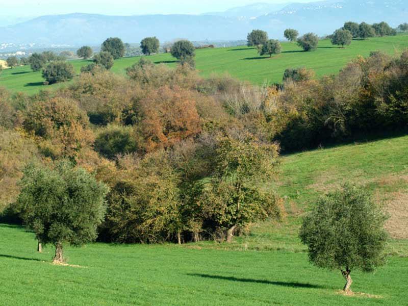
Macchia di Gattaceca e Macchia del Barco Nature Reserve extends between the Tiber Valley and Cornicolani Mountains, with a mainly hilly development and large areas used as grazing lands and with agricultural aims. The area is safeguarded both for the botanic value of its forest fragments and for the intense karstic phenomena represented by caves, swallow holes, the so-called "sventatori", and dolines. Among the latter there is Pozzo del Merro, one of the deepest collapse dolines in the world (about 80m from the countryside level, and further explored up to a depth of 310m), characterized by the walls covered by a thick vegetation and for the presence of a lake at its bottom. The Reserve, housing the olive groves from which the fine oil of the Sabina is produced, houses private agricultural firms, experimental companies and institutes under the ministerial tutelage (zootechnics, phytopathology, experimental zoology), and Università Agraria in Castel Chiodato. The landscape is fragmented both by the natural conditions and human action. Cattle and sheep grazing activities are rather intense.
Geology
The territory of Macchia di Gattaceca e Macchia del Barco Nature Reserve is situated between the Tiber Valley and Cornicolani Mountains with its main features linked to the woods, the karstic phenomena, and the landscape. The reserve mainly develops on hills of calcareous origin (Mesozoic) with a maximum height of 241m (in loc. Bosco Cerqueta) and rich in karstic phenomena (doline, caves, swallow holes). The imposing abyss called "Pozzo del Merro" is worth a mention: it is a collapse doline with subvertical walls covered by a very thick vegetation and with a small lake of considerable depth (more than 300m) at the bottom of the depression, at about 80 meters from the countryside level. The lithotypes of the reserve are completed by Plio-Pleistocene sands and clays of sea origin and tufa deriving from the activity of the Sabatino Volcano (Quaternary period).
Further information (Italian text)
Flora and Vegetation
About the half of the territory of the Reserve is cultivated mainly with olive groves and fodder fields. The largest forest formation is represented by deciduous Turkey oak woods (Quercus cerris) with a thick lower stratum of Oriental hornbeam (Carpinus orientalis) together with Field Maple (Acer campestre), Flowering ash (Fraxinus ornus), Wild Service Tree (Sorbus torminalis), Snowdrop bush (Styrax officinalis), Hawthorn (Crataegus oxyacantha), Cornelian cherry dogwood (Cornus mas), European privet (Ligustrum vulgare), Blackthorn (Prunus spinosa), Crab apple (Malus sylvestris), Service tree (Sorbus domestica) and Medlar tree (Mespilus germanica). The herbaceous stratum is invaded by the Butcher's broom (Ruscus aculeatus), while the protagonists of the spring blossoming are the Apennine Windflower (Anemone apennina) and the Cyclamens (Cyclamen repandum).
Further information (Italian text)
Fauna
The reserve still represents the ideal habitat for several animals. Among the mammals there are the fox, the badger, the porcupine, the weasel, the stone marten, and the marten. The forest avifauna includes piciforms, the cuckoo, the jay, and the hoopoe and several species of passerines. Among the birds of prey we remind the owl, the tawny owl, the scops owl, the barn owl, the buzzard, the kestrel, the hobby. The reptiles are represented by the Hermann's tortoise, whose presence must be confirmed, by the gecko, the blindworm and the common lizards. Among the amphibians: green frog, common toad, common newt and crested newt.
Further information (Italian text)
Archaeology and History
In the reserve there are traces of several settlements dating back to a
period going from the prehistorical age to the Middle Ages. The remains
of several country and luxury villas dating back to the Imperial Roman
age can be found: they are provided with sometimes very well-preserved
monumental reservoirs for the gathering of water. Also some stretches
of the Roman road bed along via Nomentana are rather interesting. Of
particular importance and charm are the imposing ruins of the tower of
the castle of Grotta Marozza, dating back to the Medieval period.
Several the sites used in the past for the building of charcoal piles and lime kilns.
Further information (Italian text)


