

Route 694b
Filettino - Colli Albanesi - Pratone - Monte Viglio
- Trail Conditions: On foot
- Interest: Flora, Wildlife, Panorama
- Departure: Filettino (1,025m)
- Duration: 3 h 40 m
- Difficulty Level: EE - For expert hikers
- Length: 5.6 km
- Difference in height: Uphill 1,085m - Downhill 10m
- Minimum Altitude: 1,083m
- Maximum Altitude: 2,160m
Beyond the last houses in Filettino towards Campo Staffi, one parks near the former Kinderheim S.Bernardo. One follows the yellow-red markers and starts climbing towards a TV repeater situated on the upland of Colle Albaneti, until one reaches a small mountain pass. One goes on climbing northwards through some clearings (Pratone).
Further information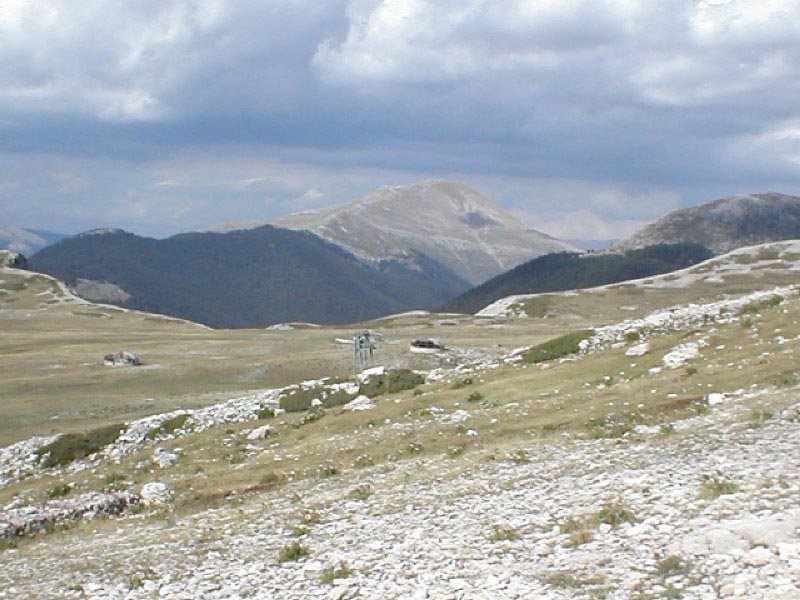
Panorama of Mt. Viglio
 Download KMZ
 Download in GPX format
Books and Guides

Protected Area(29.990,00 ha)

Lay-out of the itinerary

Departure

Arrival

Park Authority Offices

Visitor Centers (9)

Where to Sleep* (1)

Municipalities (8)

Points of Interest (78)

Photos (153)

Videos (21)

Pic-Nic Area (36)

EV charge ≥100kW (286)

E-Bike charging (9)

Airports (1)

Highway exits (1)
*: only Operators with Accommodation Page


© 2024 - Parco Naturale Regionale Monti Simbruini