

Route TR: Transhumance Path
- Trail Conditions: On foot
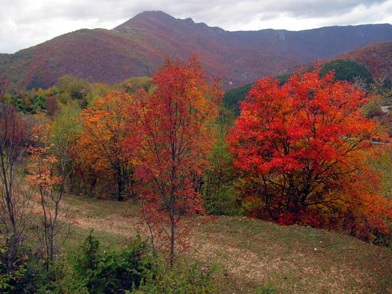
- Interest: Wildlife, Hystory
- Departure: Centro storico di Filettino
- Duration: 2 hour/s 15 minutes
- Difficulty Level: E - Hiking (level)
- Length: 4.8 km
- Difference in height: Uphill 231m - Downhill 255m
- Minimum Altitude: 868m
- Maximum Altitude: 1,058m
Ring route
The path starts from Filettino's old-town center and continues through an old mule track representing the Park's most significant environments.
The path is accessible for all and there are no equipped areas.
Transhumance Path
 Download KMZ
 Download in GPX format
Books and Guides

Protected Area(29.990,00 ha)

Lay-out of the itinerary

Departure

Arrival

Park Authority Offices

Visitor Centers (9)

Where to Sleep* (1)

Municipalities (8)

Points of Interest (78)

Photos (153)

Videos (21)

Pic-Nic Area (36)

EV charge ≥100kW (286)

E-Bike charging (9)

Airports (1)

Highway exits (1)
*: only Operators with Accommodation Page


© 2024 - Parco Naturale Regionale Monti Simbruini